Geomaticians

21

제주 ‘전자 지도’ 만든다···‘날아다니는 차’ 도입 코앞

제주에서 도심항공 교통(UAM)의 밑그림이 될 ‘지도’가 그려진다. 제주특별자치도는 국토교통부가 주관하는 ‘2024년 고정밀 전자지도 구 축 챌린지’ 사업기관에 선정돼 도시계획·개발, 지하시설물 매설 등 각종 사 업의 기본도로 활용되는 전자지도를 구축한다고 21일 밝혔다. 고정밀 전자지도는 도로, 건물, 하천 등 다양한 인공지물과 자연 지형을 일정한 축척에 따라 기호와 문자, 속성 등으로 표현한 디 지털 지리정보다. 국내에서 제작되는 수치지도 ...
news.zum.com
Estudo Mostra Que Área De Futuro Polo Agrícola Concentrou 76% Do Desmatamento De Três Estados Amazônicos

Estudo Mostra Que Área De Futuro Polo Agrícola Concentrou 76% Do Desmatamento De Três Estados Amazônicos

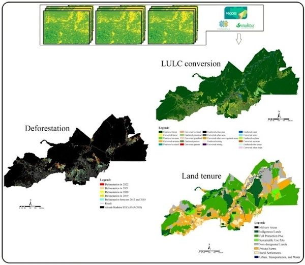
Enquanto o governo federal discute a criação de um polo agrícola na confluência entre Amazonas, Acre e Rondônia – popularmente conhecida pelo acrônimo Amacro –, o desmatamento nos municípios da região avança e já representa 76,5% do total da área devastada nos três Estados entre 2018 e 2022. A conclusão é de um estudo publicado ...
gizmodo.uol.com.br

NVIDIA Announces Earth Climate Digital Twin

To accelerate efforts to combat the $140 billion in economic losses due to extreme weather brought on by climate change, NVIDIA today announced its Earth-2 climate digital twin cloud platform for simulating and visualizing weather and climate at unprecedented scale. Part of the NVIDIA CUDA-X™ microservices, announced separately today, Earth-2’s new cloud APIs on NVIDIA ...
nvidianews.nvidia.com
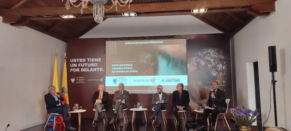
Crean Plataforma Para Democratizar La Información Histórica De Bogotá De Hace Más De Dos Siglos

Crean Plataforma Para Democratizar La Información Histórica De Bogotá De Hace Más De Dos Siglos

Con la intención de acercar y facilitar el acceso a toda la información de Bogotá, la Sociedad de Mejoras y Ornato de Bogotá creó la plataforma digital DataCivilidad, una herramienta que recoge cientos de miles de datos de la capital desde hace más de dos siglos para que, tanto personas naturales como organizaciones estatales y ...
diariodelcauca.com.co
Introducing Floorlocator, A System That Enhances Indoor Navigation

Introducing Floorlocator, A System That Enhances Indoor Navigation

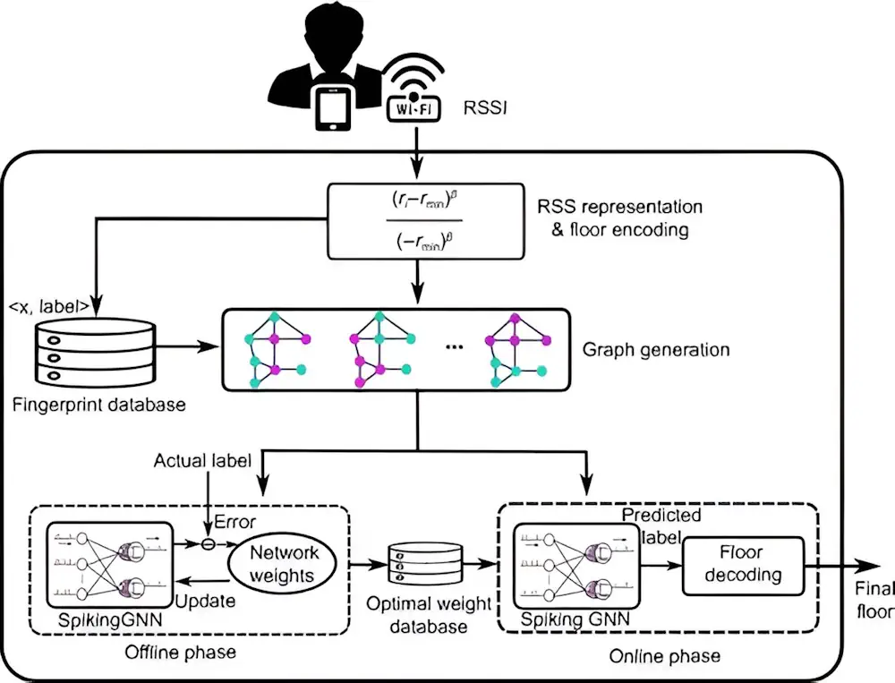
Indoor positioning is transforming with applications demanding precise location tracking. Traditional methods, including fingerprinting and sensor-based techniques, though widely used, face significant drawbacks, such as the need for extensive training data, poor scalability, and reliance on additional sensor information. Recent advancements have sought to leverage deep learning, yet issues such as low scalability and high ...
techxplore.com
Investigadores De La UJA Y Guatemala Colaboran En El Desarrollo De Técnicas Que Ayuden A Documentar Y Preservar El Patrimonio

Los grupos de investigación ‘Informática Gráfica y Geomática’ y ‘Tecnologías Avanzadas en Ingeniería Civil: Construcción y Transporte Terrestre’ de la Universidad de Jaén mantienen desde hace unos años una intensa colaboración en materia de investigación y docencia con la Facultad de Arquitectura de la Universidad de San Carlos de Guatemala (FARUSAC). Fruto de esta cooperación ...
ondacerojaen.es
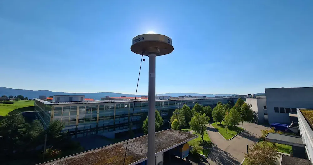
Detecting Heavy Precipitation Events Directly With GPS Data

Detecting Heavy Precipitation Events Directly With GPS Data

An exceptionally severe storm swept over Zurich on 13 July 2021 shortly before 2 a.m., with howling squalls, constant lightning and torrential rain that awakened people with a start. Benedikt Soja, Professor of Space Geodesy, got little sleep that night. “It was one of the most severe storms I’ve ever witnessed. I woke up in ...
phys.org
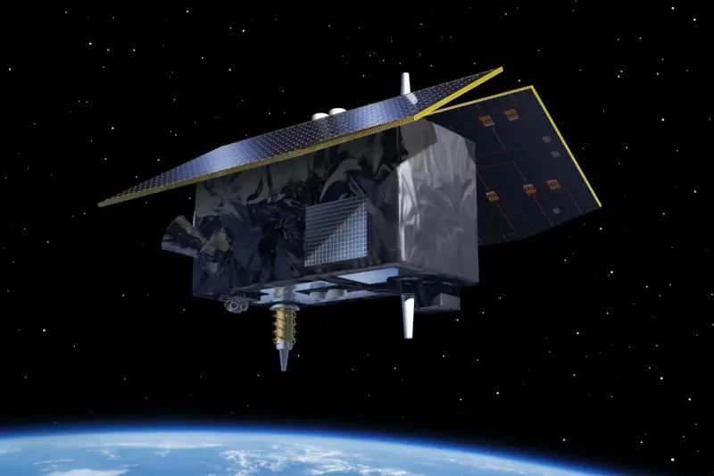
ESA Will Launch Genesis System To Measure Earth With Millimeter Precision

ESA Will Launch Genesis System To Measure Earth With Millimeter Precision

European Space Agency (ESA) allocated €76.6 million to develop the Genesis orbital observatory, which will be able to determine the position of objects on Earth with an accuracy of one millimeter. Another €156.8 million has been allocated for the launch of a low-orbit constellation of devices to test and improve the reliability of satellite navigation. ...
technewsspace.com
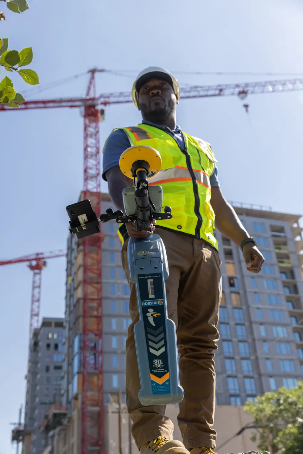
Trimble And Radiodetection Combine Survey-Grade Positioning With Underground Utilities Locating Measurement Workflows

Trimble And Radiodetection Combine Survey-Grade Positioning With Underground Utilities Locating Measurement Workflows

Trimble and Radiodetection announced today a collaboration to improve the technology used in the utility measurement and mapping process. Through the integration of the Trimble® Catalyst™ DA2 GNSS system and Radiodetection’s RD MapTM+ application and precision locator products, the software and hardware integration streamlines utility-locating workflows to provide high-accuracy measurement capabilities for the creation of ...
directionsmag.com

Geospatial Commission Joins UK Centre For Seabed Mapping

The Geospatial Commission had today (Wednesday 20 March) become the 31st member of the UK Centre for Seabed Mapping (UK CSM). The UK CSM, which is administered by the UK Hydrographic Office (UKHO), was created in June 2022 to spearhead a coordinated approach to the collection, management and access of seabed mapping data and to ...
gov.uk
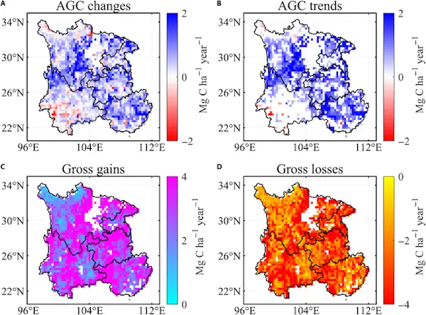
Satellite Data Illuminate Carbon Sequestration Success In Drought-Stricken Southwest China

Satellite Data Illuminate Carbon Sequestration Success In Drought-Stricken Southwest China

Recent research highlights a significant rise in Southwest China’s aboveground carbon levels between 2013 and 2021, showcasing the area’s capacity to counterbalance the negative impacts of severe droughts. This development emphasizes the vital role of Southwest China as a carbon sink, attributed to substantial ecological efforts and the deployment of cutting-edge remote sensing methodologies. For ...
spacedaily.com
Satellites Track The Tiny Silver Fish Hugely Important To Marine Life

Satellites Track The Tiny Silver Fish Hugely Important To Marine Life

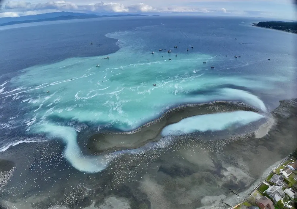
A new scientific endeavour has taken to the sky using high-tech drones and satellite images to understand better the annual spring herring spawn vital to salmon and wildlife on the West Coast. Between February and March each year, frigid ocean waters transform to a milky tropical-looking turquoise green when male herring release milt to fertilize ...
nationalobserver.com
AI And Drones Aid Farmers With Identifying Botrytis

AI And Drones Aid Farmers With Identifying Botrytis

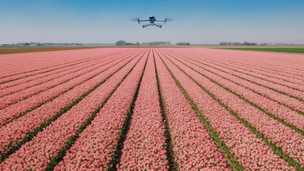
Researchers from Unmanned Valley, Greenport DB, and NL Space Campus in the Netherlands have successfully developed an AI model that enables drones to identify the disease botrytis. The model leverages artificial intelligence to analyze vast amounts of drone data, resulting in a detailed map that pinpoints, with millimeter precision, which plants are diseased or at ...
futurefarming.com