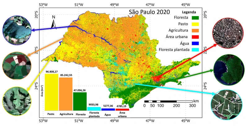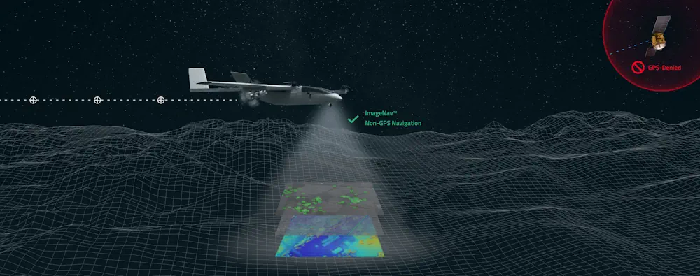
Scientific Systems Advances Navigation Software
Scientific Systems has released upgrades for ImageNav, an image-based navigation software designed for GPS-denied or compromised environments. With more than a decade of development, ImageNav offers a robust alternative to traditional GPS navigation for military operations, particularly in contested environments where jamming poses a threat to GPS reliability. The demand for such technology has become ...
gpsworld.com