Geomaticians

07

New 'Digital Twin' Earth Technology Could Help Predict Water-Based Natural Disasters Before They Strike

New ‘Digital Twin’ Earth Technology Could Help Predict Water-Based Natural Disasters Before They Strike

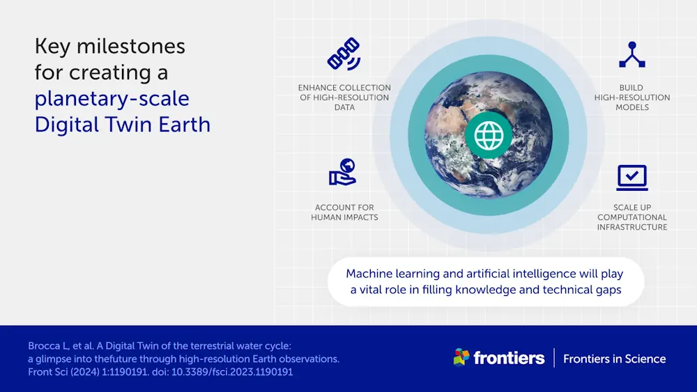
The water cycle looks simple in theory—but human impacts, climate change, and complicated geography mean that in practice, floods and droughts remain hard to predict. To model water on Earth, you need incredibly high-resolution data across an immense expanse, and you need modeling sophisticated enough to account for everything from snowcaps on mountains to soil ...
phys.org

Philsa, DENR Team Up To Create Mangrove Map Using Satellite Data

The Philippine Space Agency (PhilSA) and the Department of Environment and Natural Resources (DENR) have collaborated to develop a nationwide mangrove map using remote sensing data, a vital tool for conservation efforts. The mangrove mapping initiative is part of the DENR’s development of a national geospatial database for its environment and natural resource accounting program. ...
philstar.com
Satlantis Añade El Tercer Satélite A Su Constelación

Satlantis Añade El Tercer Satélite A Su Constelación

El satélite Horacio de 16U será el tercer satélite de Satlantis que lleve su imagen iSIM-90 al espacio. Sus datos de alta resolución proporcionarán información para múltiples aplicaciones de observación de la Tierra, como monitorización de infraestructuras, cuantificación de emisiones de gas metano, seguridad alimentaria y conciencia costera y fronteriza. Se trata de una misión ...
actualidadaeroespacial.com
Portugal To Launch Satellite

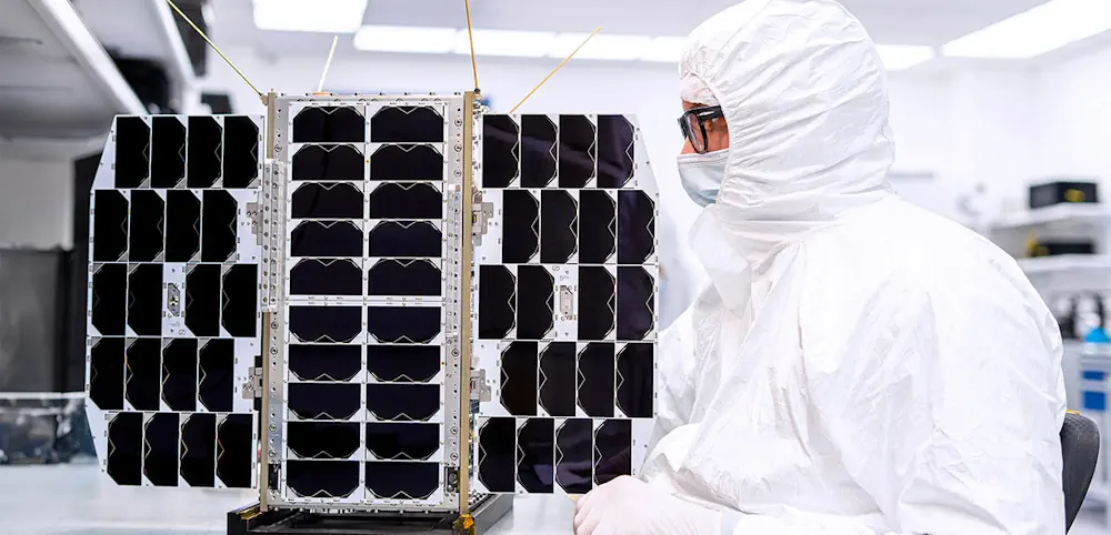
“Aeros”, a 4.5-kilo nanosatellite, took off from the SpaceX company base in Vandenberg, in the United States, at 9:18 pm on March 4th (Lisbon time). “Aeros” will be in Earth’s orbit at an altitude of 510 kilometers, slightly above the International Space Station. Communications and collection of data and images will be carried out from ...
theportugalnews.com
Inaccurate Government Data May Be Stoking Wildfires UBC Study

Inaccurate Government Data May Be Stoking Wildfires: UBC Study

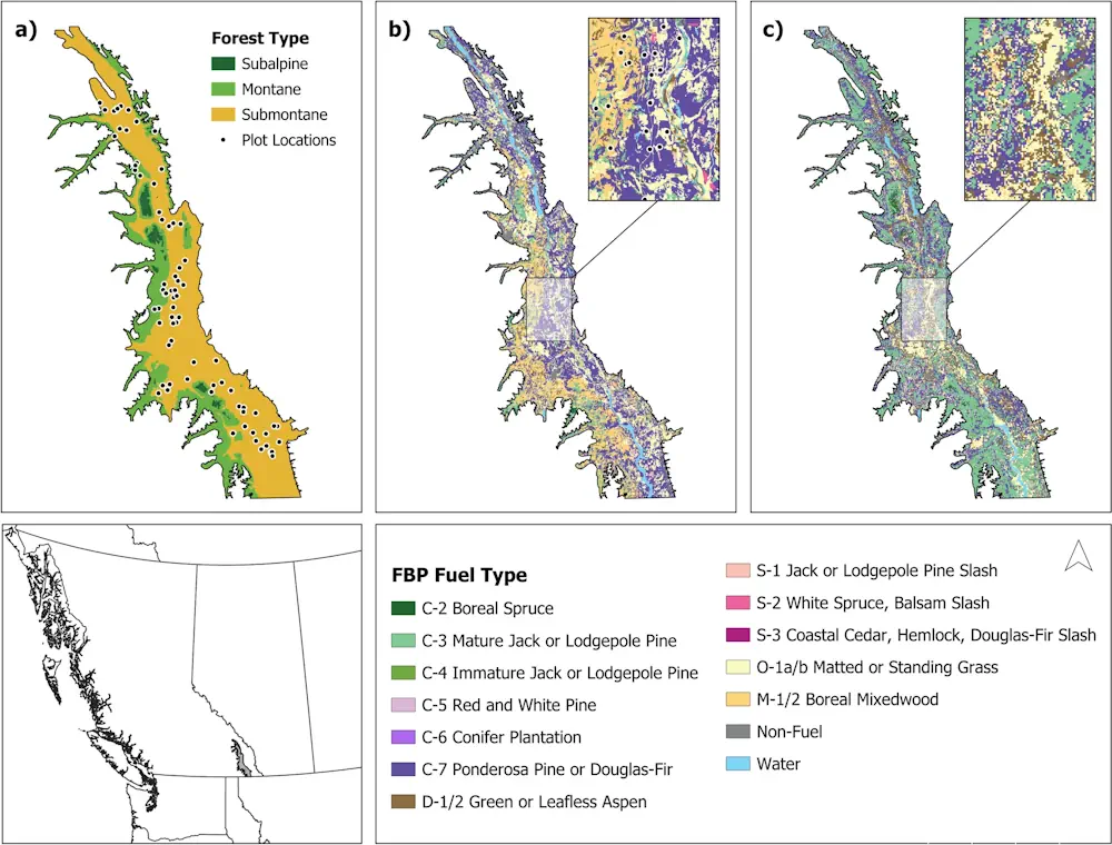
Wildfire fighting and forest management decisions are potentially being hampered by inaccurate government data that misrepresents forest fuel loads in British Columbia’s Interior, a new study has found. The B.C. government says the provincial wildfire service is working with the study’s lead author and others to close the data gap, which involves “mismatches” between remotely-sensed ...
cbc.ca
Google Maps Tests Showing Building Entrances

Google Maps Tests Showing Building Entrances

Google Maps has become an invaluable tool to navigate and to find the best spots to eat, get coffee, or to see sights. But with some bigger buildings and attractions, it can get hard to find the entrance. That’s where a new experiment comes in that Google appears to be testing with a few users ...
androidpolice.com
Australian Space Startup Esper Wants To Build Hyperspectral Sats For Cheap

Australian Space Startup Esper Wants To Build Hyperspectral Sats For Cheap

Australian remote sensing startup Esper wants to capture hyperspectral imagery from space at a fraction of the price of its competitors. The company, which launched its first demonstration satellite this Monday on SpaceX’s Transporter-10 mission, is entering a field rife with competition. There’s a reason for that: Hyperspectral is an incredibly powerful type of remote ...
techcrunch.com
Communities Severed By Roads And Traffic Experience A Larger Number Of Collisions In New York City

Communities Severed By Roads And Traffic Experience A Larger Number Of Collisions In New York City

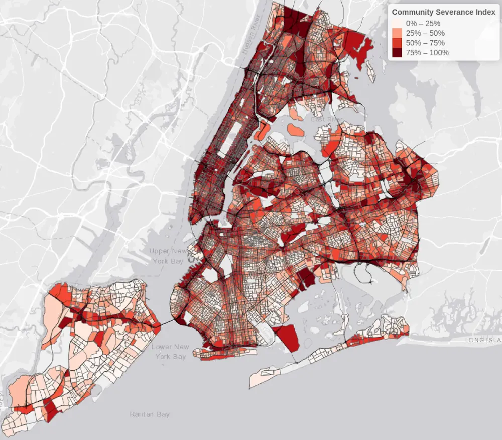
New York City neighborhoods with disrupted community connections, due to traffic, roads, and transport infrastructure, are experiencing an increase in traffic collisions. This increase is seen both in total collisions and for those in which pedestrians or cyclists are injured or killed, according to a new study from Columbia University Mailman School of Public Health. ...
phys.org

Combining Big Data And Machine Learning To Predict Power Outages And Help Consumers Prepare

Unplanned power outages due to environmental conditions (wind, lightning, tree growth, etc.) leave those without power on their own, sometimes for long periods of time. Utility companies lack the ability to predict when forced outages will occur, so no mitigation measures targeting consumers are deployed ahead of time to reduce the impact of an outage. ...
techxplore.com