Geomaticians

22

Karte Zeigt Hitze-Hotspots Für FußgängerInnen In Salzburg

Karte Zeigt Hitze-Hotspots Für Fußgänger:Innen In Salzburg

Die hohen Temperaturen machen gemütliche Spaziergänge durch Salzburg zu einer Herausforderung. Die Sonne heizt Gehwege und Straßen extrem auf, und schattenspendende Bäume für Fußgängerinnen und Fußgänger sind vielerorts Mangelware. Der Verkehrsclub Österreich (VCÖ) ruft daher die Bevölkerung dazu auf, Hotspots in einer Online-Karte zu markieren. Die Hitze belastet nicht nur die Gemüter, sondern auch die ...
salzburg24.at

El Municipio Veinticinqueño Se Suma A La Infraestructura De Datos Espaciales Bonaerense

El Municipio de 25 de Mayo se ha unido a la Infraestructura de Datos Espaciales de la Provincia de Buenos Aires (IDEBA), convirtiéndose en uno de los 30 miembros comprometidos con la gestión eficiente del territorio. A través de esta integración, tendrán acceso a una serie de recursos tecnológicos que facilitarán el seguimiento preciso de ...
lamanana.com.ar

Un Estudio De La Universitat Politècnica De Valencia Alerta Del Negativo Impacto Del Turismo Masivo En El Patrimonio Histórico

Un estudio liderado por el Centro de Investigación PEGASO de la Universitat Politècnica de València (UPV) advierte de la “emergente necesidad” de identificar medidas preventivas que ayuden a garantizar la conservación de los edificios patrimoniales y a mejorar la gestión turística de dichos inmuebles y de los centros históricos de las ciudades. Realizado en el ...
elperiodicodeaqui.com
AI Shows How Field Crops Develop

AI Shows How Field Crops Develop

Researchers at the University of Bonn have developed software that can simulate the growth of field crops. To do this, they fed thousands of photos from field experiments into a learning algorithm. This enabled the algorithm to learn how to visualize the future development of cultivated plants based on a single initial image. Using the ...
eurekalert.org
Fiscalización Ambiental SMA Asiste A Actividad De Cierre De Proyecto De Cooperación Entre Chile, Perú Y Alemania

Fiscalización Ambiental: SMA Asiste A Actividad De Cierre De Proyecto De Cooperación Entre Chile, Perú Y Alemania

La Superintendenta del Medio Ambiente de Chile y presidenta pro tempore de la Red Latinoamericana de Fiscalización y Cumplimiento Ambiental (REDLAFICA), Marie Claude Plumer, asistió el 13 y 14 de junio a la actividad de cierre del segundo proyecto de cooperación triangular entre la Superintendencia del Medio Ambiente (SMA), el Organismo de Evaluación y Fiscalización ...
portal.sma.gob.cl
New Way To Spot Beetle-Killed Spruce Can Help Forest, Wildfire Managers

New Way To Spot Beetle-Killed Spruce Can Help Forest, Wildfire Managers

A new machine-learning system developed at the University of Alaska Fairbanks can automatically produce detailed maps from satellite data to show locations of likely beetle-killed spruce trees in Alaska, even in forests of low and moderate infestation where identification is otherwise difficult. The automated process can help forestry and wildfire managers in their decisions. That’s ...
phys.org
London Heritage Properties Marked For Demolition Digitally Preserved By City

London Heritage Properties Marked For Demolition Digitally Preserved By City

A growing number of heritage buildings primed for demolition in London will live on virtually with the help of high-end 3D technology. The city has amassed a small but growing number of virtual building replicas as part of its regular process to document and photograph heritage properties, or properties with heritage components, before their date ...
cbc.ca
When In Drought Researchers Map Which Parts Of The Amazon Are Most Vulnerable To Climate Change

When In Drought: Researchers Map Which Parts Of The Amazon Are Most Vulnerable To Climate Change

In the late 2000s, Scott Saleska observed an unusual phenomenon in the Amazon rainforest. A severe drought in 2005 led to increased green growth in vast areas of the Amazon, contrary to field researchers’ observations of browning plants and some dying due to the drought. Recent research published in Nature by Shuli Chen, a doctoral ...
phys.org
Albedo Takes Earth Observation Up Close And Personal From Very Low Earth Orbit

Albedo Takes Earth Observation Up Close And Personal From Very Low Earth Orbit

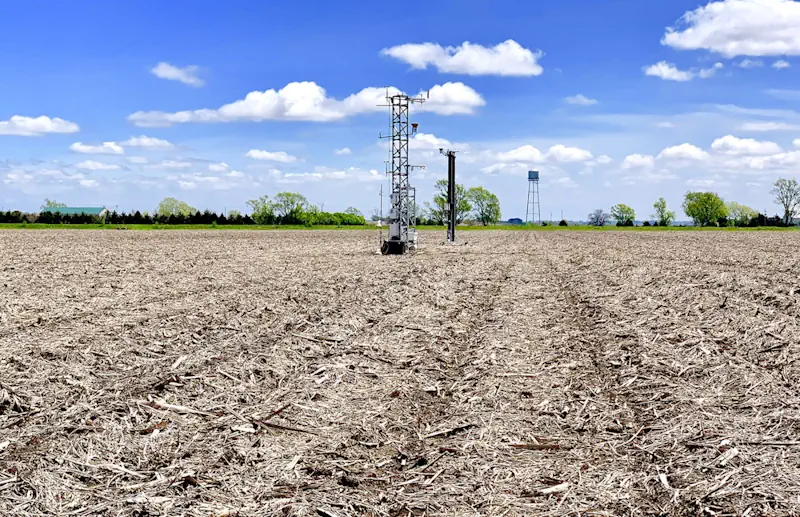
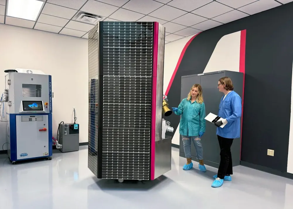
Satellite imagery startup Albedo is preparing for its up-close-and-personal debut. Albedo’s first satellite will take to orbit next spring as the company looks to turn the commercial Earth observation industry upside down with its novel approach and ultra-high-resolution cameras. The satellite, called Clarity, will hitch a ride to very low Earth orbit (VLEO) on SpaceX’s ...
techcrunch.com
Planetary Boundary Layer Revealed Satellites Illuminate Atmospheric Mysteries

Planetary Boundary Layer Revealed: Satellites Illuminate Atmospheric Mysteries

Unlocking the secrets of Earth’s planetary boundary layer (PBL), a pivotal zone influencing air quality and climate, a new study offers unprecedented insights into atmospheric thermal contrasts (TC). By scrutinizing satellite data, researchers have shed light on how the surface-to-atmosphere temperature gradient affects the detection of atmospheric pollutants. The endeavor to keep tabs on and ...
eurekalert.org
Study Reveals Stable Soil Moisture Variability Within Fields, Opens Door For Satellite Remote Sensing

Study Reveals Stable Soil Moisture Variability Within Fields, Opens Door For Satellite Remote Sensing

A multi-institutional study led by University of Illinois and Agroecosystem Sustainability Center (ASC) scientists concluded that, although soil moisture varies significantly both within a single field and from field to field due to varying soil properties and different management practices, soil moisture distribution relative to the field average remains consistent across time within each field. ...
phys.org