Geomaticians

14

Lanzan Una Plataforma Para Acceder En Línea A Información Forestal Detallada

Lanzan Una Plataforma Para Acceder En Línea A Información Forestal Detallada

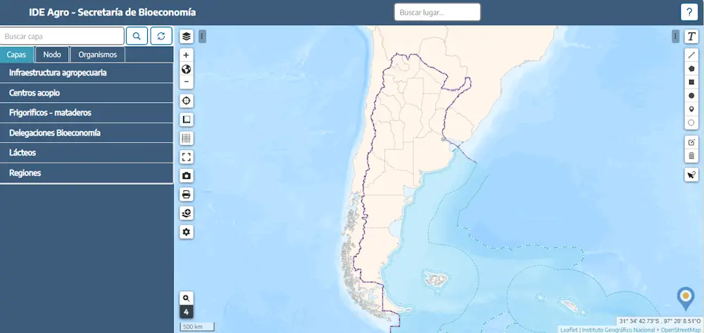
El Geoportal se destaca por su capacidad para integrar y superponer múltiples capas de información generadas por diferentes organismos nacionales, permitiendo la visualización de datos de alta precisión sobre la cobertura forestal, distribución de especies y otros aspectos centrales del sector foresto industrial argentino. El Gobierno Nacional lanzó la Información Cartográfica Forestal a través de ...
argentina.gob.ar
Remote Sensing Characterization Of Post-Fire Vegetation Recovery

Remote Sensing Characterization Of Post-Fire Vegetation Recovery

Remote sensing is a powerful tool to measure fire’s effects on plant life. How severe was the damage to vegetation? How quickly can a landscape recover? A new project is looking at those questions from a before, during, and after fire perspective, and the Wildland Fire Team at EROS investigates how using different remote sensing ...
usgs.gov
Scientists Have Built A ‘Digital Twin’ Of Earth To Predict The Future Of Climate Change

Scientists Have Built A ‘Digital Twin’ Of Earth To Predict The Future Of Climate Change

Scientists have built a highly accurate digital simulation of planet Earth to provide reliable information about extreme weather and climate change. This AI-powered “digital twin” virtually simulates the interaction between natural phenomena and human activities to predict their effect on things like water, food and energy systems. In the past, climate and weather predictions have ...
euronews.com
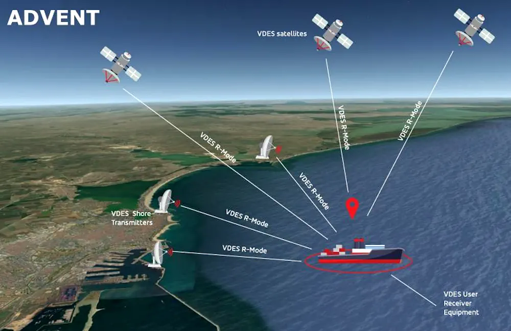
ESA-Funded ADVENT Project Demonstrates VDES-Based PNT

ESA-Funded ADVENT Project Demonstrates VDES-Based PNT

In the maritime sector, work is ongoing towards the identification and development of alternative PNT (positioning, navigation and timing) solutions, that is, solutions that are not wholly dependent on GNSS-based technologies. “The VHF data exchange system [VDES], is being considered as a source of alternative PNT [A-PNT] for maritime,” said Michael Turner of GMV NSL, ...
insidegnss.com
India To Introduce GNSS-Based Toll Collection System

The National Highways Authority of India (NHAI) invited expressions of interest from global innovators to develop a GNSS-based electronic toll collection system, as announced by the Ministry of Road Transport and Highways. This initiative aims to integrate the GNSS system within the existing FASTag framework through a hybrid model combining RFID and GNSS-based toll collection. ...
kashlem.com
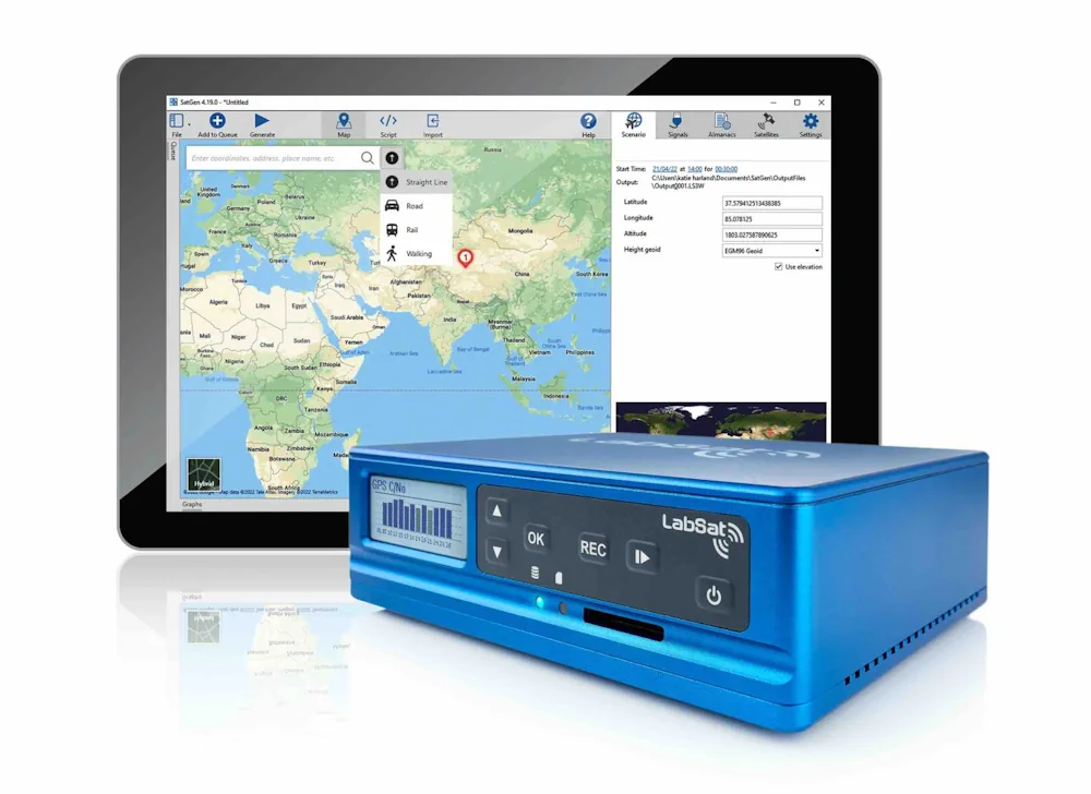
LabSat Announces The Launch Of The LabSat 4 GNSS Simulator For Enhanced GNSS Testing

LabSat Announces The Launch Of The LabSat 4 GNSS Simulator For Enhanced GNSS Testing

LabSat has introduced the LabSat 4 GNSS Simulator, a GNSS test solution. This latest addition to the LabSat range is designed to meet the rigorous demands of modern GNSS signal testing, providing enhanced customization and precision. Key to LabSat 4 are its three RF channels, each configurable with up to 12-bit I&Q quantization and a ...
insidegnss.com

Pythagoras Launches Pointorama For Streamlined Point Cloud Management

Pythagoras has released Pointorama, a groundbreaking cloud-based platform designed to simplify point cloud management. The official launch took place at GeoBusiness 2024, which was held on 5-6 June in London. Pythagoras is a provider of innovative software solutions for land surveyors and contractors. In today’s rapidly evolving field of land surveying, the quest for efficiency ...
gim-international.com
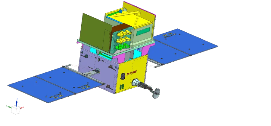
TRISHNA Mission

TRISHNA Mission: Advancing High-Resolution Thermal Imaging For Climate And Resource Management

The TRISHNA (Thermal Infra-Red Imaging Satellite for High-resolution Natural Resource Assessment) mission, a collaborative endeavor between ISRO and CNES, is engineered to deliver high spatial and high temporal resolution monitoring of Earth’s surface temperature, emissivity, biophysical and radiation variables for surface energy budgeting at regional to global scale. This mission addresses critical water and food ...
isro.gov.in
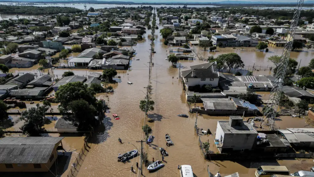
How A ‘Citizen Map’ Is Helping Brazil Prepare For Next Big Flood

How A ‘Citizen Map’ Is Helping Brazil Prepare For Next Big Flood

In the wake of last month’s disastrous flooding in southern Brazil, researchers are asking residents to use their smartphone cameras to document the damage and high-water marks. The data collected will help scientists map flood risk and inform decisions on where to rebuild. When Lucas George Wendt arrived in Lajeado in late May, the water ...
e360.yale.edu