Geomaticians

07

Researchers Unveil Most Detailed Map Of Water Bodies Across Qinghai-Xizang Plateau

Researchers Unveil Most Detailed Map Of Water Bodies Across Qinghai-Xizang Plateau

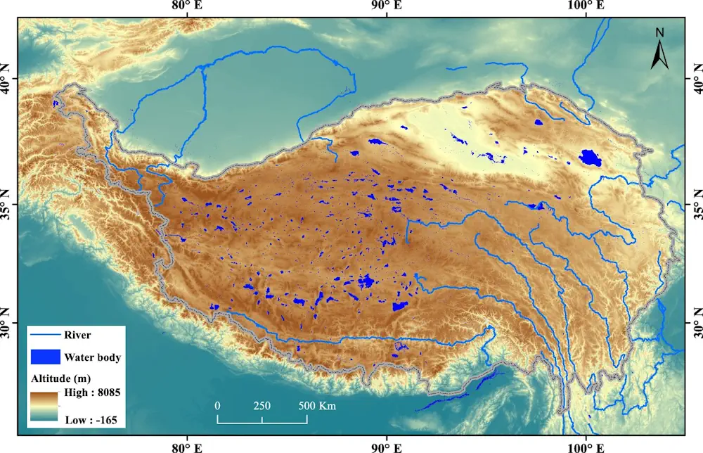
In a study published in Scientific Data, researchers from the Aerospace Information Research Institute of the Chinese Academy of Sciences unveiled the most detailed dataset to date, illuminating the complex network of water bodies sprawled across the Qinghai-Xizang Plateau. This dataset, openly available in figshare, paints a holistic picture by furnishing a high-resolution map of ...
phys.org
Shape And Depth Of Ocean Floor Profoundly Influence How Carbon Is Stored There

Shape And Depth Of Ocean Floor Profoundly Influence How Carbon Is Stored There

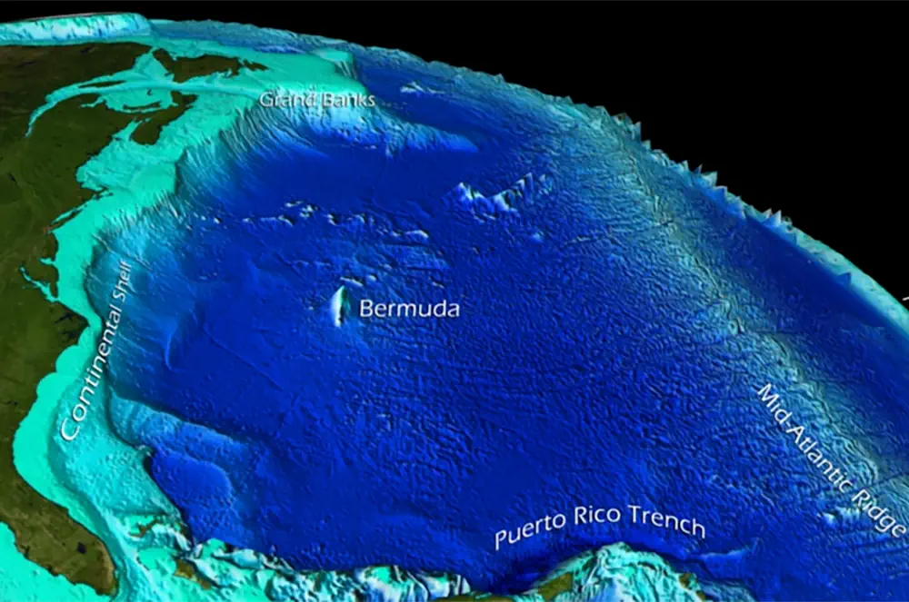
The movement of carbon between the atmosphere, oceans and continents — the carbon cycle — is a fundamental process that regulates Earth’s climate. Some factors, like volcanic eruptions or human activity, emit carbon dioxide into the atmosphere. Others, such as forests and oceans, absorb that CO2. In a well-regulated system, the right amount of CO2 ...
newsroom.ucla.edu
New NASA Mission To Map Earth’s Surface In 3D Moves One Step Closer

New NASA Mission To Map Earth’s Surface In 3D Moves One Step Closer

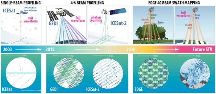
The Earth Dynamics Geodetic Explorer (EDGE)—a newly proposed NASA satellite mission to monitor the three-dimensional structure of global vegetation and ice—is one of four finalists selected for NASA’s next generation of Earth-observing satellites under the Earth System Explorers Program. The project, which includes Northern Arizona University assistant research professor Chris Hakkenberg as co-investigator and biodiversity ...
news.nau.edu
Study Reviews Current State Of Global Navigation Satellite System Reflectometry

Study Reviews Current State Of Global Navigation Satellite System Reflectometry

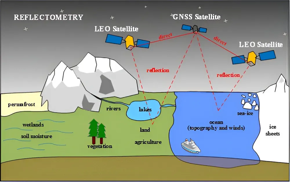
Global navigation satellite system reflectometry (GNSS-R) is emerging as a pivotal technology in remote sensing due to its ability to provide high-precision, real-time data under all weather conditions. Traditionally, the GNSS has been utilized for positioning, navigation, and timing. However, recent advancements have demonstrated its efficacy in environmental monitoring through scatterometry and reflectometry. GNSS-R capitalizes ...
phys.org
Chinese Internet Giant Baidu To Provide Map Service For Tesla EVs, As US Carmaker Eyes Mainland Launch Of Self-Driving System

Chinese Internet Giant Baidu To Provide Map Service For Tesla EVs, As US Carmaker Eyes Mainland Launch Of Self-Driving System

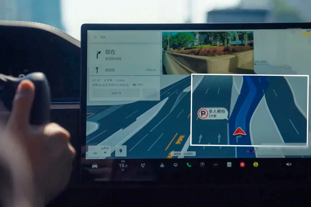
Chinese internet search giant Baidu will provide Tesla with mapping software for its electric vehicles (EVs), paving the way for the US carmaker to launch its Full Self-Driving (FSD) system on the mainland. Version 20 of Baidu Maps, a desktop and mobile web-mapping application released in April, will soon be available on Tesla’s EVs, the ...
scmp.com

Comparing Sandy Beach And Dune Changes Using Lidar And Drone Technology

Coastal landscapes, including sandy beaches and foredunes, are dynamic and susceptible to changes caused by water level fluctuations, storm events, and human activities. Monitoring these changes is crucial for effective coastal management and resilience planning. Traditional methods for measuring geomorphic changes, such as small-unoccupied aircraft systems paired with structure-from-motion photogrammetry (sUAS-SfM), are often costly and ...
naturalsciencenews.com
Internet Of Waste SLU Researcher Uses AI To Tackle STL’s Waste And Recycling Problem

Internet Of Waste: SLU Researcher Uses AI To Tackle STL’s Waste And Recycling Problem

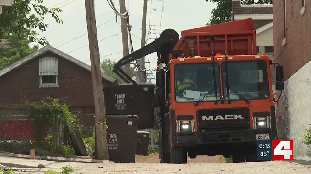
Neighborhoods in the City of St. Louis will soon be able to track their recycling and solid waste thanks to a geospatial sensor developed by a Saint Louis University researcher. Orhun Aydin, Ph.D., assistant professor in Earth and Atmospheric Science at SLU’s School for Science and Engineering, received a $149,791 planning grant from the National ...
firstalert4.com
Stormwater Hits D.C.'S Poorest Neighborhoods Hardest, Study Finds

Stormwater Hits D.C.’S Poorest Neighborhoods Hardest, Study Finds

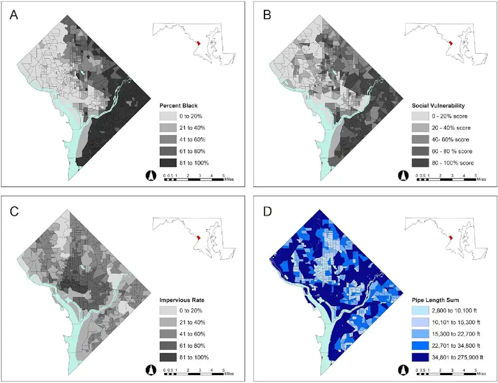
A new University of Maryland study suggests that Washington, D.C.’s most socioeconomically vulnerable neighborhoods are less equipped to handle runoff from heavy rainfalls made more frequent by climate change. Published this month in Cities, the study reveals that the most densely populated communities in the District of Columbia, particularly in historically Black Southeast D.C., lack ...
phys.org
BAS Releases Interactive Antarctic Map Viewer

BAS Releases Interactive Antarctic Map Viewer

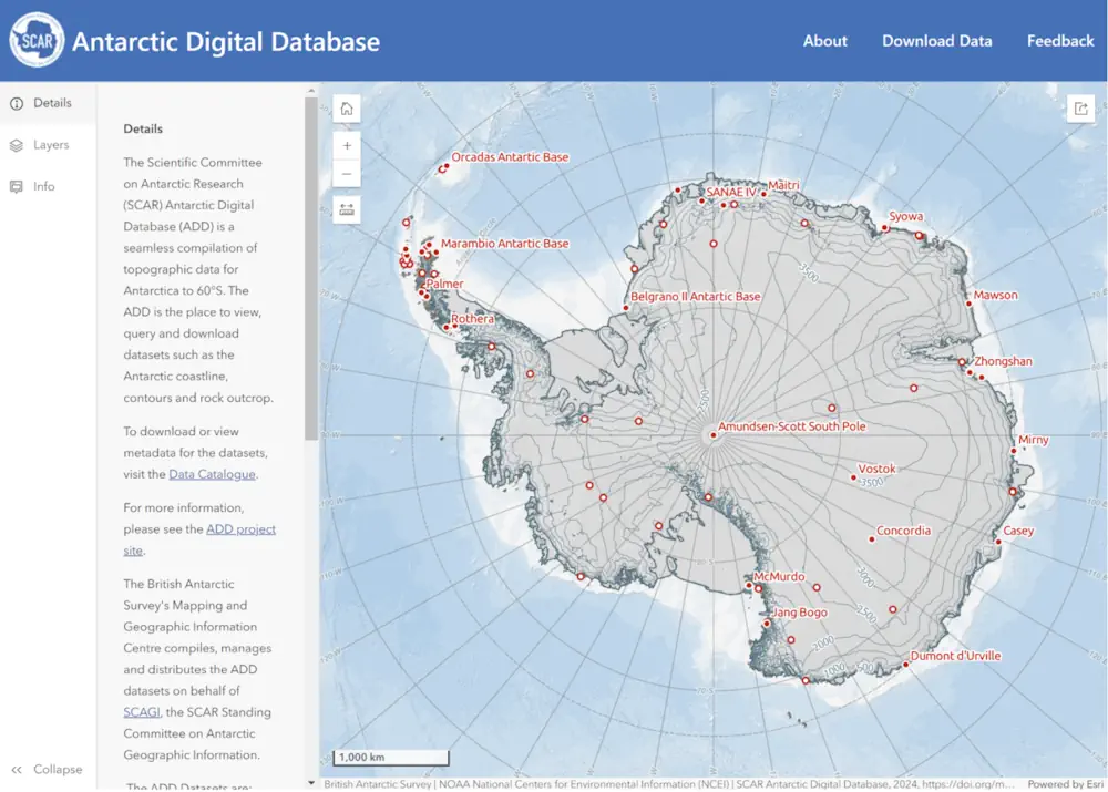
The British Antarctic Survey (BAS) has released a new map viewer that brings together all of the Antarctic Digital Database datasets, plus other useful information, and displays them together in an open-access interactive website. The BAS’ Mapping and Geographic Information Centre (MAGIC) is responsible for keeping the maps and data up to date, with the ...
spatialsource.com.au

Satelytics Uses AI-Powered Geospatial Analytics To Help Georgia Power With Shoreline Management

Satelytics, a company specializing in geospatial analytics, has announced a successful partnership with Georgia Power, the largest electric subsidiary of Southern Company. Using advanced AI-powered geospatial technology, Satelytics is aiding Georgia Power in monitoring lakes and reservoirs, which are crucial for the utility’s hydroelectric system that serves over 2.6 million residents in Georgia. Satelytics deployed ...
waterpowermagazine.com
University Of Nevada, Reno Team Develops New Vegetation Mapping Tools

University Of Nevada, Reno Team Develops New Vegetation Mapping Tools

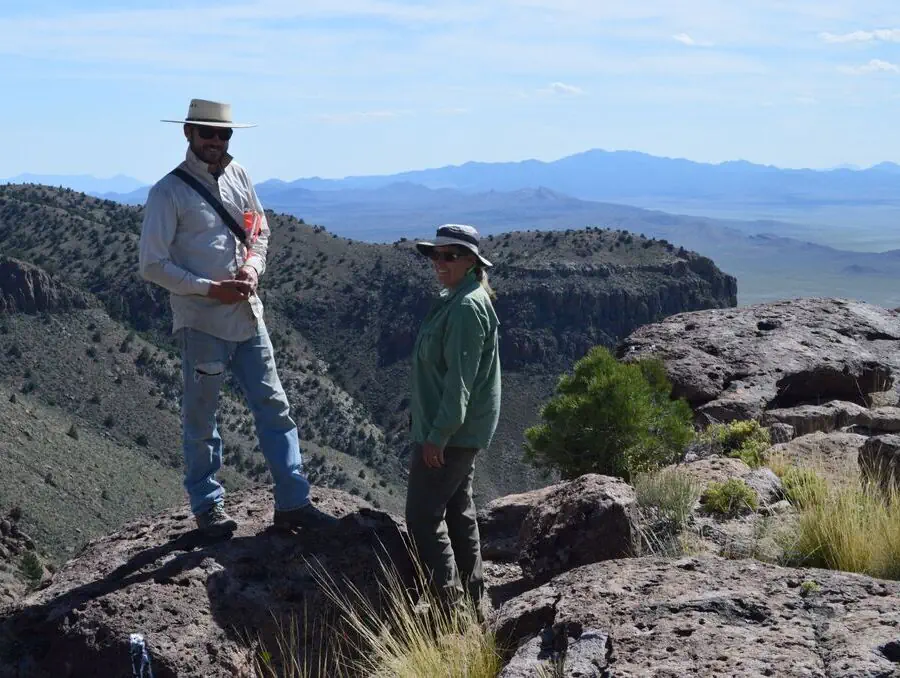
Powerful new digital mapping tools developed by University of Nevada, Reno researchers hold promise to improve management of rangeland, particularly public lands in the far-flung Western United States. The significant improvements in mapping of vegetation enabled by the University’s research provide managers of rangeland, ranchers as well as federal managers of public lands, with better ...
unr.edu

3D Modelling Assists In Post-Flood Rebuild

A comprehensive geospatial mapping project has commenced at the Australian Wildlife Conservancy’s (AWC) Mornington Wildlife Sanctuary (Bunuba and Kija country) in the central Kimberley, to assist in the site’s post-flooding restoration. The newly launched J2 Geospatial Intelligence Service (J2 GIS), a social enterprise of the veteran-led non-for-profit Disaster Relief Australia (DRA), has signed on to ...
spatialsource.com.au