Geomaticians

July

Google Maps Patent Hints At A Multi-car Navigation Feature, Enabling Easier Group Travel

Google Maps Patent Hints At A Multi-car Navigation Feature, Enabling Easier Group Travel

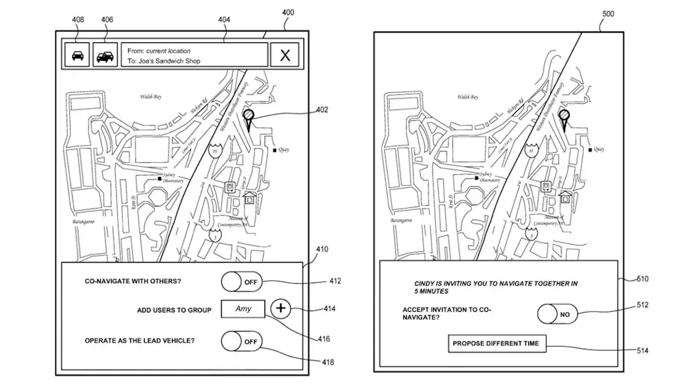
Google Maps is one of the most widely used navigation apps in the world, with 60 million active users in India alone as of 2023, according to Miriam Daniel, Vice President and Head of Google Maps. The web mapping platform introduces new features and improvements to existing ones on a regular basis, helping solo travellers ...
gadgets360.com

Turkmenistan Advances Land Reform With New Administration System

Turkmenistan is currently in the process of establishing a comprehensive land administration system, which includes both a cadastre and a land registration system. Since 1990, the official land statistics of Turkmenistan have shown minimal individualization. This is largely due to the fact that former collective farms still list land now held in family leaseholds as ...
daryo.uz
Japan Launches Advanced Earth-Observing Satellite On 3rd Flight Of H3 Rocket

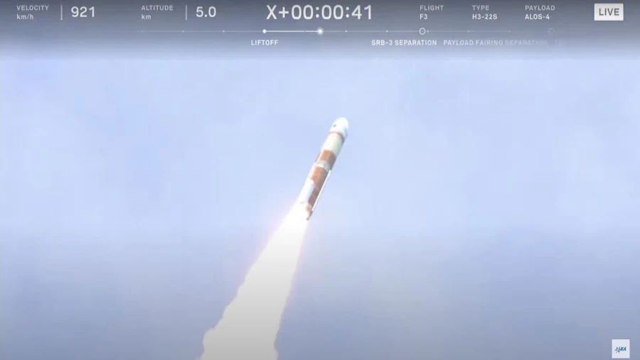
Japan Launches Advanced Earth-Observing Satellite On 3rd Flight Of H3 Rocket

Japan’s new H3 rocket flew for the third time ever tonight (June 30). The H3 launched the Advanced Land Observing Satellite-4 (ALOS-4; also known as DAICHI-4) from Japan’s Tanegashima Space Center tonight, rising off the pad at 11:06 p.m. EDT (0306 GMT and 12:06 p.m. Japan Standard Time on July 1). ALOS-4 was deployed into ...
space.com
New Satellite To Show How AI Advances Earth Observation

New Satellite To Show How AI Advances Earth Observation

ESA’s new Φsat-2 mission, launching in the coming weeks, will push the boundaries of AI for Earth observation – demonstrating the transformative potential of AI for space technology. The integration of AI has significantly enhanced Earth observation. AI capabilities allow for more data to be processed quickly and accurately, helping to enable to transform vast ...
esa.int
Using Remote Sensing To Study How Wild Horses Reduce Shrub And Grassland Biomass

Using Remote Sensing To Study How Wild Horses Reduce Shrub And Grassland Biomass

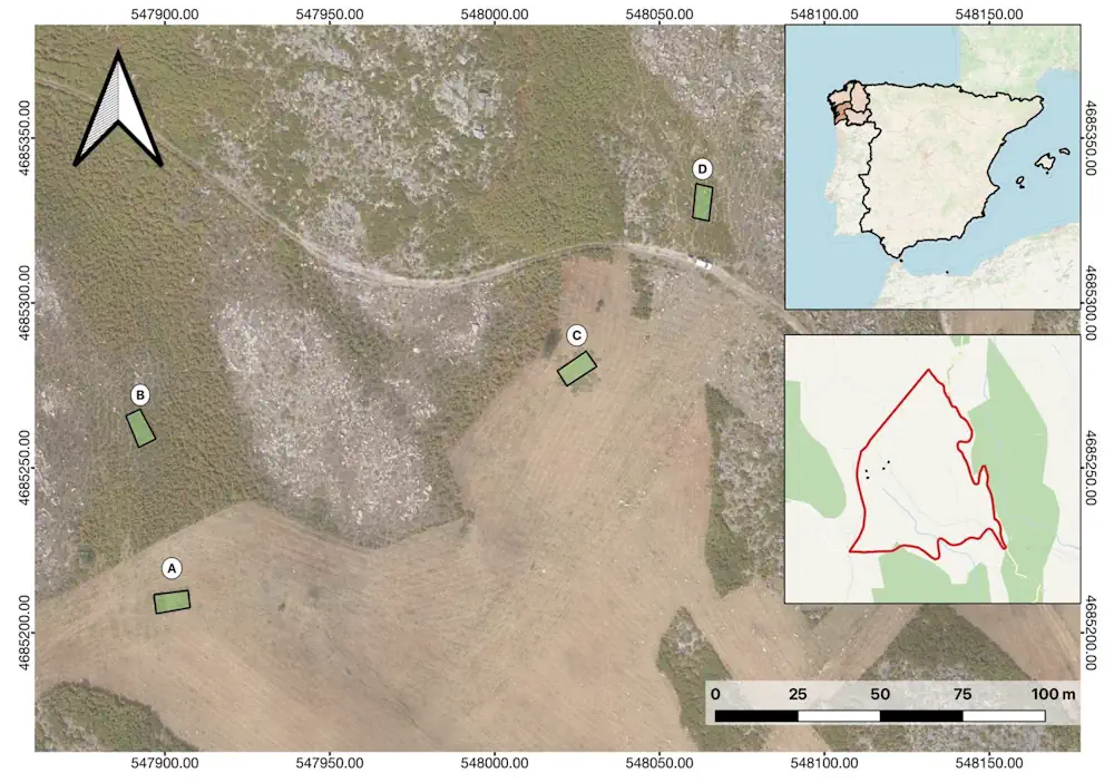
Forests in Galicia, northwestern Spain, are frequently ravaged by wildfires, leading to significant environmental and economic damage. The increasing virulence of these fires, exacerbated by climate change, poses a heightened risk to both natural landscapes and human populations. Traditional forestry methods to mitigate these fires are costly, prompting the exploration of alternative measures. One such ...
naturalsciencenews.com
From Space To Swamp AI Method Classifies Mangrove Species With Unprecedented Accuracy

From Space To Swamp: AI Method Classifies Mangrove Species With Unprecedented Accuracy

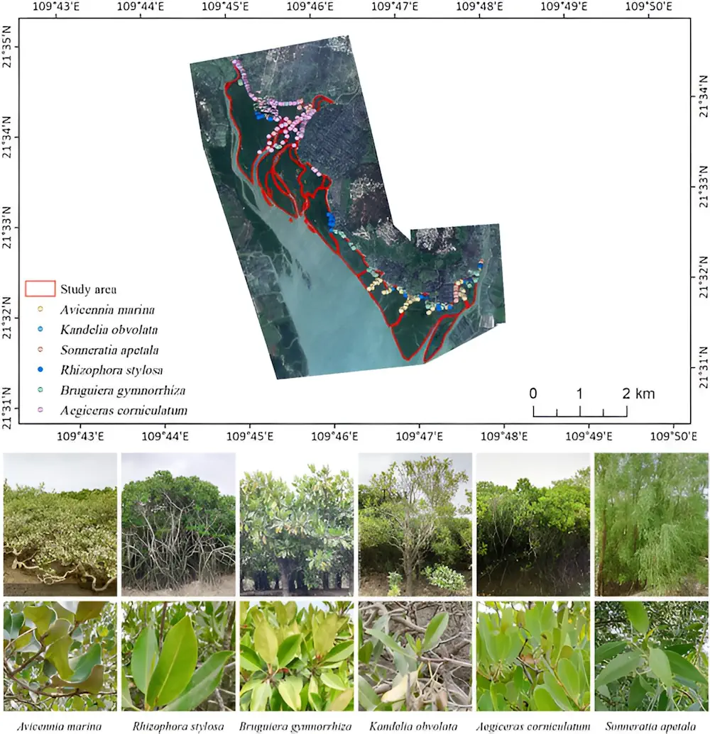
Mangroves are crucial for biodiversity, climate change mitigation, and coastal protection but face threats from climate change and human activities. Traditional monitoring methods fall short in accurately capturing their complex features. The integration of advanced machine learning algorithms with multisource remote sensing data offers a promising solution. Based on these challenges, it is essential to ...
phys.org
New Map Shows The Highest Heat Risk Isn’t Always Where Temperatures Are Hottest

New Map Shows The Highest Heat Risk Isn’t Always Where Temperatures Are Hottest

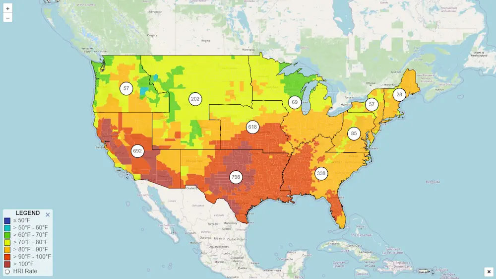
An interactive map created by the Centers for Disease Control and Prevention rates each ZIP code in the mainland U.S. to identify areas “most likely to experience negative health outcomes from heat.” But CDC’s Heat and Health Index shows that heat risk is about much more than temperatures. Heat vulnerability varies sharply within cities and ...
scientificamerican.com
Ottawa Launches Residential School Map To Help In Search For Missing Children

Ottawa Launches Residential School Map To Help In Search For Missing Children

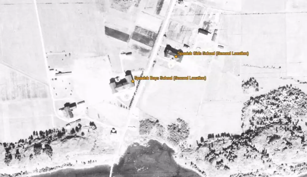
The Canadian government has launched a new interactive online map pinpointing the location of residential schools, and experts say it will help in the search for unmarked or forgotten graves of children forced to go to the institutions. Many residential school buildings have been torn down, paved or built over since the first one opened ...
cbc.ca

Morocco, Turkey Sign Strategic Energy and Mining Agreements

Morocco and Turkey have signed two crucial agreements covering energy, earth sciences, and mining. The agreements were signed on Thursday in Rabat between Morocco’s Ministry of Energy Transition and Sustainable Development Leila Benali and Alparslan Bayraktar, Turkey’s Ministry of Energy and Natural Resources. These agreements include collaboration in renewable energies, green hydrogen, energy efficiency, electricity ...
moroccoworldnews.com
Tunisia To Pilot GIS Mapping For Public Health

Tunisia To Pilot GIS Mapping For Public Health

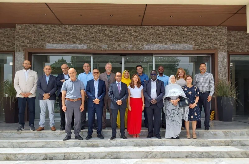
Tunisia has expressed interest in implementing Geographic Information System (GIS) mapping for laboratory functions among North African countries. This initiative aims to create detailed visual representations of laboratory capacities and capabilities across the country. The candidacy emerged during Africa CDC’s first meeting on GIS mapping for public health with seven North African countries, which included ...
africacdc.org

Hydrosat Announces The Launch Of First High-Res Thermal Imagery Commercial Satellite

Hydrosat, the climate tech company leveraging thermal imagery to measure water stress in agriculture and mitigate the effects of climate change, announced the upcoming launch of its first satellite, VanZyl-1, scheduled for early July on SpaceX’s Transporter-11. This satellite will showcase Hydrosat’s proprietary, first-of-its-kind custom imagers, to accelerate the delivery of global high-resolution thermal imaging ...
geospatialworld.net