Geomaticians

18

Researchers From ETH Zurich And Google Introduce InseRF A Novel AI Method For Generative Object Insertion In The NeRF Reconstructions Of 3D Scenes

Researchers From ETH Zurich And Google Introduce InseRF: A Novel AI Method For Generative Object Insertion In The NeRF Reconstructions Of 3D Scenes

In 3D scene generation, a captivating challenge is the seamless integration of new objects into pre-existing 3D scenes. The ability to modify these complex digital environments is crucial, especially when aiming to enhance them with human-like creativity and intention. While adept at altering scene styles and appearances, earlier methods falter in inserting new objects consistently ...
marktechpost.com
Interactive Approach To Geospatial Search Combines Aerial Imagery, Reinforcement Learning

Interactive Approach To Geospatial Search Combines Aerial Imagery, Reinforcement Learning

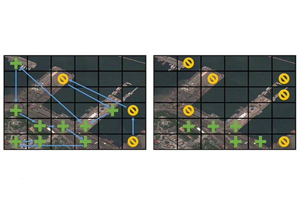
When combatting complex problems like illegal poaching and human trafficking, efficient yet broad geospatial search tools can provide critical assistance in finding and stopping the activity. A visual active search (VAS) framework for geospatial exploration developed by researchers in the McKelvey School of Engineering at Washington University in St. Louis uses a novel visual reasoning ...
engineering.wustl.edu

İzmir’in Tsunami Haritası Çıkarılacak

İzmir Dokuz Eylül Üniversitesi (DEÜ) Mühendislik Fakültesi Jeoloji Mühendisliği Bölümü Öğretim Üyesi ve Deprem Araştırma ve Uygulama Merkez (DAUM) Müdürü Doç. Dr. Ökmen Sümer, İzmir iç ve dış körfezindeki tüm kıyıların ve koyun geometrisini çıkartıp, depremlerin tsunami etkilerini araştırdıklarını belirtip, sonunda oluşturulacak tsunami baskın haritalarıyla, risklerin azaltılmasına imkan sağlanacağını söyledi. Doç. Dr. Sümer, “Bu proje ...
cumhuriyet.com.tr
Neue Luftbilder Der Stadt Bern Sind Verfügbar

Neue Luftbilder Der Stadt Bern Sind Verfügbar

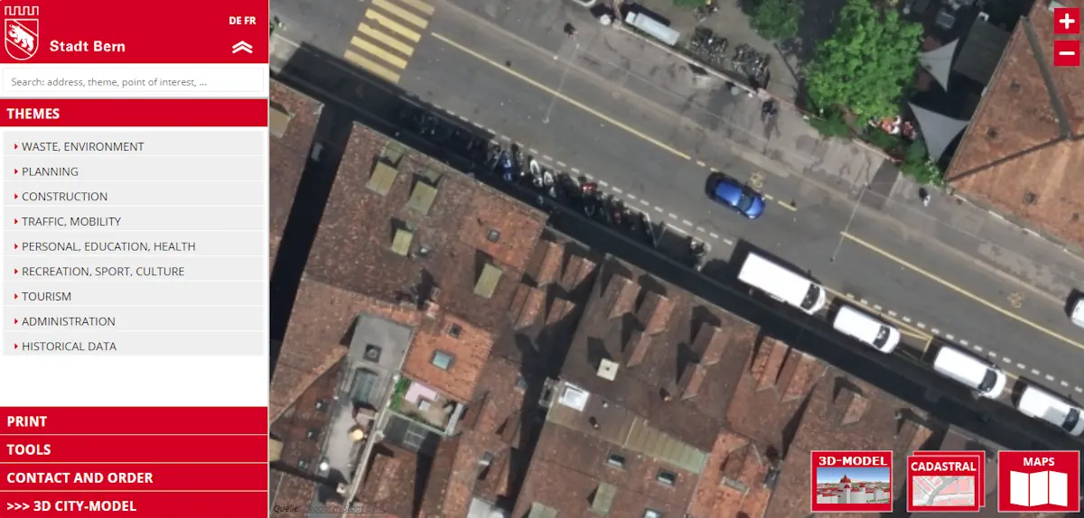
Drei Jahre nach den letzten Aufnahmen hat die Stadt Bern neue Luftbilder der gesamten Gemeinde erstellt. Sie setzt damit eine Zeitreihe mit Aufnahmen von 1999, 2004, 2008, 2012, 2016 sowie 2020 fort. Die Luftaufnahmen wurden am 30. Mai 2023 gemacht und anschliessend zu einem Orthofotomosaik verarbeitet. Künftig dienen sie als Hintergrund- und Referenzdaten für Arbeiten ...
bern.ch
Cartographie Des Traditions Orales Terrastories Arrive Sur Le Maroni

Cartographie Des Traditions Orales : Terrastories Arrive Sur Le Maroni

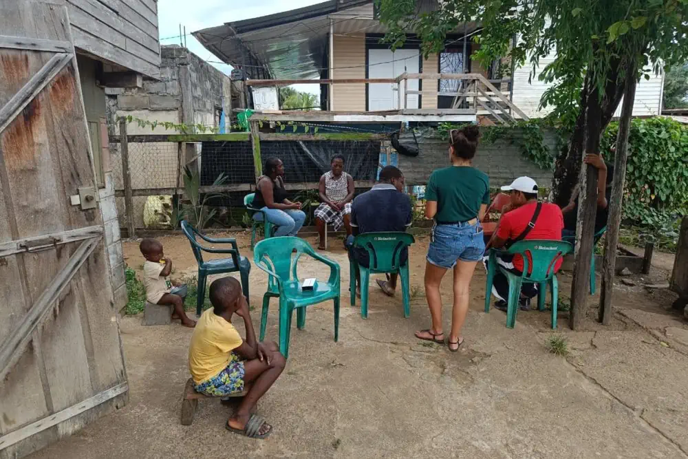
Déjà testée et approuvée au Suriname, l’application Terrastories est désormais en train d’être introduite sur le Haut-Maroni et Papaïchton, afin que les communautés Wayana et Aluku puissent cartographier leurs traditions orales sur des lieux qui ont une signification ou une valeur importante pour elles. Terrastories est une application mobile permettant aux communautés de cartographier, protéger ...
franceguyane.fr
Projeto Biogeomar Convida O Público A Fotografar Animais E Plantas Marinhos

Projeto Biogeomar Convida O Público A Fotografar Animais E Plantas Marinhos

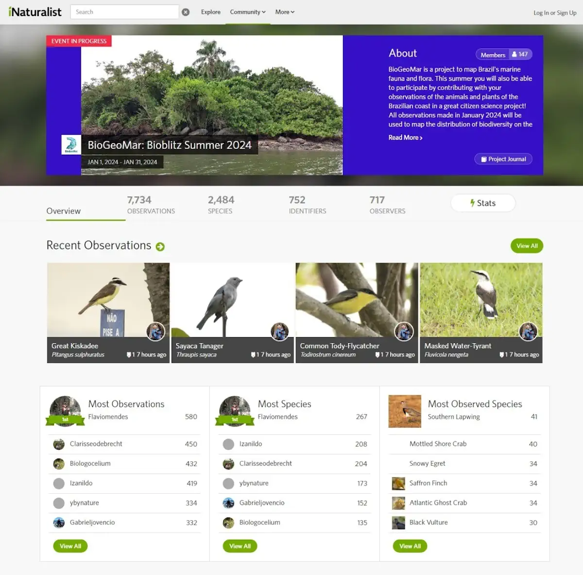
Onde estão as espécies do litoral brasileiro? Buscando conhecer melhor a biodiversidade marinha brasileira, o Programa BioGeoMar acaba de lançar a campanha de ciência cidadã BioBlitz Verão 2024. Nela, o público é convidado a explorar, identificar e registrar a vida dentro e fora da água, sejam animais ou plantas, encontrados em praias, mergulhos ou em ...
ufpr.br

It’s Challenging To Determine Bead-Eligible Locations, Says Wireless 20/20

It’s become obvious that it’s going to be super complicated for states to define the bidding areas for Broadband Equity, Access & Deployment (BEAD) grants. Some states may define bid areas by census blocks, school districts or some other defined geography or cluster. But other states may go with a “free-for-all” approach, allowing bidders to ...
fiercetelecom.com
From Forest-Listening To Advanced Remote Sensing, Can AI Turn The Tide On Deforestation

From Forest-Listening To Advanced Remote Sensing, Can AI Turn The Tide On Deforestation?

Monitoring deforestation across millions of hectares of Amazonian jungle has always been an onerous ask. When illegal logging first became an issue, the authorities relied on word-of-mouth and reports from indigenous communities, before buzzing the jungle in small planes to find the deforested areas. In the 1980s the first satellite images became available, with resolution ...
reuters.com
A New, Rigorous Assessment Of Remote Sensing Tool's Accuracy For Supporting Satellite-Based Water Management

A New, Rigorous Assessment Of Remote Sensing Tool’s Accuracy For Supporting Satellite-Based Water Management

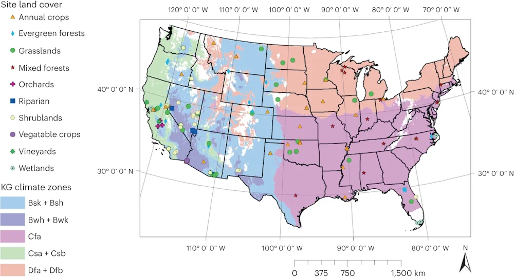
Sustainable water management is an increasing concern in arid regions around the world, and scientists and regulators are turning to remote sensing tools like OpenET to help track and manage water resources. OpenET uses publicly available data produced by NASA and USGS Landsat and other satellite systems to calculate evapotranspiration (ET), or the amount of ...
phys.org

بهره‌برداری از ایستگاه جدید اخذ داده‌های ماهواره‌ای

«عادل پیغامی» مدیرعامل سازمان منطقه آزاد قشم به همراه جمعی از مدیران این سازمان ضمن دیدار با «حسن سالاریه»، معاون وزیر و رئیس سازمان فضایی ایران از مرکز فضایی قشم سازمان فضایی ایران بازدید کردند. در نشستی که واسطه این دیدار برگزار شد، ضمن بیان جزئیات مربوط به فعالیت‌ها و ماموریت‌های مرکز فضایی قشم، طرح‌های ...
irna.ir
New Map Shows Where Damaging Earthquakes Are Most Likely To Occur In US 

New Map Shows Where Damaging Earthquakes Are Most Likely To Occur In US 

Nearly 75% of the U.S. could experience damaging earthquake shaking, according to a recent U.S. Geological Survey-led team of more than 50 scientists and engineers. This was one of several key findings from the latest USGS National Seismic Hazard Model (NSHM). The model was used to create a color-coded map that pinpoints where damaging earthquakes ...
phys.org