Geomaticians

12

Researchers Use Spinning Metasurfaces To Craft Compact Thermal Imaging System

Researchers Use Spinning Metasurfaces To Craft Compact Thermal Imaging System

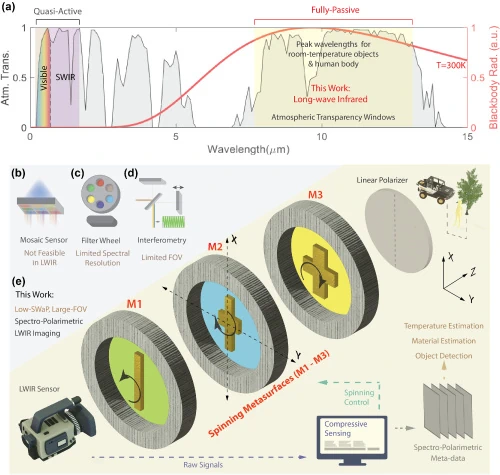
Researchers have developed a new technology that uses meta-optical devices to perform thermal imaging. The approach provides richer information about imaged objects, which could broaden the use of thermal imaging in fields such as autonomous navigation, security, thermography, medical imaging and remote sensing. “Our method overcomes the challenges of traditional spectral thermal imagers, which are ...
optica.org

New GISTDA App Warns Of Hot Spots To Reduce Wildfire Risks

The GISTDA is continuing to develop its application called FAIPA, “Forest Fire” in English, to notify hotspots at the sub-district, district, and provincial levels, using real-time or near real-time satellite data for primary users, including agencies like the Department of Disaster Prevention and Mitigation, volunteer groups, and local residents. The application provides nationwide hotspot data, ...
nationthailand.com
Newly Released Avian Data Monitoring Portal Available To Public And Researchers

Newly Released Avian Data Monitoring Portal Available To Public And Researchers

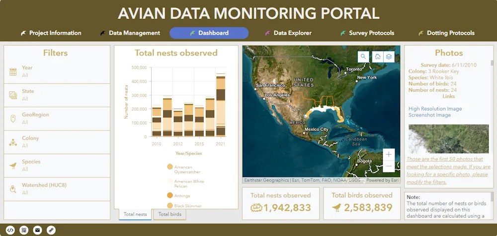
A newly released Avian Data Monitoring Portal brings together more than a decade of aerial survey photos along the northern Gulf of Mexico to provide an easily searchable database for researchers, natural resource managers, and the public. Found at avianmonitoring.com, the portal will help coastal managers, coastal restoration engineers, researchers, and others not only see ...
press-herald.com
Austin Peay Team Used Special Technology To Help Tennessee Tornado Victims

Austin Peay Team Used Special Technology To Help Tennessee Tornado Victims

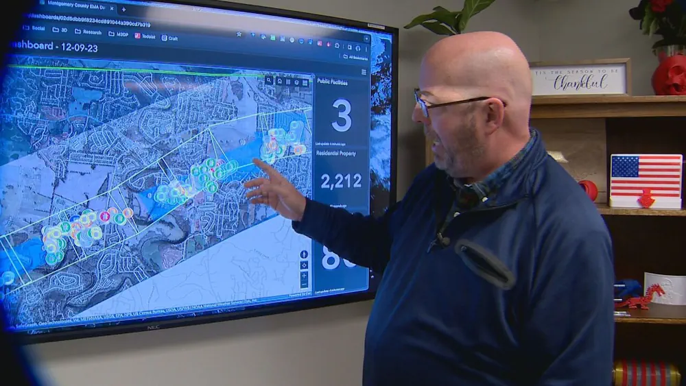
It’s been one month since deadly tornadoes tore through Tennessee counties and left serious devastation. Since then, many have jumped in to help. One team — part of a data center at Austin Peay State University — used a special computer system to get assistance to victims faster. Mike Wilson, the director of the APSU ...
newschannel5.com
Mecklenburg County GIS Time Machine Going Forward By Seeing Where We’ve Been

Mecklenburg County GIS Time Machine: Going Forward By Seeing Where We’ve Been

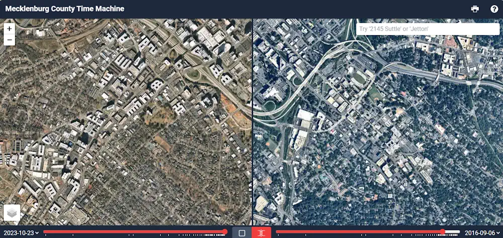
Mecklenburg County Geospatial Information Services (GIS) is starting off 2024 by reflecting on our growth and tree canopy. The Mecklenburg County GIS Time Machine is a Historical Aerial Photo Viewer that allows the user to zoom into a location of interest and view land use changes over time through the display of historical aerial photography ...
news.mecknc.gov

NGA To Tap Commercial Satellite Data Under ‘Luno’ Program

The National Geospatial-Intelligence Agency (NGA) on Jan. 10 issued a solicitation for commercial satellite Earth observation data under a new program called Luno. The program aims to leverage commercial satellite imagery and data analytics to bolster NGA’s global monitoring capabilities, the agency said in the request for proposals. Submissions are due March 26. NGA officials ...
spacenews.com