Geomaticians

11

Cartografia E Telerilevamento, Online L’aggiornamento Dei Dati Territoriali

Si aggiorna e si sviluppa il patrimonio foto-cartografico della Toscana. Sono disponibili online nuovi prodotti derivati dai più recenti rilievi aerei che consentiranno una conoscenza ancora più approfondita di tutto il territorio regionale e delle sue trasformazioni. Questo grazie a specifici progetti di telerilevamento realizzati con risorse interamente regionali. Si tratta, nello specifico, di aggiornamenti ...
toscana-notizie.it

Les Enfants Des Campagnes Ont Les Os Plus Solides Que Les Enfants Des Villes

Tout au long de leur croissance, et jusqu’à l’âge adulte, les enfants construisent leur capital osseux à l’aide de plusieurs apports : la génétique certes, mais aussi une bonne alimentation et un cadre de vie adapté. Mais selon une nouvelle étude menée sur de petits belges, le fait de profiter d’un environnement vert et d’être ...
doctissimo.fr
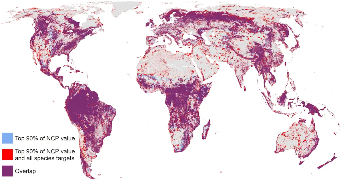
New Research Reveals That Only 18 Percent Of Land Critical For Both Human Well-Being And Biodiversity Is Protected

New Research Reveals That Only 18 Percent Of Land Critical For Both Human Well-Being And Biodiversity Is Protected

A new study supported by One Earth and published in Nature Communications sheds light on a critical environmental issue: the balance between human well-being and biodiversity conservation. The research, conducted by an international team of researchers, reveals that conserving approximately half of the global land area is essential to maintain the majority of nature’s contributions ...
oneearth.org
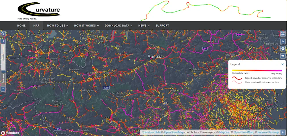
This Website Will Help You Find The Best Driving Roads In The World

This Website Will Help You Find The Best Driving Roads In The World

The search for the perfect driving road never ends. Besides being a subjective matter, how does one even begin such a monumental task as seeking out roads around the world? Actually, it may not be as daunting as you think, thanks to this very cool website that not only highlights twisty roads, but delivers gobs ...
motor1.com
This US-Indian Satellite Will Monitor Earth’s Changing Frozen Regions

This US-Indian Satellite Will Monitor Earth’s Changing Frozen Regions

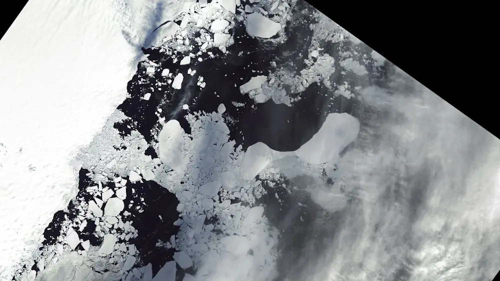
NISAR, the soon-to-launch radar satellite from NASA and the Indian Space Research Organisation (ISRO), will measure some key Earth vital signs, from the health of wetlands to ground deformation by volcanoes to the dynamics of land and sea ice. This last capability will help researchers decipher how small-scale processes can cause monumental changes in the ...
jpl.nasa.gov