Geomaticians

10

Endesa Aplica La Inteligencia Artificial Para Crear “Gemelos Digitales” De Sus Centrales Hidroeléctricas

Endesa aplica la inteligencia artificial para crear “gemelos digitales” de sus centrales hidroeléctricas, lo que permite realizar visitas virtuales en 3D y elaborar diagnósticos preventivos sobre el funcionamiento de estas instalaciones fundamentales en el sistema energético. El primer piloto de gemelo digital para realizar visitas virtuales se lanzó en 2023 en la central hidroeléctrica de ...
europapress.es
Este Mapa 3D Te Enseña Lo Flipantes Que Son Las Enrevesadas Estaciones De Tren Y Metro Para Ahorrar Espacio En La Ciudad

Este Mapa 3D Te Enseña Lo Flipantes Que Son Las Enrevesadas Estaciones De Tren Y Metro Para Ahorrar Espacio En La Ciudad

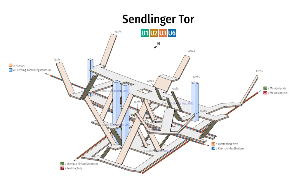
El ingeniero catalán de 26 años, Albert Guillaumes, lleva más de una década haciendo planos de cada estación de tren, metro o intercambiador que visita. Dibuja su forma y sus accesos, así como cada andén, pasillo, ascensor o escalera, y desde hace cuatro años convierte estos bocetos en mapas 3D. Por el momento, en su ...
motorpasion.com
Córdoba Trabaja Para Conseguir La Indicación Geográfica Protegida Del Garbanzo De La Campiña

Córdoba Trabaja Para Conseguir La Indicación Geográfica Protegida Del Garbanzo De La Campiña

El garbanzo de la campiña cordobesa busca tener su Indicación Geográfica Protegida (IGP). Para ello se está trabajando en un proyecto, dirigido por Íñigo Priego, ingeniero agrónomo, quien nos ha explicado qué hace que la campiña cuente con un garbanzo único en el mundo. “En la provincia contamos con suelos arcillosos que provienen de vertisoles. ...
cope.es

Geospatial Commission Highlights MUDDI Model For Subsurface Data

The Geospatial Commission has flagged up the development by the Open Geospatial Consortium (OGC) of a standard for data on subsurface features. It has been the first organisation to use the Model for Underground Data Definition and Integration (MUDDI) in its development of National Underground Asset Register (NUAR), which will provide a national data source ...
ukauthority.com
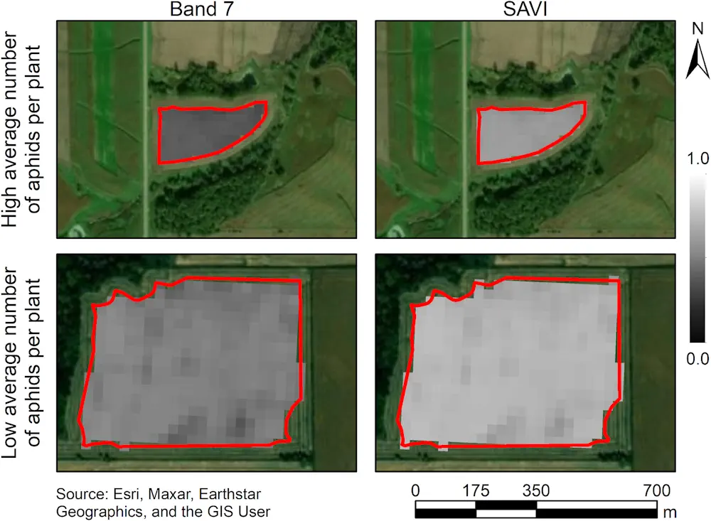
Satellites And AI Could Help Farmers Detect Soybean Aphid Infestations

Satellites And AI Could Help Farmers Detect Soybean Aphid Infestations

Satellite-based remote sensing allows us to see much more than we can see when standing on the ground. New research from the University of Minnesota found, when combined with artificial intelligence, remote sensing could dramatically improve management of soybean aphid, an invasive pest that negatively impacts soybean yield and quality. Published in the journal Crop ...
twin-cities.umn.edu
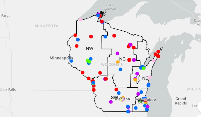
WisDOT interactive map shows where infrastructure funding is awarded

WisDOT Interactive Map Shows Where Infrastructure Funding Is Awarded

The Wisconsin Department of Transportation (WisDOT) announced it launched an interactive map and dashboard that will show where federal discretionary grants were awarded to municipalities across the state. As of Monday, the department said more than $888 million would come to Wisconsin for transportation projects in all corners of the state. “WisDOT is committed to ...
dailyreporter.com
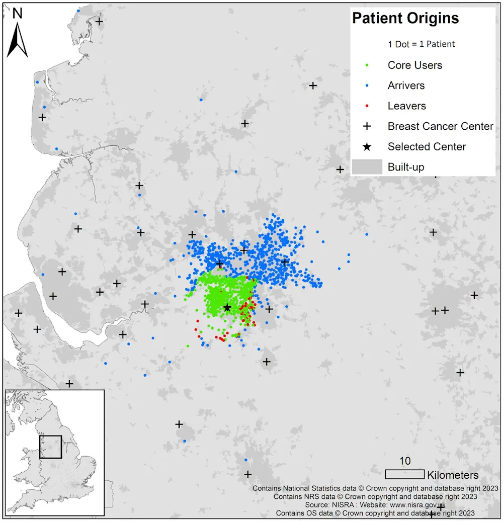
Many Women Bypass Nearest Hospital for Breast Cancer Surgery

Many Women Bypass Nearest Hospital for Breast Cancer Surgery

Many women undergoing breast-conserving surgery (BCS) or mastectomy bypass their nearest hospitals, according to a study published online Jan. 8 in Cancer. Ajay Aggarwal, M.D., Ph.D., from the London School of Hygiene and Tropical Medicine, and colleagues used linked administrative datasets from the English National Health Service to identify all women who underwent BCS or ...
healthday.com
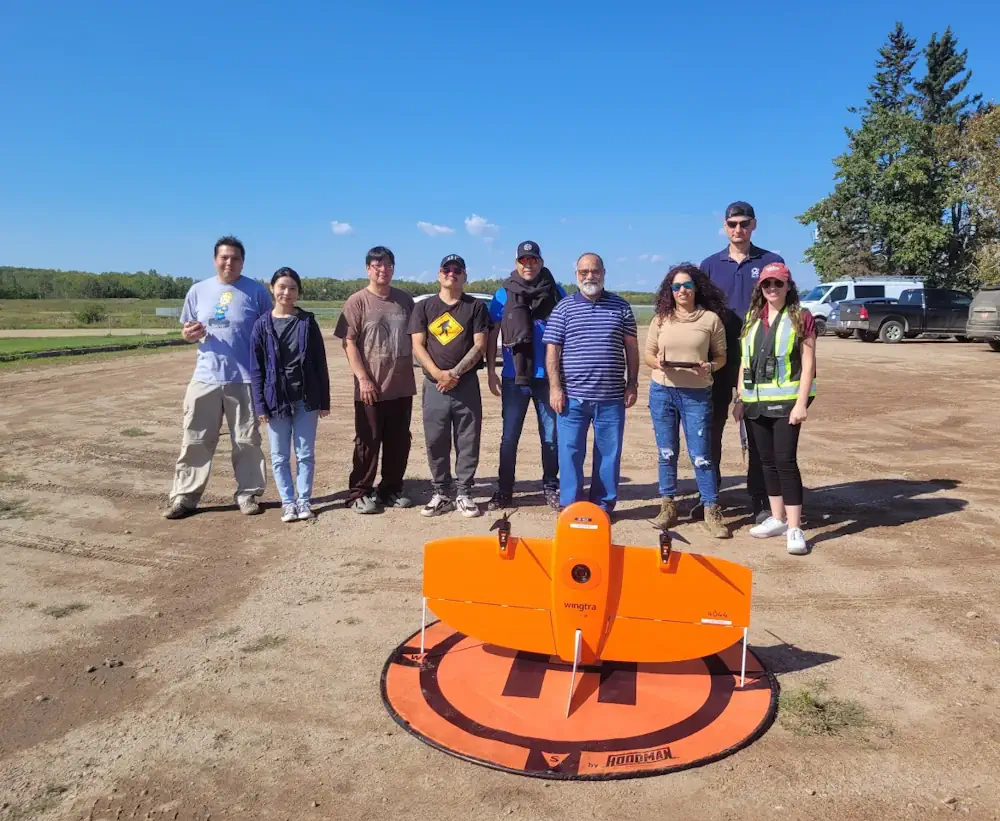
Calgary Researchers Using High-Tech Drones To Map Alberta First Nation

Calgary Researchers Using High-Tech Drones To Map Alberta First Nation

Researchers and students at the Southern Alberta Institute of Technology are using sophisticated drones to digitally map Frog Lake First Nation. The nation, about 260 kilometres northeast of Edmonton, has relied on paper and low-resolution digital maps that no longer represent the community, according to the research team. “Maps are incredibly dynamic. They change quite ...
cbc.ca
The Sound Maps That Predict Poachers' Movements

The Sound Maps That Predict Poachers’ Movements

In the Upper Paraná Atlantic Forest lies the world-renowned Iguazu Falls. On one side of the towering cascades is the Iguazú National Park of Argentina, on the other is the Iguaçu National Park of Brazil. Greened by over 2,000 plant species, the landscape is home to an array of creatures, including the charismatic jaguar. And ...
bbc.com