Geomaticians

02

Coinvolge Anche Il Friuli L’audio-Mappa Digitale Dei Dialetti

Una mappa interattiva open con migliaia di file audio, registrati dai cittadini, in 18 dialetti e lingue minoritarie darà vita alla più grande banca dati digitale mai realizzata dedicata allo studio, alla documentazione e alla ricerca sui dialetti e le varietà linguistiche con status di lingua minoritaria parlate nelle regioni del Nord Italia. Questo uno ...
udineoggi.news
Hochwasserschutz In Bayern Interaktive Gefahrenkarten Online

Hochwasserschutz In Bayern: Interaktive Gefahrenkarten Online

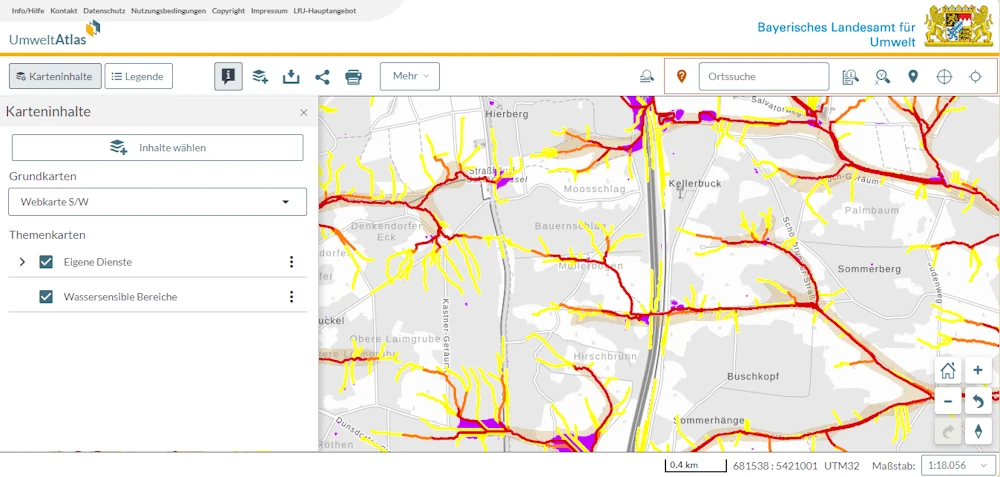
Zum besseren Schutz der bayerischen Bevölkerung vor Sturzfluten steht im Internet ab sofort eine landesweite Gefahrenlandkarte zur Verfügung. “Die Hinweiskarte ist ein wichtiger Schritt hin zu einem besseren Umgang mit Sturzflutgefahren. Die Karte gibt allen Verantwortlichen vor Ort die Möglichkeit zu einer ersten Beurteilung des jeweiligen Sturzflutrisikos”, sagte Umweltminister Thorsten Glauber (Freie Wähler) der Nachrichtenagentur ...
br.de

Le Deep Learning Et La Cartographie Pour Établir Des Liens Entre Exposition Aux Pesticides Et Cancer

Présomption forte de lien entre exposition aux pesticides et six pathologies, dont plusieurs cancers et la maladie de Parkinson. C’est ce que confirme le rapport de l’Inserm (Institut national de la santé et de la recherche médicale) de 2021, en s’appuyant sur plusieurs études épidémiologiques récentes. Et cette conclusion concerne autant les professionnels du monde ...
cio-online.com
Mapeamento De Cabo Verde Para Proteger As Tartarugas Do Plástico

Mapeamento De Cabo Verde Para Proteger As Tartarugas Do Plástico

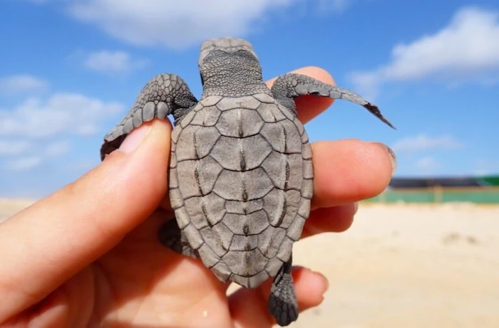
A estudante do Programa Doutoral em Biologia da FCUP, Diana Sousa Guedes, tem estado a mapear, com recurso a um drone, o lixo marinho das praias de Cabo Verde, num trabalho que procura perceber o impacto do plástico nas tartarugas-marinhas. O objectivo é proteger estas espécies ameaçadas de extinção, num cenário cujos resultados não são, ...
campeaoprovincias.pt
Un Equipo Multidisciplinar De La UBU Hace Posible Visitar Las Alturas De La Catedral

Un Equipo Multidisciplinar De La UBU Hace Posible Visitar Las Alturas De La Catedral

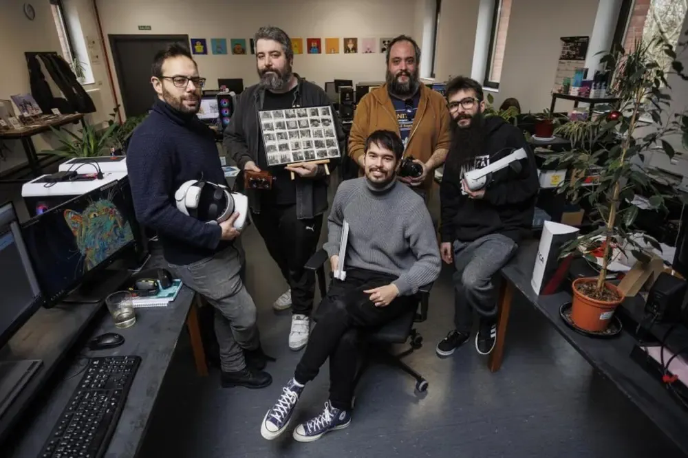
Si aún lo ha probado, no tarde en hacerlo: la experiencia es fascinante. No es de extrañar, pues, que se esté poco a poco convirtiendo en uno de los grandes atractivos de la Catedral, que ya es decir tratándose de la gran joya del gótico español. Acertó de pleno el Cabildo metropolitano cuando, ante los ...
diariodeburgos.es
Method Combines Artificial Intelligence And Satellite Imagery To Map Crop-Livestock Integration Systems

Method Combines Artificial Intelligence And Satellite Imagery To Map Crop-Livestock Integration Systems

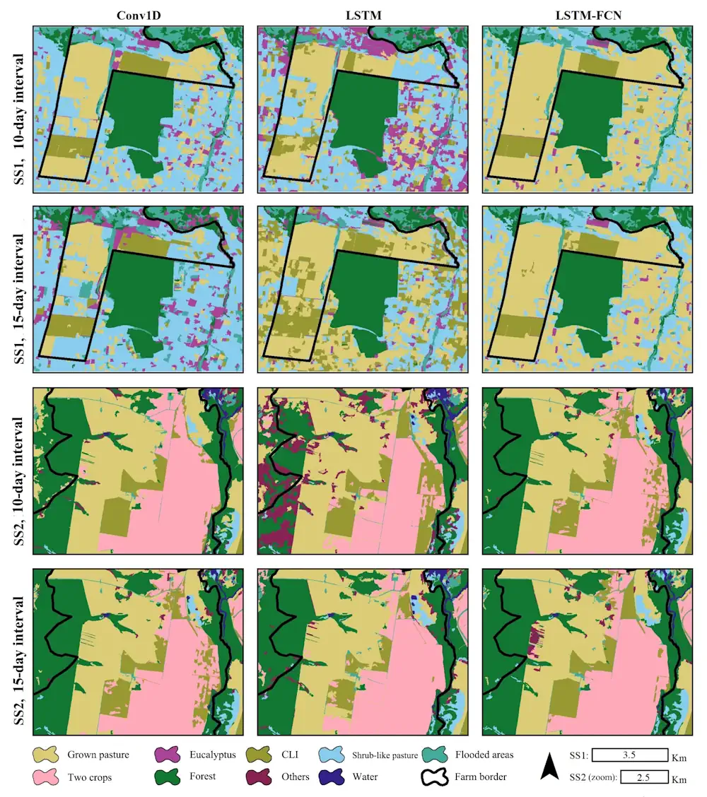
Crop-livestock integration (CLI) systems combine the growing of crops in rotation or consortium, especially grain crops such as soybeans, corn and sorghum, and forage plants used to feed cattle and pigs, with the raising of livestock, typically beef cattle. The crops provide most of the cash income, while the livestock has food available during the ...
phys.org
Auckland Tsunami Map Refreshed

Auckland Tsunami Map Refreshed

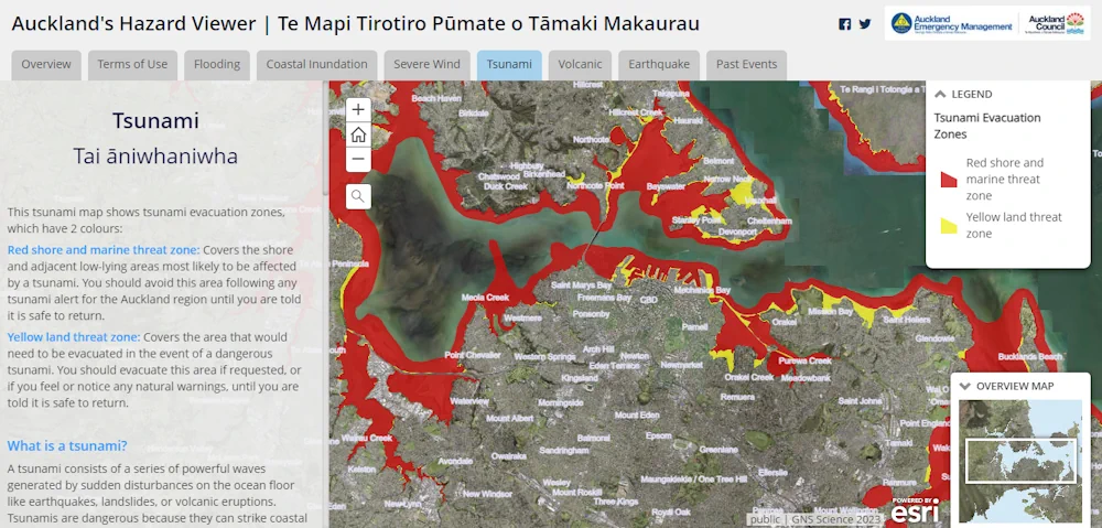
Fewer Auckland residents would be at risk in the event of a tsunami than the council previously thought. Auckland Emergency Management (AEM) has updated the region’s tsunami map in the wake of new data which it says showed less of the city’s coastline would be at threat. AEM head of operations John Cranfield said the ...
rnz.co.nz
Esri Launches Maps.Com, A Content Platform For Creators Demonstrating The Power Of Maps

Esri Launches Maps.Com, A Content Platform For Creators Demonstrating The Power Of Maps

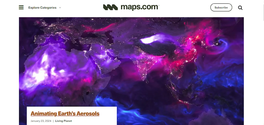
Created by Esri, the global leader in mapping and location intelligence software, the new website is a platform for sharing and discussing visually engaging maps that inspire, challenge, educate, reward, and provoke across a range of topics and formats. The site will serve as a celebration of science and art, presenting maps that captivate not ...
businesswire.com