Geomaticians

05

Mapping marine heatwaves to understand their impacts

Mapping marine heatwaves to understand their impacts

Marine heatwaves are becoming more frequent in a warming world, as rising ocean temperatures trigger these mysterious and damaging phenomena. The profound effects of marine heatwaves on ecosystems – from coral bleaching to disruptions in biodiversity – explain why scientists believe great urgency is required to understand their development and longevity. As we grapple with the challenges of climate change, ...
earth.com
High-resolution map details active faults in New Zealand

High-resolution map details active faults in New Zealand

An interactive high-resolution dataset has been released to the public, showing the active faults running through New Zealand. The data set, made available by GNS Science, shows the locations of faults that have broken or deformed the surface in the last 125,000 years. Scientists made the information available in a bid to help further research, hazard assessment, ...
stuff.co.nz
Notre Dame Cathedral reopens 3D mapping guides historic restoration

Notre Dame Cathedral reopens: 3D mapping guides historic restoration

Notre Dame Cathedral in Paris has reopened its doors five years after the devastating fire, showcasing its restored interior after extensive rebuilding work. The restoration, costing approximately €700 million ($737 million), was financed entirely by donations from around the world.  On April 15, 2019, Notre Dame went up in flames, with the spire collapsing and ...
gpsworld.com

PCMC launches GIS-based road asset management system

In a unique initiative, the Pimpri-Chinchwad Municipal Corporation (PCMC) has launched the GIS-based Road Asset Management System (RAMS) to overhaul the city’s road maintenance and management process. The initiative addresses critical challenges that have plagued urban road management for years, including the absence of centralised data, inefficient resource allocation, and ad-hoc repair decisions. Furthermore, road ...
hindustantimes.com
Expanded AI Model with Global Data Enhances Earth Science Applications

Expanded AI Model with Global Data Enhances Earth Science Applications

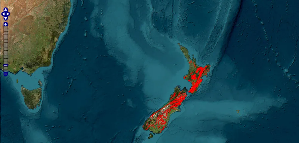
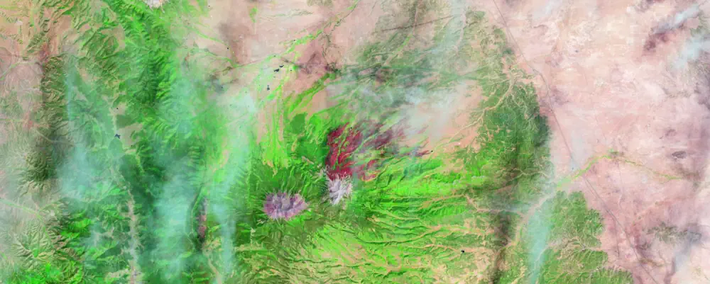
NASA, IBM, and Forschungszentrum Jülich have released an expanded version of the open-source Prithvi Geospatial artificial intelligence (AI) foundation model to support a broader range of geographical applications. Now, with the inclusion of global data, the foundation model can support tracking changes in land use, monitoring disasters, and predicting crop yields worldwide.  The Prithvi Geospatial foundation model, ...
science.nasa.gov