Geomaticians

18

Brasil E China Participam Da 19º Reunião Do Comitê De Projetos Conjuntos (JPC) No INPE

Brasil E China Participam Da 19º Reunião Do Comitê De Projetos Conjuntos (JPC) No INPE

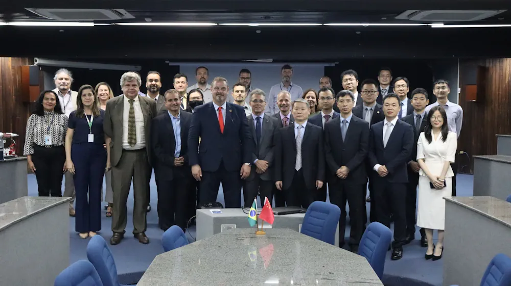
OInstituto Nacional de Pesquisas Espaciais (INPE), e China Academy of Space Technology (CAST) participam da 19ª reunião do Comitê de Projetos Conjuntos (JPC – sigla em inglês). Estiveram presentes nesta reunião vários Coordenadores e especialistas do INPE e representantes de diversos setores da CAST. Iniciando a reunião, o Diretor Clezio Marcos De Nardin deu as ...
gov.br
Los Puertos De Baleares Incorporan Tecnología Geoespacial Para Controlar El Alto Volumen De Escalas

Los Puertos De Baleares Incorporan Tecnología Geoespacial Para Controlar El Alto Volumen De Escalas

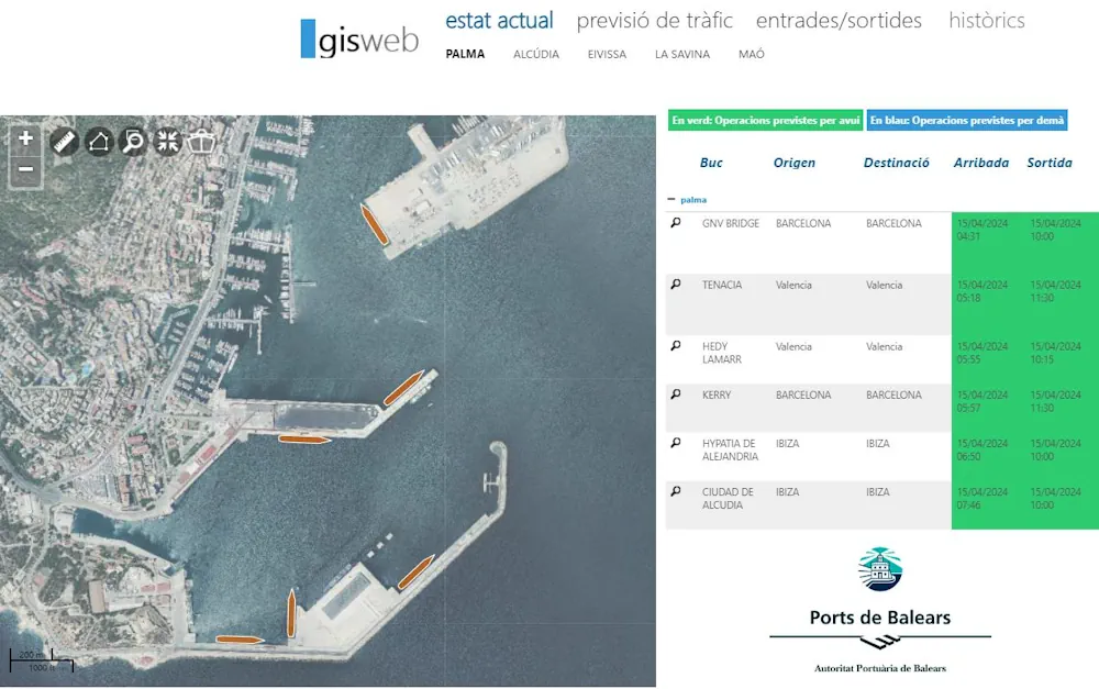
La Autoridad Portuaria de Baleares (APB) ha incorporado tecnología geoespacial para gestionar «de manera más eficiente» la información sobre sus infraestructuras y operaciones portuarias en en tiempo real. No en vano, las Islas lideran el ránking nacional de escalas con más de 50.000 entradas y salidas de ferries, barcos de mercancías y cruceros. A todo ...
menorca.info
Aerial Photos Of London And Surrounding Counties Give Glimpse Into City's History

Aerial Photos Of London And Surrounding Counties Give Glimpse Into City’s History

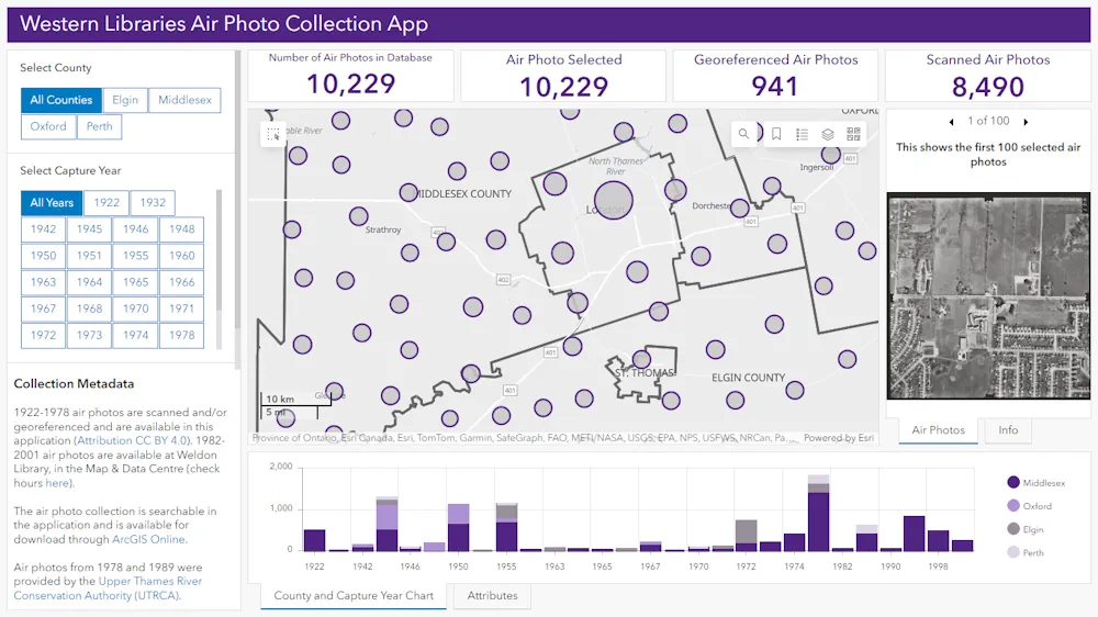
A new app featuring more than 10,000 aerial photos from London and surrounding counties shows what the region looked like from the air in the last 100 years. Developed by Eunice Chu, a fourth-year geographic information systems (GIS) student who works as a student library assistant at the Map and Data Centre at Western University’s ...
cbc.ca
New Geological Map Reveals Secrets Of Greenland's Icy Interior

New Geological Map Reveals Secrets Of Greenland’s Icy Interior

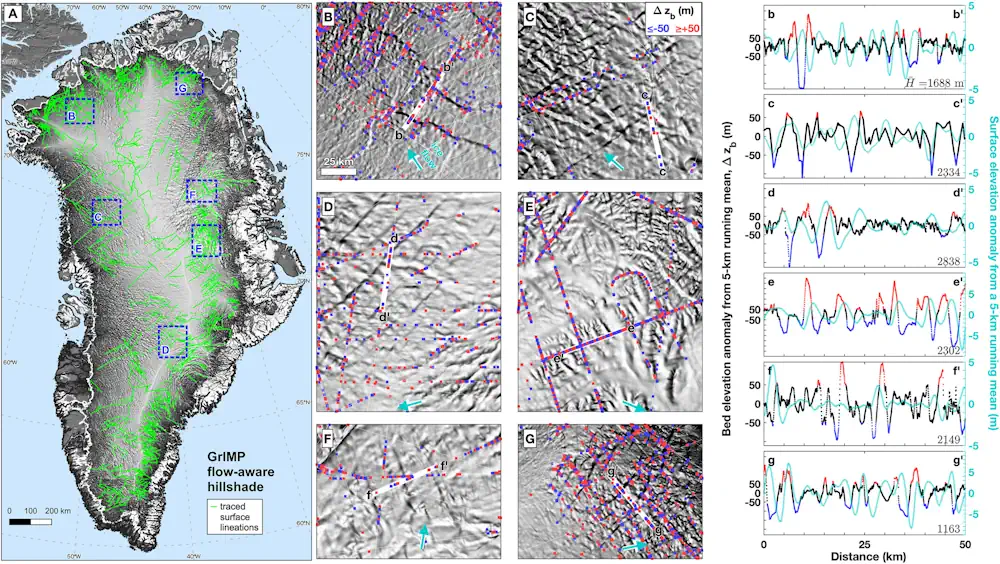
A team of international scientists involving the Durham University Geography department has unveiled a new map of the geological provinces hidden beneath the Greenland Ice Sheet. This comprehensive synthesis, published in Geophysical Research Letters, promises to advance our understanding of this critical component of the global climate system. The new subglacial geology map provides an ...
phys.org

In A First, Japan Doctors Sue Google Over Negative Reviews On Firm’s Map App

A group of 63 doctors filed a lawsuit with the Tokyo District Court on Thursday against Google seeking ¥1.45 million (about $9,400) in compensation for causing harm to their businesses through what they described as one-sided, hateful reviews for their clinics on Google Maps. The suit is the first in Japan — and possibly the ...
japantimes.co.jp

Bangladesh To Introduce Drone Technology To Assess Crop Losses

Bangladesh is preparing to introduce remote sensing and drones to detect crop damage caused by extreme weather events or diseases. Around 20 officers of the Department of Agricultural Extension (DAE) are initially receiving training to learn how to use the state-of-the-art technologies. Malay Choudhury, additional secretary, Ministry of Agriculture, and Edimon Ginting, ADB Country Director ...
en.prothomalo.com
Overture Maps Foundation Releases The First Beta Of Its Open Map Dataset

The Overture Maps Foundation today launched the first beta of its global open map dataset. With this, the foundation, which is backed by the likes of Amazon, Esri, Meta, Microsoft and TomTom, is getting one step closer to launching a production-ready open dataset for developers who need geospatial data to power their applications. “This Beta ...
techcrunch.com
Brazil Looking To Improve Geological Mapping System For Mining

Brazil Looking To Improve Geological Mapping System For Mining

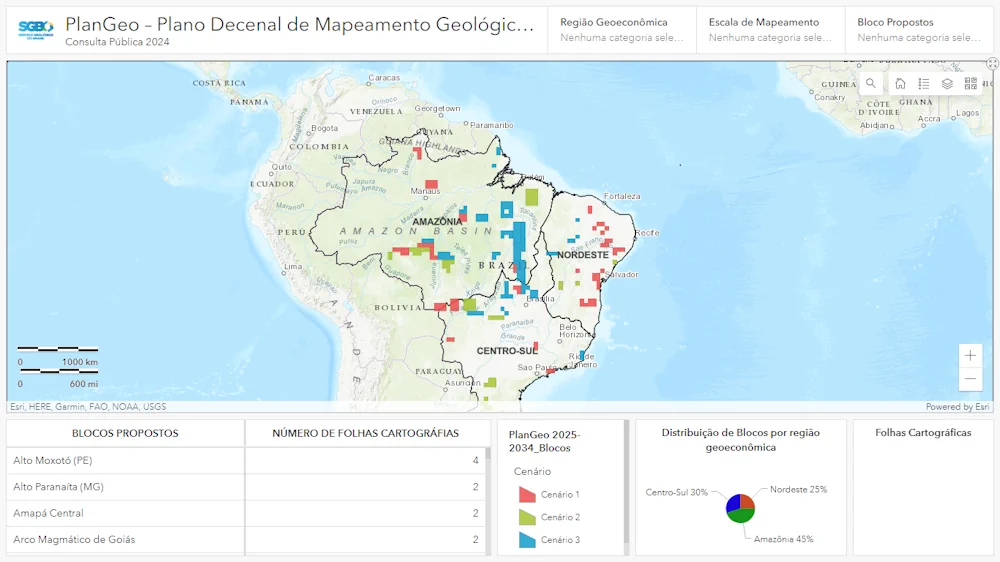
The Brazilian geological survey department, SGB, launched a public consultation to improve the country’s geological mapping system for the mining sector. The public consultation will be open until June 15. “This action is part of the 10-year basic geological mapping plan (PlanGeo) and is aimed at receiving proposals from the mining sector and civil society ...
bnamericas.com

Barcelona Bus Route Removed From Map Apps To Tackle Tourist Overcrowding

While some places will go to any lengths to attract visitors, residents of La Salut neighbourhood in Barcelona are celebrating a move to wipe themselves off the map. For years, residents had complained that they could not get home because the number 116 bus was always crammed with tourists visiting Antoni Gaudí’s Park Güell. The ...
theguardian.com

Microsoft, Siemens Join Forces To Standardize Digital Twin Languages

In a collaborative move with the W3C Consortium, Siemens and Microsoft have announced their commitment to converge the Digital Twin Definition Language (DTDL) with the Thing Description standard from international standards organization, W3C. By unifying both languages, customers are offered consistent modeling experiences, mitigating fragmentation in an evolving IoT landscape. With customers typically deploying a ...
thefastmode.com
Satellite Shows Hazards of US Winter Rivers

Satellite Shows Hazards of US Winter Rivers

Researchers from the University of Alaska Fairbanks have developed a new technology using synthetic-aperture radar (SAR) to detect hazardous sections of open water in frozen rivers in Alaska during winter. This technology can also be applied across the Arctic, where open water zones pose similar dangers. By identifying these open water zones, researchers hope to ...
globeecho.com

The Integrated Transport Centre Signs A MoU With A Leading Japanese Company “Location Mind” In Research And Development

On the sidelines of the 10th session of the Abu Dhabi Japan Economic Council, held in the capital Abu Dhabi, the Integrated Transport Centre (ITC) of the Department of Municipalities and Transport (DMT) in Abu Dhabi signed a strategic Memorandum of Understanding (MoU) with “Location Mind”, a leading Japanese company in the field of research, ...
zawya.com

Unlocking The Secrets Of Forest Heights: The Role Of GEDI Lidar Technology

A team of researchers has unveiled a novel approach to accurately characterizing tree height composition in forests using the Global Ecosystem Dynamics Investigation (GEDI) Light Detection and Ranging (LiDAR) technology. This study marks a significant advancement in our understanding of forest ecosystems, shedding light on the intricacies of tree height variability and its implications for ...
eurekalert.org
London Gatwick Airport Builds Geospatial Platform With Esri GIS

London Gatwick Airport Builds Geospatial Platform With Esri GIS

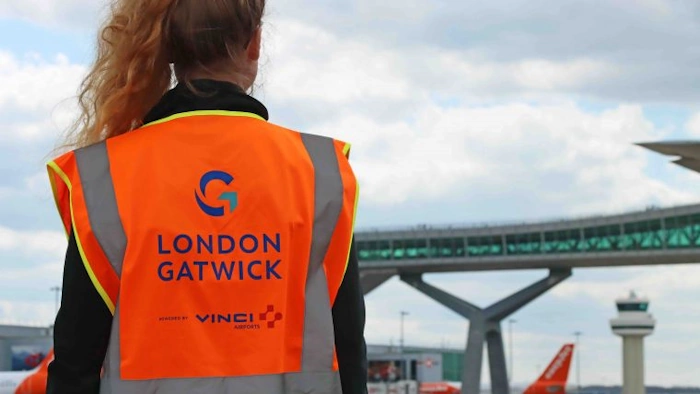
London Gatwick has created a new geospatial platform using Esri’s ArcGIS to support multiple operational areas at the airport, including engineering and environmental services. The system is already making engineering and construction works safer by reducing accidental strikes on buried utilities and enabling better management of the airports biodiversity. London Gatwick is one of the ...
gim-international.com