Geomaticians

2023

Trees Are Not Always A Miracle Cure For Improving Air Quality

Donato Kofel has quantified the positive and negative effects of trees on outdoor air quality in Geneva Canton. His method can be used by city planners to design their large-scale planting programs more effectively. For his Master’s project at the end of his degree program, Kofel developed a new way to use the GIS application ...
phys.org

Satellite Imagery Helps Texas City Detect Water Leaks

The City of Midland spends $2.5 million a year to bring water to Midland. On Tuesday, the Midland City Council approved a contract that will help make sure more of that water reaches the city and its customers. City leaders approved $212,000 in costs with Asterra of La Jolla, California, and that Asterra will perform ...
govtech.com
WSGS Debuts Interactive Map Of Wyoming's Mineral Resources

WSGS Debuts Interactive Map Of Wyoming’s Mineral Resources

The Wyoming State Geological Survey has developed a new interactive map that will make it easier to research the state’s extensive mineral resources. The online Mineral Resources of Wyoming map will be routinely updated as new data become available. The map is an update and expansion of the WSGS’s 2018 Mines and Minerals map. New ...
wyomingnews.com

Museu De Arqueologia E Etnologia Da USP Usa Startup De Blockchain Para Registrar Areas Em São Paulo

O Museu de Arqueologia e Etnologia da USP (MAE) está usando soluções de uma startup baseada em tecnologia blockchain no mapeamento e registro do patrimônio arqueológico de São Paulo. A solução foi desenvolvida para Museu pela Quipo Tech, empresa residente na Incubadora do Laboratório Nacional de Computação Científica (LNCC), ligado ao Ministério de Ciências Tecnologias ...
br.cointelegraph.com
El INAH Y El Instituto Nacional Del Patrimonio Cultural De Ecuador Signan Convenio De Colaboración

El INAH Y El Instituto Nacional Del Patrimonio Cultural De Ecuador Signan Convenio De Colaboración

La Secretaría de Cultura del Gobierno de México, a través del Instituto Nacional de Antropología e Historia (INAH), firmó un convenio de colaboración con el Instituto Nacional del Patrimonio Cultural (INPC) de la República del Ecuador, para coadyuvar en la protección, preservación, promoción y administración de la herencia cultural de ambos países. Los intercambios de ...
inah.gob.mx
El SEGEMAR Y El Servicio Geológico De Arabia Saudita Firman Acuerdo De Cooperación Científica Geológica

El SEGEMAR Y El Servicio Geológico De Arabia Saudita Firman Acuerdo De Cooperación Científica Geológica

El objeto del acuerdo es la cooperación en el campo de la geología, proporcionando un marco institucional para el intercambio de conocimientos y mejorar las competencias técnicas y geológicas entre ambos organismos. En este sentido, ambas instituciones coincidieron en promover la cooperación científica y técnica en temas de prospección geológica, geofísica y evaluación de recursos ...
argentina.gob.ar
Measuring The Extent Of Global Droughts In Unprecedented Detail

Measuring The Extent Of Global Droughts In Unprecedented Detail

While some parts of the world suffer extreme heat and persistent drought, others are being flooded. Overall, continental water volumes vary so much over time that global sea levels fluctuate significantly too. By combining the hydrological model WaterGAP with GRACE satellite data, a team of geodesists at the University of Bonn have come up with ...
phys.org

Cooling Centers Interactive Map Added To City’s Alerts Page

Having somewhere to cool off on a hot day in Austin is crucial to staying safe during the summer. Knowing where you can go to cool off is now easier for Austinites and visitors thanks to an interactive Google Map on the City’s Alerts page. During the summer months, City facilities like Austin Public Library ...
austintexas.gov

La Xunta Desarrolla Tecnologías De Inteligencia Artificial Para Ayudar En La Actualización Del Registro De Viñedos

Las tecnologías de inteligencia artificial que permiten “entrenar” un sistema para que sea capaz de diferenciar entre tierras ocupadas por viñedos y aquellas que no lo están serán utilizadas por la Xunta para actualizar la información sobre parcelas vitícolas. Hasta ahora son los técnicos los que tienen que comprobar y, en su caso, descartar las ...
galiciapress.es

U.S. Commission To Investigate China’s Remote-Sensing Technologies

The U.S.–China Economic and Security Review Commission issued a solicitation for an unclassified report on China’s remote sensing technologies and applications. The commission, established in 2000, is an independent agency of the U.S. government that directly reports to Congress and the president. The request for proposals, issued Aug. 8, seeks a report that assesses China’s ...
spacenews.com

IN-SPACe May Be Looking At 130 Satellites, But Need More Than That: Experts

Is the Indian government looking at having about 130 earth observation satellites under the public-private-partnership model, an idea mooted by the Indian National Space Promotion and Authorisation Centre (IN-SPACe) in its consultation paper? It seems yes, based on the kind of imagery that is required and the number of revisits a satellite has to make ...
nagalandpost.com
The USGS Estimates Potential Spread Of Invasive Species Carried By Hurricane-induced Flooding

The USGS Estimates Potential Spread Of Invasive Species Carried By Hurricane-induced Flooding

Hurricane-related flooding can result in a slow transformation of ecosystems found on land and in water, as floodwaters can carry invasive wildlife and plant species into new regions, accelerating their spread. When invasive species spread into new areas, there can be environmental, economic and human health effects that can cost the U.S. billions of dollars. ...
usgs.gov
Early Detection Helps States Control Invasive Species Before It’s Too Late

Early Detection Helps States Control Invasive Species Before It’s Too Late

As non-native plants invade new areas, state officials worry about their effects on local ecosystems, infrastructure and recreation. Japanese knotweed, an invasive plant commonly found in the Northeast along roadsides, wetland areas and waterways, for example, can damage highway and water infrastructure, according to a 2021 report from the U.S. Transportation Department. It can grow ...
Bluesky Metrovista 3D City Model Underpins Nottingham’s Digital Twin

Bluesky Metrovista 3D City Model Underpins Nottingham’s Digital Twin

Nottingham City Council is a step closer to achieving its vision of creating a digital twin for the city. In what’s believed to be a UK first they are combining the intricate, rich MetroVista 3D mesh with existing photogrammetric 3D modelling within the same application. This enables the visualisation of new developments in an immersive ...
directionsmag.com

Nowe Regulacje Usprawnią Standaryzację Zbiorów Danych Przestrzennych

Na stronach Rządowego Centrum Legislacji pojawił się projekt zmiany rozporządzenia Ministra Rozwoju i Technologii, który stawia ważny krok w kierunku standaryzacji tworzonych zbiorów danych przestrzennych. Zmiany dotyczącą dokładnie projektu regulacji zmieniających rozporządzenie w sprawie zbiorów danych przestrzennych oraz metadanych w zakresie zagospodarowania przestrzennego(1). Jego celem jest aktualizacja oraz rozszerzenie regulacji w zakresie tworzenia zbiorów obejmujących ...
teraz-srodowisko.pl
Austria Publishes Map Of Locations With Available Grid Capacity For PV

Austria Publishes Map Of Locations With Available Grid Capacity For PV

The Austrian government introduced the Electricity Industry and Organization Act (ElWOG) two years ago, leading to the creation of a map of locations with available grid capacity for solar. The ElWOG require grid operators to be transparent about grid-connection capacity. Oesterreich Energie will update the map on a quarterly basis, by using reports from Austrian ...
pv-magazine.com

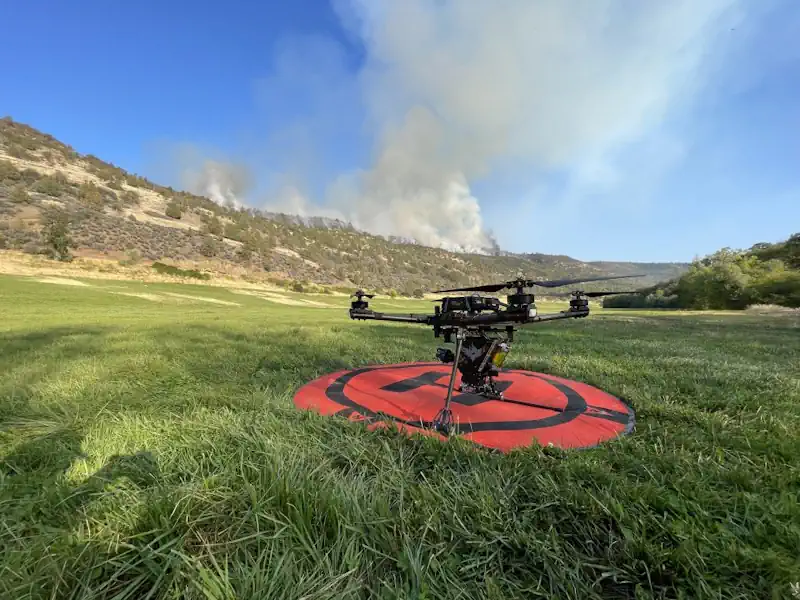
Orman Yangınlarıyla Mücadelede “Yapay Zeka” Desteği Artıyor

Bakanlık orman yangınlarıyla mücadelede üst düzey teknolojik sistemlerden faydalanarak projeler geliştiriyor. Bu kapsamda, Orman Genel Müdürlüğü ve özel sektör işbirliğiyle yapay zeka destekli “Yangın Risk Yönetimi Projesi” uygulanıyor. Projeyle orman yangınlarının önceden tahmin edilebilmesine yönelik çalışmalar yapılarak bu bölgelerde gerekli önlemler alınmaya çalışılıyor. Çeşitli faktörler göz önünde bulundurularak geliştirilen projeyle meteorolojik veriler, bitki örtüsü, topografya, ...
aa.com.tr

NOAA Eliminates Certain Restrictions On Commercial Remote Sensing Companies

The U.S. government lifted certain restrictions on commercial remote sensing satellite companies on Monday. The changes came from NOAA’s Commercial Remote Sensing Regulatory Affairs (CRSRA) office, which is a division of the Office of Space Commerce. CRSA said restrictions in place kept companies from offering their full capabilities to the public. In 2020, CRSA changed ...
satellitetoday.com
Hong Kong's First-ever And One Of The World's Largest Satellite Manufacturing Facilities To Deliver First Satellite By 2024

Hong Kong’s First-ever And One Of The World’s Largest Satellite Manufacturing Facilities To Deliver First Satellite By 2024

China’s Hong Kong Special Administrative Region (HKSAR) has newly launched the city’s first and one of the world’s largest satellite manufacturing facilities, known as AMC. The facility revealed to the Global Times in an exclusive interview that their first made-in-Hong Kong, high-quality satellite would hopefully be delivered by the beginning of 2024. Referred also as ...
globaltimes.cn

Russia Launches Newly Redesigned Navigation Satellite

The first GLONASS-K2 satellite finally reached the launch status in the middle of 2023, or a decade behind the original schedule. At the end of July 2023, the adminstration of the Safronovskoe settlement in the Lensk District in the Arkhangelsk Region (Oblast) posted a letter from the Deputy Commander of the Russian Space Forces, VKS, ...
russianspaceweb.com

NextNav Completes Initial Tests For 3D Poisition, Navigation And Timing Service

The solution combines NextNav’s reliable TerraPoiNT system with existing LTE and 5G network signals. The tests, conducted in and around San Jose, California, US, showcased the integration of TerraPoiNT signals with cellular infrastructure to deliver highly accurate 3D positioning and timing information without depending solely on traditional satellite-based GPS and GNSS signals. NextNav’s system utilises ...
construction-europe.com
Roman Road Network Spanning The South West Identified In New Research

Roman Road Network Spanning The South West Identified In New Research

Archaeologists at the University of Exeter have used laser scans collected as part of the Environment Agency’s National LiDAR Programme to identify new sections of road west of the previously understood boundary. Among the things it reveals is that far from Exeter being the main nerve centre of the network, it was North Tawton that ...
sciencedaily.com
Modelo Geoespacial Analisa A Relação Custo-benefício Dos Telhados Verdes Nas Cidades

Modelo Geoespacial Analisa A Relação Custo-benefício Dos Telhados Verdes Nas Cidades

Telhados verdes têm sido apontados como uma das possíveis soluções para o combate às mudanças climáticas nas cidades. Isso porque, além de permitirem a captação de água da chuva e a produção de hortaliças no alto dos edifícios, eles também são capazes de gerar microclima, reduzindo a temperatura local e o gasto energético com refrigeração, ...
mundogeo.com
Butterflies Can Remember Where Things Are Over Sizeable Spaces, Study Finds

Butterflies Can Remember Where Things Are Over Sizeable Spaces, Study Finds

Heliconius butterflies are capable of spatial learning, scientists have discovered. The findings, published in Current Biology, also suggest Heliconius butterflies may be able to learn spatial information at large scales, consistent with the apparent importance of long-range spatial learning for traplining, which involves foraging within a home range of a few hundred square meters. Spatial ...
bristol.ac.uk

재난·재해 반복되는데 예방위한 디지털트윈 예산 ‘0’

폭우·폭염 등 재난재해가 반복되는 가운데 예방책 중 하나인 디지털트윈 관련 사업 예산이 보류됐다. 윤석열 정부 국정 과제에 디지털트윈국토 완성이 포함됐으나 긴축기조 속 미래 투자부터 줄인 것으로 보인다. 6일 업계와 관계부처에 따르면 국토교통부 ‘디지털트윈 시범도시’ 사업이 기획재정부 예산 심의 과정에서 빠졌다. 지방자치단체 중심의 ‘시범사업’에서 한 단계 발전시킨 ‘시범도시’ 사업이 좌초위기에 빠진 것이다. 디지털트윈 시범도시 사업은 고정밀전자지도와 ...
etnews.com

3 Indian Space Startups To Launch Satellites In FY24: In-space

Three private sector satellite makers are expected to send their earth observation satellites this fiscal, according to the sectoral regulator Indian National Space Promotion and Authorisation Centre (IN-SPACe). The three companies are the Chennai-based GalaxEye Space Solutions Pvt Ltd, Hyderabad-based Dhruva Space and the Bengaluru-based Pixxel. GalaxEye’s first satellite Dhrishti is expected to launch in ...
hindupost.in
Spying On Arctic Foxes From Space Reveals The Species Have A Green Thumb Effect On Tundra

Spying On Arctic Foxes From Space Reveals The Species Have A Green Thumb Effect On Tundra

The effects of climate change appear to be driving Arctic fox numbers down in northern Manitoba, threatening their role as “ecosystem engineers” that have a green thumb effect on relatively barren swaths of tundra. That’s according to two separate studies published this summer based on recent research in the Churchill area. “We have classified Arctic ...
cbc.ca
Wildfire Watch Forest Fuel Mapping And Drones Represent The Next Wave Of Firefighting

Wildfire Watch: Forest Fuel Mapping And Drones Represent The Next Wave Of Firefighting

Technology is furthering innovation in wildland firefighting across the west, including the Tahoe Basin — and not just in the process of extinguishing flames but in prevention of these catastrophic burns. Last fall, researchers at the University of Nevada, Reno, kicked off a series of projects that seek to map out the vegetation in the ...
tahoedailytribune.com

Índice De Clasificaciones De Agua Superficial Desde El Espacio Landsat 2022

El Instituto Nacional De Estadística Y Geografía (INEGI) Pone A Disposición De Las Y Los Usuarios El Índice De Clasificaciones De Agua Superficial Desde El Espacio (ICASE) Landsat 2022. Este Consiste En Un Producto De Análisis Geoespacial Experimental Que Proporciona Información Sobre La Presencia De Agua Superficial A Lo Largo De Todo El Territorio Mexicano. ...
journalmex.com.mx

Russian Gov’t Agencies Banned From Using Foreign Geospatial Systems

Russian President Vladimir Putin signed a law prohibiting government agencies and a number of organizations from using foreign geospatial systems, technologies, and tools, local media reported on Saturday. According to RIA Novosti, the ban will apply to state corporations, public companies, and natural monopolies. The ban will also affect business entities in the authorized capital ...
english.news.cn