Geomaticians

29

Esri Launches Online GIS Course For Climate Action

As the impacts of climate change increase and intensify around the world, one aspect that has become clear is the geographic nature of the issue. The ability to tackle such a wide-reaching geographic challenge requires technology that gives context, which location intelligence provides. To support the individuals working toward this goal, Esri, the global leader ...
businesswire.com

Powstaje Mapa, Która Pomoże W Bezpiecznym Lataniu Dronami

Od kilkunastu dni, częściej niż zwykle, nad podwarszawskimi gminami można zobaczyć drony. W ten sposób realizowany jest projekt unijny „Usługi cyfrowe dla Bezzałogowych Statków Powietrznych”, w ramach którego powstanie specjalna mapa zwiększająca bezpieczeństwo lotów bezzałogowymi statkami powietrznymi (BSP). Drony tworzą mapę terenu, która w przyszłości pomoże w bezpiecznym poruszaniu się takich urządzeń nad danym terenem. ...
gisplay.pl
La UCLM Y El MNCN Desarrollan Un Método Que Obtiene Mapas Más Fiables Del Riesgo De Las Inundaciones Fluviales

Cuando un río se desborda, inunda los terrenos que lo rodean provocando numerosos daños y situaciones de peligro. La Directiva Europea de Inundaciones regula, entre otras materias, qué se puede cultivar, edificar o programar en las vegas de los ríos con la intención de minimizar los efectos indeseados de un desbordamiento. Un equipo de investigadores ...
lacerca.com
StarNav Receiver Produces Positioning And Timing Results Using Simulated Xona PULSAR Signals

StarNav Receiver Produces Positioning And Timing Results Using Simulated Xona PULSAR Signals

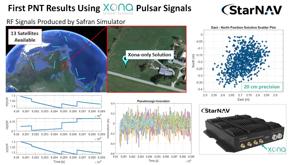
In a recent demonstration, a StarNav receiver yielded 20 cm positioning precision from a cold start using simulated Xona PULSAR signals. StarNav’s receiver tracked up to 13 signals from Xona PULSAR satellites, StarNav CEO Joshua Morales said. The signals were simulated by a Safran simulator. Morales showcased the results at ION GNSS+ in Denver earlier ...
insidegnss.com

In A First, CIDCO To Use AI, Satellite Imagery To Detect Illegal Structures

The City and Industrial Development Corporation (CIDCO for the first time is eyeing the possibility of using automated technology to identify illegal constructions happening in its area. The application that CIDCO plans to develop will enable officials to do extensive area-based study with the help of high resolution satellite imagery. “This technological intervention will supplement ...
hindustantimes.com
HHS Launches Climate And Health Outlook Portal To Identify Counties At Risk Of Climate-related Hazards

HHS Launches Climate And Health Outlook Portal To Identify Counties At Risk Of Climate-related Hazards

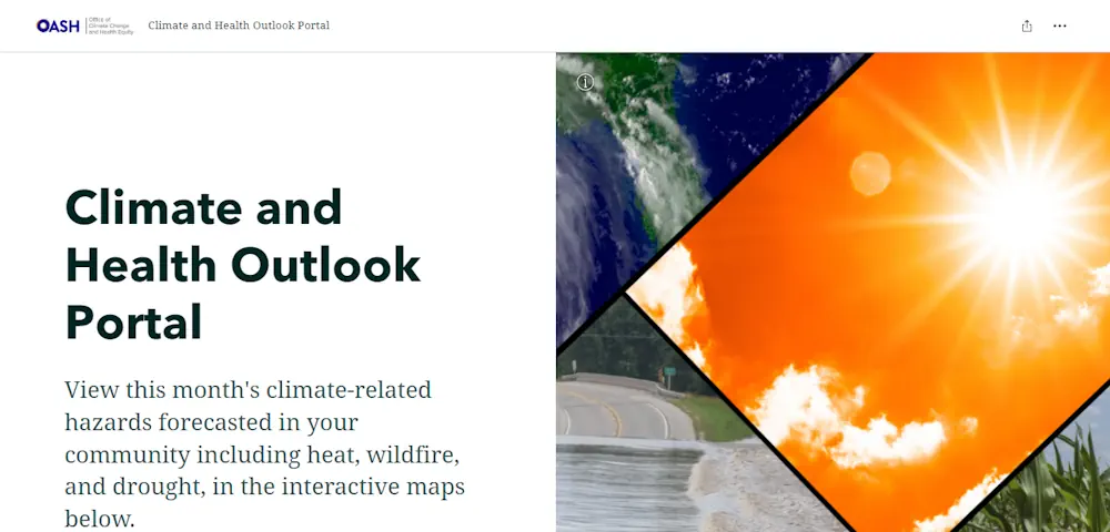
Today, in coordination with the White House Summit on Building Climate Resilient Communities, the U.S. Department of Health and Human Services’ (HHS) Office of Climate Change and Health Equity (OCCHE) and Administration for Strategic Preparedness and Response’s (ASPR) Geospatial Team launched the Climate and Health Outlook Portal , an interactive tool that provides actionable, county-level ...
hhs.gov
Ecologists Use Satellite Images To Predict Wheat Yield With 98% Accuracy Via Satellite Imagery

Ecologists Use Satellite Images To Predict Wheat Yield With 98% Accuracy Via Satellite Imagery

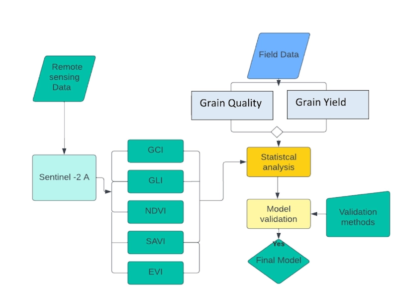
RUDN University ecologists found a parameter in satellite images that allows accurately calculating and increasing the wheat yield. Such technology helps agronomists monitor crops and make decisions. These results were published in The Egyptian Journal of Remote Sensing and Space Science. Low crop yields are usually associated with disturbances in agro-climatic conditions, improper or untimely ...
phys.org