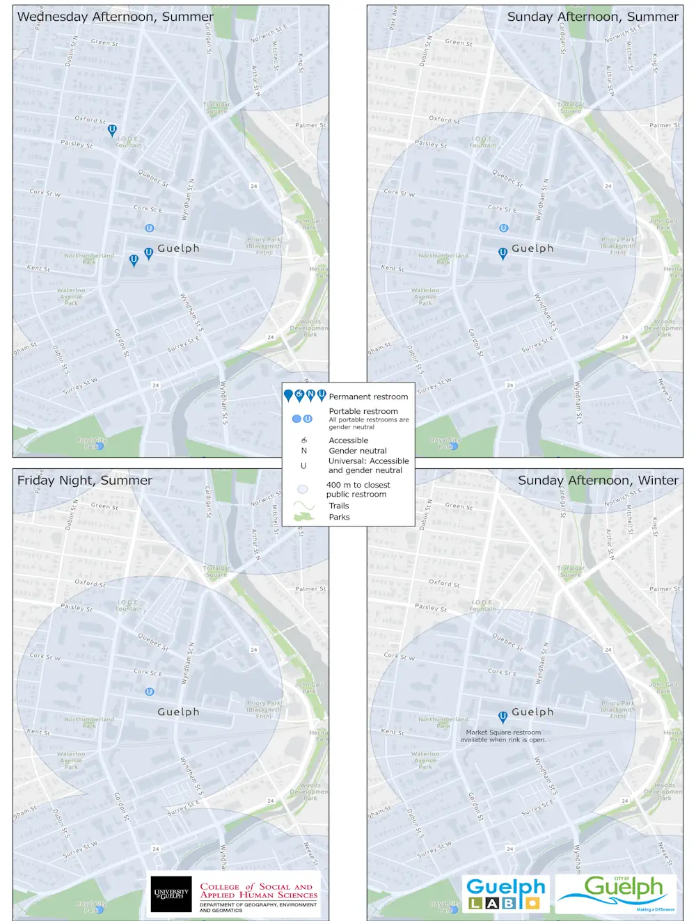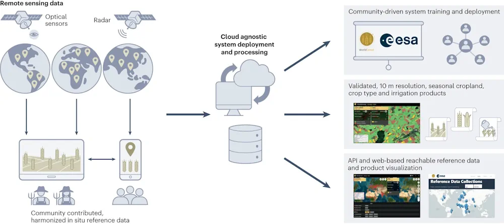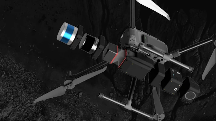
Balko Tech Unveils Advanced Modular Drone Lidar Solution
Balko Tech, a Canadian innovator in the geospatial industry, has announced the launch of Connectiv, the next evolution of its modular drone Lidar system. This release also includes the introduction of the e-Connect application. Following the success of the e-ONE system in 2021, Connectiv represents a significant leap forward in technology, designed to offer geospatial ...
gim-international.com