Geomaticians

22

India’s Leading Drone Tech Company IG Drones Enters Global Partnership With Korea-based IGiS At GITEX Dubai

India’s Leading Drone Tech Company IG Drones Enters Global Partnership With Korea-based IGiS At GITEX Dubai

India’s foremost drone technology company, IG Drones, has forged a strategic alliance with iGiS, a Korean specialist in geospatial information-based drone solutions, announced during the prestigious North Star GITEX Global event. IG Drones and iGiS have formed a significant partnership through a strategic Memorandum of Understanding (MOU). This collaboration aims to leverage their strengths for ...
livemint.com
Crowdsourcing Bathymetry Could Provide Near-time Picture Of Nation’s Inland Waterways

Crowdsourcing Bathymetry Could Provide Near-time Picture Of Nation’s Inland Waterways

The more the merrier. That common saying could be the motto for an effort within the U.S. Army Corps of Engineers (USACE) to create a near real-time system that would track the safety and accessibility of our nation’s inland waterways. Taking advantage of vessels already on the water, an effort in the works at the ...
erdc.usace.army.mil
Scientists Mapped The Grand Canyon Of The Sea Right Down To The Centimeter

Scientists Mapped The Grand Canyon Of The Sea Right Down To The Centimeter

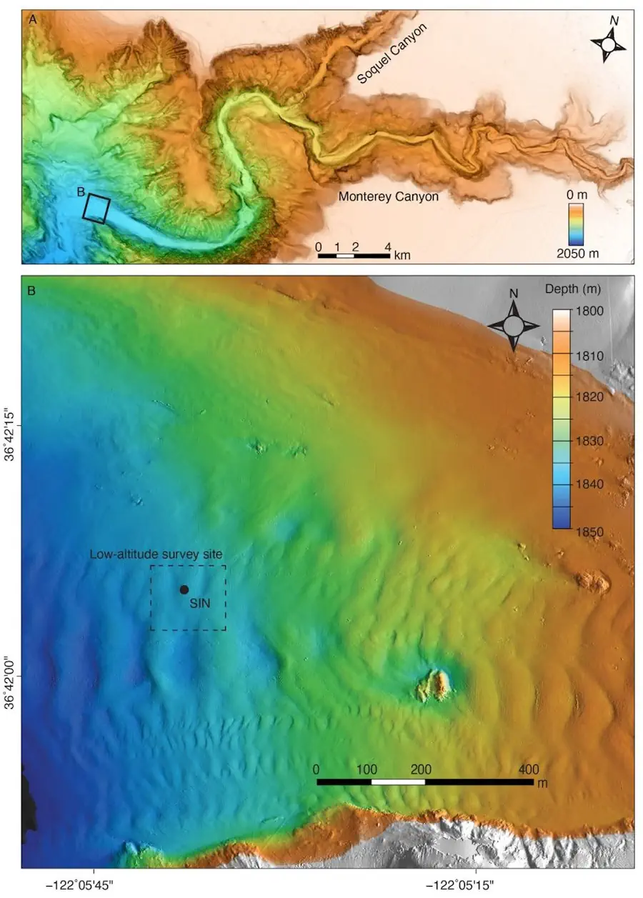
Monterey Bay, California, is known for its beaches. Big Sur in the north is a favorite destination among surfers, and Moss Landing in the south is a bird-watchers paradise. But just off the coast lies a stunning geographic landscape that few know about—and even fewer have seen with their own eyes. It’s called the Monterey ...
popularmechanics.com