Geomaticians

21

La Universidad De León Desarrollará Innovación Tecnológica Para Impulsar La Unidad De Drones De La UME

La secretaria de Estado de Defensa y presidenta de ISDEFE (Ingeniería de Sistemas para la Defensa de España), Amparo Valcarce, y el rector de la Universidad de León (ULE), Juan Francisco García Marín han firmado este jueves en el Palacio de Congresos y Exposiciones de la capital leonesa un Protocolo General de Actuación para impulsar ...
actualidadaeroespacial.com
Detektia, The Start-up That Quietly Monitors Infrastructure From Space

Detektia, The Start-up That Quietly Monitors Infrastructure From Space

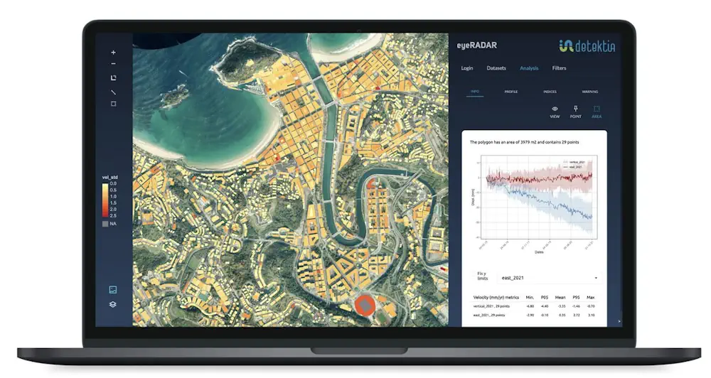
A summer vacation changed Candela Sancho’s life. After studying physics in Madrid, getting additional training in Barcelona and Toronto and spending six years at the University of Utrecht, she traveled with friends to northern Italy in 2018. Upon returning home to Spain, she found out about the collapse on August 14 of the Ponte Morandi ...
english.elpais.com
University Researchers Map Out Vegetation In The Klamath Mountains

University Researchers Map Out Vegetation In The Klamath Mountains

Cal Poly Humboldt students and faculty across various disciplines are embarking on an ambitious project to map out vegetation in the Klamath Mountains. This data will have many applications, including understanding how vegetation regenerates after fires, and how plant communities are being affected by a drying and warming climate. In the long term, this project ...
now.humboldt.edu
New Analysis Of Nariño, Colombia’s Roads Could Help Coffee Growers

New Analysis Of Nariño, Colombia’s Roads Could Help Coffee Growers

In the southwest of Colombia lies the department of Nariño, known for its majestic mountains that give rise to one of the world’s most excellent coffees, thanks to its unique qualities and characteristics. However, these same mountains represent a considerable challenge for agricultural supply chains in the region. In the scientific article entitled “Evaluation of ...
latinamericareports.com
Scientists Release 10-Meter-Resolution Cotton Map Of Xinjiang, China

Scientists Release 10-Meter-Resolution Cotton Map Of Xinjiang, China

Scientists from the Aerospace Information Research Institute (AIR) of the Chinese Academy of Sciences (CAS), together with collaborators from Shihezi University (Xinjiang, China) and University of Toronto (Toronto, Canada), have proposed a cotton mapping strategy and provided high-resolution cotton maps throughout Xinjiang Uygur Autonomous Region, China. Xinjiang is the leading and largest cotton production region ...
phys.org