Geomaticians

20

Porozumienie GGK Ze Stowarzyszeniem Geodetów Polskich

Główny Geodeta Kraju Alicja Kulka zawarła porozumienie ze Stowarzyszeniem Geodetów Polskich (SGP), w którym wyrażono wolę i gotowość dalszej współpracy na rzecz rozwoju geodezji i kartografii w Polsce. Porozumienie, które zawarto 18 października 2023 r. dotyczy współpracy między innymi w zakresie: rozwoju geodezji i kartografii w Polsce, a w szczególności wykorzystania w pracach geodezyjnych oraz ...
gisplay.pl
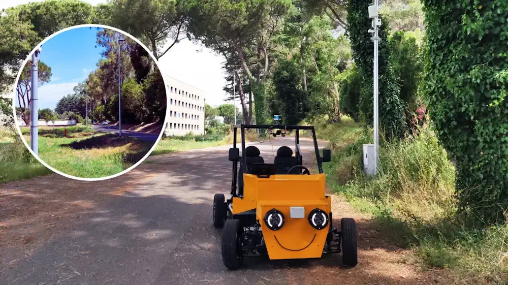
Lampioni Intelligenti E Veicoli A Guida Autonoma Nella Smart Road ENEA

Lampioni Intelligenti E Veicoli A Guida Autonoma Nella Smart Road ENEA

Una vera e propria ‘strada intelligente’ dove migliorare la sicurezza, i flussi di traffico e il comfort di guida, con benefici anche in termini di risparmio energetico e sostenibilità. È la Smart Road che ENEA ha realizzato nel Centro Ricerche Casaccia (Roma), nell’ambito del programma “Ricerca di Sistema Elettrico” (RSE) finanziato dal Ministero dell’Ambiente e ...
meteoweb.eu

Canada To Launch New Satellites To Monitor Climate Change, Gather Military Data

The Canadian Space Agency (CSA) will receive substantial new government funding to extend the long-standing Radarsat satellite series, a keystone of the country’s climate change strategy and international disaster response, not to mention military surveillance. The agency allocation is $1.012 billion CDN (roughly $740,000 USD) over 15 years, a substantial boost to annual spending. At ...
space.com
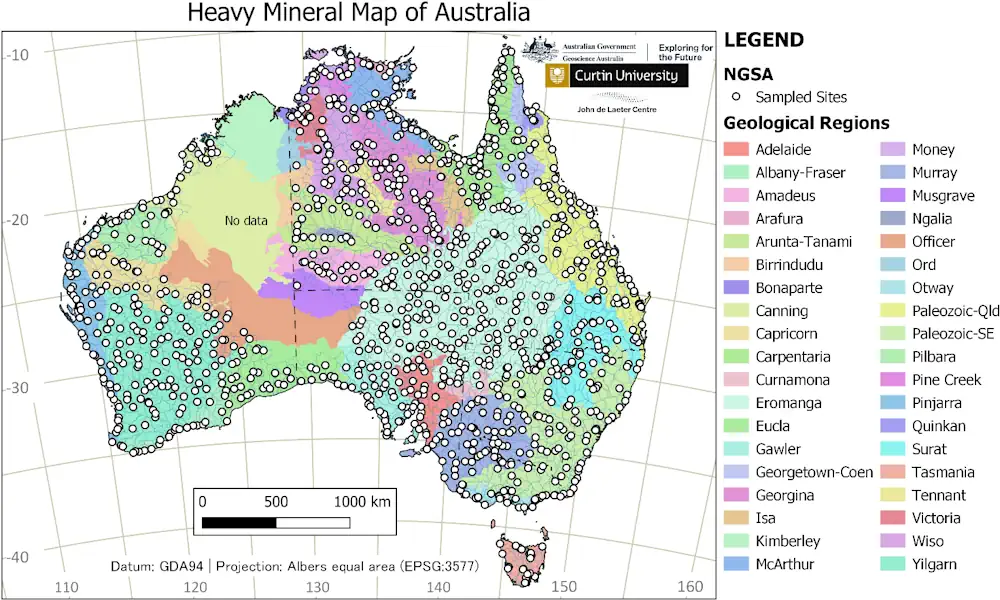
Mapping Australia’s Heavy Minerals In World-First

Mapping Australia’s Heavy Minerals In World-First

The Australian Government’s Exploring for the Future program is continuing to deliver for the resources industry with the release of a new tool to support the discovery of minerals critical to the net zero transformation. The Heavy Mineral Map of Australia, developed by Geoscience Australia in collaboration with Curtin University, has been created using heavy ...
minister.industry.gov.au

Novo Mapa Traz O Levantamento Total Da Biomassa Da Floresta Amazônica

Estudo conduzido por grupo do Inpe e colaboradores combina varredura da área por lasers aerotransportados, imagens de satélite e inventários de campo. Resultados podem contribuir para a definição de políticas de planejamento, conservação e manejo sustentável. No contexto da grave crise vivida pela Amazônia, uma boa notícia é a divulgação de um novo mapa de ...
agencia.fapesp.br

Younger Trees Champion Carbon Capture As Seen By ESA’s Biomass Earth Explorer Satellite

Thanks to their ability to absorb and store carbon dioxide from the atmosphere, forests have long been recognised as a key tool in the fight against climate change – but not all forests are equal. New research based on data from ESA’s SMOS satellite mission has found that, surprisingly, young trees are champions at carbon ...
spaceref.com