Geomaticians

19

Dorset Council Applies GIS To Optimising Home Care

Dorset Council has highlighted the role of interactive digital maps in a successful trial of an approach to optimise home care around the county. It has used the maps in a pilot project in which it worked with the Dorset Care Association, Home Care Forum and providers to reduce the average waiting time for a ...
ukauthority.com

U.S. Gathers Experts To Tackle Illegal Mining In Ghana

The U.S. Department of State, the U.S. Embassy Ghana, and the University of Mining and Technology (UMaT), Tarkwa are convening mining stakeholders from across Ghana to brainstorm tech-enabled solutions to illegal mining. As part of “Tech Camp Takoradi” this week, fifty stakeholders including representatives of mining communities and companies, scientists and innovators, policymakers, environmental activists, ...
gh.usembassy.gov
UM-led Project Creates Mapping Tool Using Satellites, 1950s Photo Archive

UM-led Project Creates Mapping Tool Using Satellites, 1950s Photo Archive

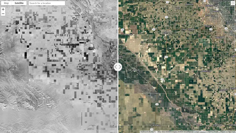
When the Cold War grew chillier around 1950, the U.S. military worried about a communist land invasion of the United States. So pilots were employed – many of them veterans of World War II – to photograph the entire country using aircraft. This 70-year-old archive of overlapping photos was taken at different angles, providing topographic ...
umt.edu
Leica Geosystems Develops First-Person Laser Scanner

Leica Geosystems Develops First-Person Laser Scanner

Leica Geosystems, part of Hexagon has developed the Leica BLK2GO PULSE, its first-person laser scanner that combines lidar sensor technology with the original Leica BLK2GO form factor. The technology is set to be released in early 2024. The scanner offers users a rapid, simple and intuitive first-person scanning method that can be controlled with a ...
gpsworld.com
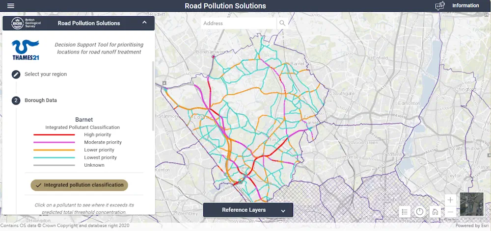
London Pollution Maps Shows Worst Areas For Road Run-Off Pollution

London Pollution: Maps Shows Worst Areas For Road Run-Off Pollution

A new online map has been created to show where contaminated rain water from roads is polluting rivers in London. Environmental charity Thames21 has launched the site to help local authorities, as well as local communities, identify problem areas. Thames21 said contaminated run-off was caused by oil spills and tyre wear on the roads which ...
bbc.com
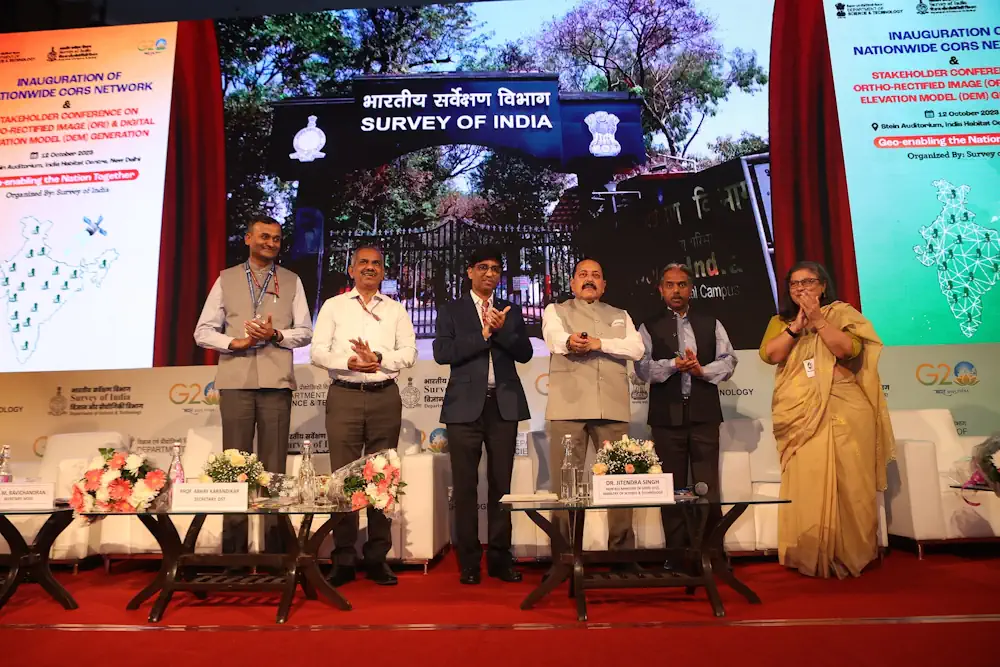
Union Minister Dr Jitendra Singh Launches State-Of-Art Latest National Survey Network

Union Minister Dr Jitendra Singh Launches State-Of-Art Latest National Survey Network

Union Minister of State (Independent Charge) Science & Technology, MoS PMO, Personnel, Public Grievances, Pensions, Atomic Energy and Space, Dr Jitendra Singh today launched state-of-art latest National Survey Network. The nationwide “Continuously Operating Reference Stations” (CORS) Network will be operated by the Survey of India. “India now has a world class Precise Location based service, ...
dst.gov.in
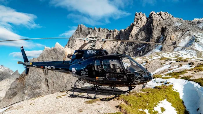
Mapping Altitudes In The Alpine Region

Mapping Altitudes In The Alpine Region

Gravitational acceleration measurements were conducted in the Allgäu region of southern Germany by the Federal Agency for Cartography and Geodesy (BKG) in September this year. In high-altitude locations, helicopters were utilized to access the measurement points. These measurements play a crucial role in enhancing altitude determination through satellite-based methods such as GNSS. The elevations derived ...
gim-international.com
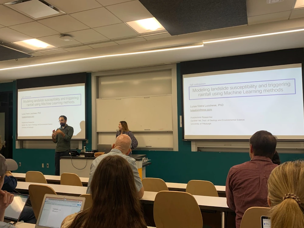
Mapa Mostra Locais Sensíveis A Deslizamento De Terra

Mapa Mostra Locais Sensíveis A Deslizamento De Terra

Luísa desenvolveu métodos de aprendizagem de máquina, principalmente as Redes Neurais Artificiais. Chamadas de RNA, são técnicas computacionais que apresentam um modelo matemático inspirado na estrutura de organismos inteligentes que adquirem conhecimento através da experiência. “São instrumentos que modelam as precipitações antecedentes a esses desastres”, conta ela, que usou como referência a geomorfologia da Serra ...
gov.br
Die Vermessung Der Stadt Per Rad

Die Vermessung Der Stadt Per Rad

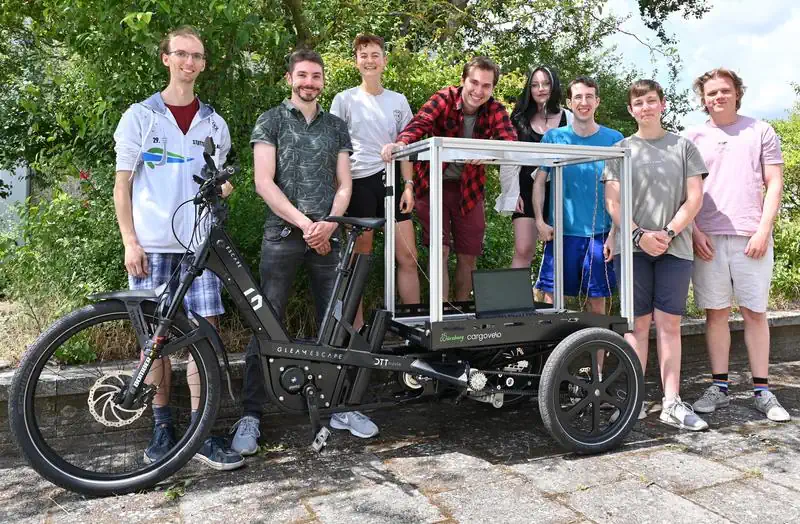
Deutschlands Bevölkerung lebt überwiegend in Städten, für die eine enge Bebauung und eine hohe Bevölkerungsdichte charakteristisch sind. Verkehrsprobleme und urbane Hitzeinseln sind häufig damit einhergehende Begleiterscheinungen. Dabei zeigt sich allerdings eine hohe Variabilität: So ist der urbane Hitzeinseleffekt zwar grundsätzlich in hoch verdichteten Innenstädten stärker ausgeprägt, aber auch dort mag ein kleiner Park mit viel ...
idw-online.de

Orman Yangınlarının Önüne LİDAR Teknolojisiyle Geçilecek

Karadeniz Teknik Üniversitesi Öğretim Üyesi Doç. Dr. Alperen Coşkuner, orman yangınlarını, LİDAR olarak bilinen lazer tarama teknolojisi ile belirlenebileceğini, bu alanda yaptıkları ilk araştırmaların yüksek doğrulukta sonuçlar verdiğini bildirdi. Orman yangınlarıyla mücadelede başarılı olabilmek, yangın risk ve tehlike potansiyeli ile yangın davranışı hakkında doğru ve hızlı bilgi verebilen kapsamlı sistemlerin varlığıyla mümkün olabilirken bu sistemlerin ...
aa.com.tr
Geospatial Technology Can Help Corn Producers Assess Potential Wind Damage In Fields

Geospatial Technology Can Help Corn Producers Assess Potential Wind Damage In Fields

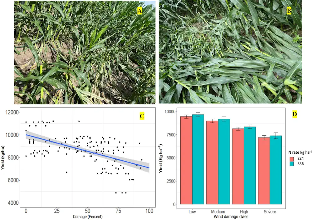
As cornfields suffer crop damage caused by weather, corn producers can use geospatial and remote sensing technologies to get a more accurate measurement of the damage and estimate potential economic loss, according to a recent study published in Frontiers in Agronomy. In the study, the United States Department of Agriculture’s (USDA), Agricultural Research Service (ARS) ...
phys.org
In 2020, 30% Of The Pantanal Was Burned To Cinders By Wildfires

In 2020, 30% Of The Pantanal Was Burned To Cinders By Wildfires

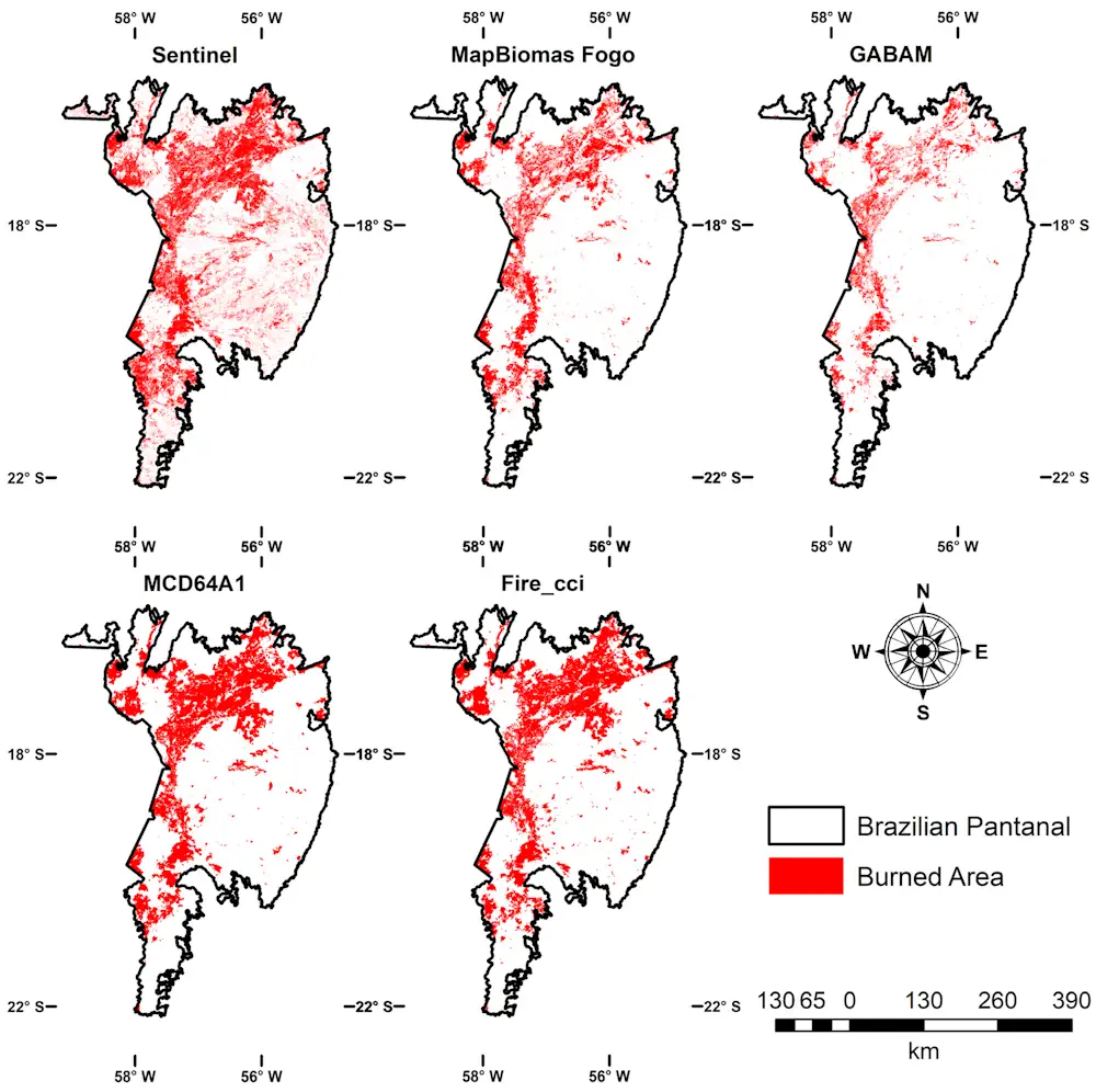
In 2020, the Pantanal, the largest tropical freshwater wetland in the world and a biodiversity hotspot, was swept by high-intensity fires that destroyed native vegetation in an area totaling 44,998 square kilometers (km²), or about 30% of the Brazilian portion of the biome, which spans some 150,000 km². The estimate is presented in an article ...
eurekalert.org

Global Inventory Map Of Floating Photovoltaics

A group of researchers led by China’s Nanjing University has created a global-scale inventory map to determine the spatio-temporal distribution of floating photovoltaics. “Existing statistical reports on water-surface photovoltaics (WSPV) only provide aggregated summary statistics but lack spatiotemporal information, which hinders the environmental assessment and policy management,” the research’s lead author, Shanchuan Guo, told pv ...
pv-magazine.com