Geomaticians

13

Harxon Introduces New GNSS And Helix Antennas

Harxon Introduces New GNSS And Helix Antennas

Harxon has launched its new survey GNSS antenna, HX-CSX600A, and helix antenna, HX-CUX615A, designed for high-accuracy positioning applications across the geospatial industry. These two antennas are set to debut at INTERGEO 2023. HX-CSX600A boasts a pre-filtered Low Noise Amplifier (LNA) offering exceptional out-of-band rejection, ensuring strong anti-interference performance even in challenging environments. It is designed ...
gpsworld.com

Trimble Monitoring Software Expands Sensor Support To Deliver Broader Rail And Structural Deformation Analytics

Trimble announced today at the INTERGEO conference the latest release of Trimble® 4D (T4D) Control™ software, version 6.5, expanding rail track monitoring capabilities to address a wider range of standards and specifications. This update also adds support for Syscom Instruments acceleration sensors for event-based monitoring of ground motion, as well as updating authentication methods for ...
amerisurv.com
Open Cosmos’ MANTIS Satellite Prepped For Upcoming Launch

Open Cosmos’ MANTIS Satellite Prepped For Upcoming Launch

MANTIS was successfully integrated with its EXOpod Nova deployment system in Berlin, provided by Exolaunch as part of their mission management and integration service, prior to completing its integrations with SpaceX’s Falcon 9 before lift-off from Vandenberg Space Force Base. MANTIS, which stands for Mission Agile Nanosatellite for Terrestrial Imagery Services, will be the first ...
news.satnews.com
Azercosmos, Bayanat Sign Agreement On Development Of Geographic Information Systems

Azercosmos, Bayanat Sign Agreement On Development Of Geographic Information Systems

Azercosmos and Bayanat company of the United Arab Emirates (UAE) have signed a cooperation agreement. According to the agreement, the parties will cooperate in the area of Geographic Information Systems (GIS). This includes promoting potential projects and opportunities for the acquisition, processing and application of remote sensing data, geospatial data capabilities, experience and knowledge sharing. ...
azertag.az
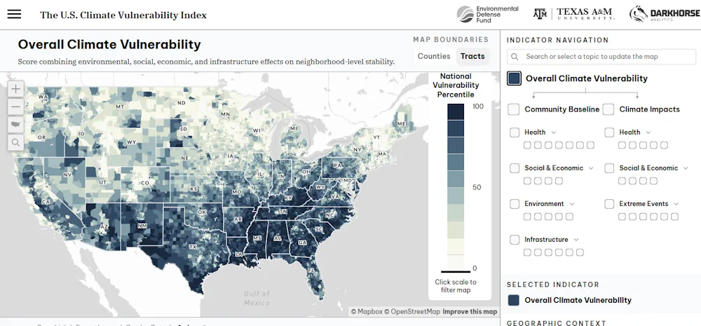
How Does Climate Change Threaten Your Neighborhood A New Map Has The Details

How Does Climate Change Threaten Your Neighborhood? A New Map Has The Details.

If you’ve been wondering what climate change means for your neighborhood, you’re in luck. The most detailed interactive map yet of the United States’ vulnerability to dangers such as fire, flooding, and pollution was released in early October by the Environmental Defense Fund and Texas A&M University. The fine-grained analysis spans more than 70,000 census ...
yaleclimateconnections.org