Geomaticians

09

RCMRD And CRTEAN Sign Agreement On Geospatial Training And Projects

Dr Emmanuel Nkurunziza, the Director-General of the Regional Centre for Mapping of Resources for Development (RCMRD), and Dr El-Hadi Gashut, the Director General of the Regional Center for Remote Sensing of North Africa States (CRTEAN), have signed a memorandum of understanding today to promote collaboration on geospatial projects and training. This partnership aims to avail ...
africanews.space

EUSI And Pixxel Partner For Hyperspectral Imagery Offerings

European Space Imaging (EUSI) and Pixxel have announced a strategic partnership that will give customers access to the “world’s most detailed hyperspectral imagery” from Pixxel directly through EUSI. Together with EUSI’s capability to build insights and products, the partnership has the potential to set a new benchmark in remote sensing applications in the region. Furthermore, ...
spacewatch.global

Stadt Bochum Und Hochschule Für Gesundheit Starten Beteiligung Gegen Lärm

Die Stadt Bochum ist gesetzlich verpflichtet, alle fünf Jahre Umgebungslärm, der von Hauptlärmquellen wie zum Beispiel Straßen- und Schienenverkehr ausgeht, zu kartieren und den Lärmaktionsplan zu aktualisieren. Dabei sind auch die Bürgerinnen und Bürger gefragt. Wo sind besonders laute oder auch, um diese zu schützen, besonders leise Orte? Was hat sich seit dem letzten Lärmaktionsplan ...
bochum.de
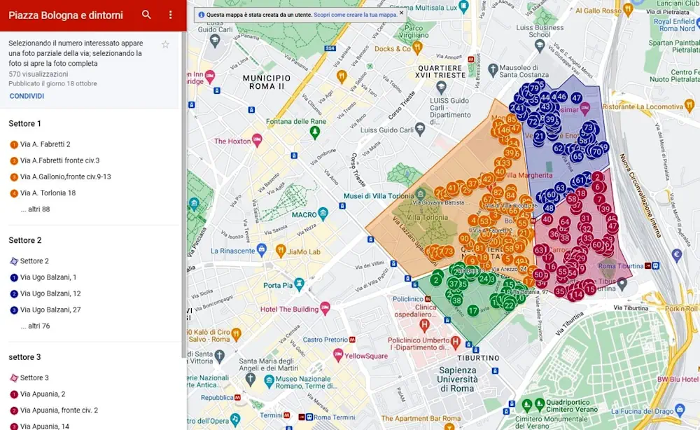
“Mancano Centinaia Di Alberi” I Cittadini Fotografano I Marciapiedi Spogli Del Nomentano

“Mancano Centinaia Di Alberi”: I Cittadini Fotografano I Marciapiedi Spogli Del Nomentano

Quanti sono gli alberi mancanti nelle strade di Roma? Non è semplice rispondere a questa domanda. A Roma manca un censimento aggiornato degli alberi e per farsi un’idea di quale sia l’effettiva carenza, si dovrebbero incrociare i dati dei tagli e delle nuove piantumazioni. Ma sono informazioni che saranno disponibili solo con il prossimo bilancio ...
romatoday.it
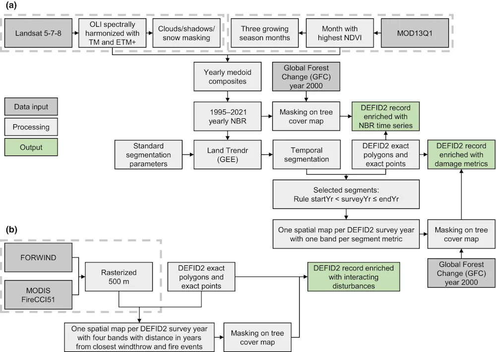
A Database Unifies The Information On Damage To European Forests Over The Last 60 Years

A Database Unifies The Information On Damage To European Forests Over The Last 60 Years

The University of Córdoba is participating in the creation of the first database that harmonizes the recording of disturbances caused by insects and diseases in forests in 8 European countries by combining remote sensing, satellite images and field data. Forest damage caused by insects and diseases is increasing in many parts of the world due ...
eurekalert.org