Geomaticians

08

El Proyecto DATAPASS Elabora El Primer Mapa Interactivo Sobre Vivienda Que Integra Las Bases De Organismos Públicos Transfronterizos

El proyecto DATAPASS de cooperación transfronteriza, en el que participa el Gobierno de Navarra y Nasuvinsa-Lursarea, ha elaborado un mapa interactivo que integra las bases de datos de los organismos implicados en el diseño de políticas públicas en ordenación del territorio y urbanismo, en el marco de un estudio sobre vivienda y territorio en el ...
pamplonaactual.com

FG To Launch e-CRVS, Geospatial Data Repository

The Federal Government (FG) on Monday disclosed plans to launch the electronic Civil Registration and Vital Statistics System (eCRVS) and Geospatial Data Repository. It said the electronic system will help revolutionise how vital events are recorded, tracked, and analysed in the country. The Chairman of the National Population Commission (NPC) made the disclosure at a ...
tribuneonlineng.com
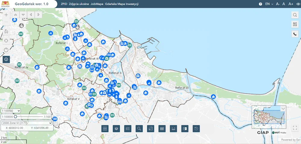
Gdańsk Ma Nowy Geoportal

Gdańsk Ma Nowy Geoportal

Zaprezentowane właśnie narzędzie zapewni mieszkańcom i odwiedzającym Gdańsk dostęp do bardziej zaawansowanych, wszechstronnych map oraz informacji o mieście – pozwoli na jego odkrywanie w zupełnie nowy sposób. GeoGdańsk to kompleksowy i intuicyjny portal mapowy, który oferuje użytkownikom znacznie więcej niż tradycyjne mapy on-line. Portal umożliwia szybkie przeglądanie map, lokalizowanie ważnych punktów, dostęp do informacji o ...
geoforum.pl
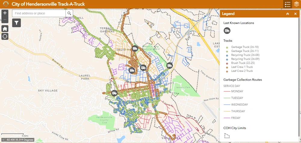
Track-a-Truck Interactive Map Available For Customers

Track-a-Truck Interactive Map Available For Customers

Track-a-Truck is a pilot program with the City of Hendersonville. This online application available on the City’s website shows the near real-time location of garbage and recycling trucks as they drive along their collection routes. It is also a way to see what day of the week your garbage will be collected in an interactive ...
hendersonvillenc.gov

Network Rail Seeks InSAR Provider For Geotechnical Asset Monitoring

The UK rail infrastructure operator wants to create an integrated system that combines interferometric synthetic aperture radar (InSAR) – which can monitor ground deformation at very high temporal and spatial resolution – with its existing asset data. InSAR could be used to alert Network Rail to areas that show instability based on their movement history. ...
geplus.co.uk

ESA And EC To Unite On Climate Action From Space

ESA and the Commission’s Directorate-General for Climate Action (CLIMA) are, therefore, seizing the opportunity to harness their combined expertise and resources to bring about transformative change, not least in the context of the EU’s Copernicus space programme and ESA’s Space for a Green Future Accelerator. ESA and CLIMA are reinforcing their cooperation by working together ...
azocleantech.com
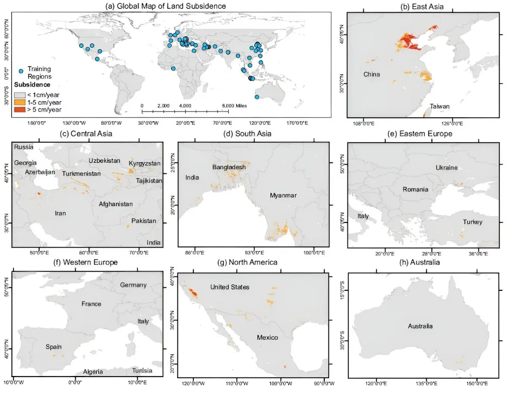
Scientists Map Loss Of Groundwater Storage Around The World

Scientists Map Loss Of Groundwater Storage Around The World

Global water resources are stretched by climate change and human population growth, and farms and cities are increasingly turning to groundwater to fill their needs. Unfortunately, the pumping of groundwater can cause the ground surface above to sink, as the aquifers below are drained and the architecture of the ground collapses. For the first time, ...
phys.org