Geomaticians

November

Open Geospatial Consortium Wants Your View On Time

The Open Geospatial Consortium (OGC) is seeking comment on a candidate Abstract Specification Topic, ‘Topic 25 – Abstract Conceptual Model For Time’. The OGC points out that, “Historically, the coordinate systems used in geospatial communities are two- or three-dimensional with temporal aspects stored as attributes of the data rather than valid components of the coordinate ...
spatialsource.com.au
New Heat Map Explores Potential Benefits Of Philly Tree Plan With Block-by-Block Detail

New Heat Map Explores Potential Benefits Of Philly Tree Plan With Block-by-Block Detail

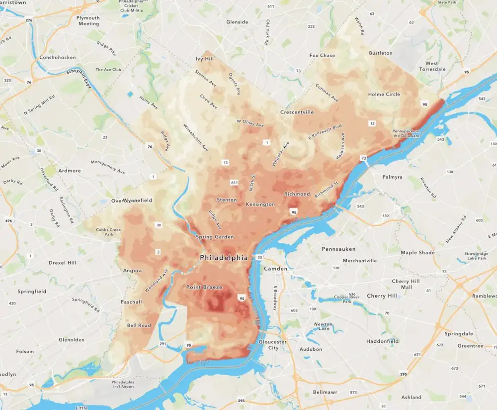
As Philadelphia plants thousands of trees to help cool heat-stricken sections of the city, residents can use a new online tool to see how the decade-long project might help their neighborhoods. You can slide between two overlapping maps of the city: one that reveals how bad the summer heat problem is on a detailed, block-by-block ...
billypenn.com
Près De 60 % Des Bâtiments Cartographiés Dans Le Cadre De La Plus Grande Recherche Canadienne Sur L'accessibilité Ne Sont Pas Accessibles

Près De 60 % Des Bâtiments Cartographiés Dans Le Cadre De La Plus Grande Recherche Canadienne Sur L’accessibilité Ne Sont Pas Accessibles

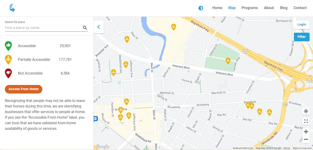
Une nouvelle recherche publiée aujourd’hui par AccessNow, une entreprise de technologie de l’accessibilité, en collaboration avec l’Université de Calgary, Lésions médullaires Canada et BDO, révèle que près de 60 % des bâtiments cartographiés à Vancouver, Calgary et Ottawa ne sont pas entièrement accessibles et met en évidence les zones où les villes et les propriétaires ...
ecranmobile.fr

New Flood Evacuation Tool Helps With Preparedness, Evacuation And Response

Four Clemson University researchers are part of a national team that has developed a Flood Evacuation Tool to help forecast floods, identify at-risk roads and verify safe evacuation routes. The tool partners artificial intelligence (AI) with human knowledge. Researchers are using this human-AI teaming (HAT) partnership to create an intelligent model for addressing flood evacuation ...
news.clemson.edu

Sino-Kenyan Forum Opens In Kenya To Boost Use Of Geospatial Technologies

A Sino-Kenyan forum started in the Kenyan capital, Nairobi, Wednesday to seek ways of promoting the use of geospatial technologies in agriculture, urban planning and natural resource management. The 2023 Supermap GIS software innovation conference that was jointly organized by Kenya’s Directorate of Resource Surveys and Remote Sensing and Chinese firm Supermap gathered government officials, ...
china.org.cn

UAE Launches Development Phase Of Sirb Satellite Programme

The project will enable partnerships with global institutions and offer incentives, as an extension of the Space Economic Zones project. The Sirb programme will enable the commercialisation of satellites and the data they generate on both national and international fronts. This milestone project will include three synthetic aperture radar (SAR) satellites that use advanced imaging ...
gulfbusiness.com

China’s GPS-Like Beidou Navigation System Recognised As Global Standard For Commercial Aviation In ‘Important Milestone’

China’s equivalent to the US’ Global Positioning System (GPS) has gained an international qualification that allows it to expand into global commercial aviation, with the “important milestone” a potential boost for the technology, analysts said. The home-grown BeiDou system has been recognised by the International Civil Aviation Organisation as one of its standards, becoming a ...
scmp.com
Desarrollaron Mapas Digitales De Cada Zona Vitivinícola Argentina Para Consultar De Manera Gratuita

Desarrollaron Mapas Digitales De Cada Zona Vitivinícola Argentina Para Consultar De Manera Gratuita

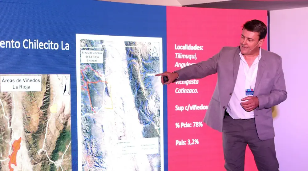
El inmenso trabajo fue encabezado por el Consejo Federal de Inversiones (CFI) junto con COVIAR y permite consultar cada perfil geológico y climático del país, mediante una plataforma de acceso libre ya disponible. Identificar todas las variables climatológicas y geológicas de cada rincón del país en donde crece una uva no solo es posible, sino ...
uvasargentinas.com.ar

SISPER, Herramienta Para Conocer Los Peligros Naturales En Nuestro Entorno

Los riesgos y peligros a los que estamos expuestos vuelven vulnerables a las poblaciones. Por ello, conocer qué territorios representan mayor peligro a fin de ayudar en la planificación y reducción de daños es el objetivo del Sistema de Información Sobre Peligros y Riesgos (SISPER), una plataforma web desarrollada por científicos de distintas especialidades de ...
cronica.com.mx

In A First, Survey Of India Joins Hands With Private Mapping Firm For ‘Digital Twins’

In a first-of-its-kind initiative, the Survey of India (SoI), historically the custodian of India’s maps, has signed an agreement with a Mumbai-based private company, Genesys International, to prepare three-dimensional maps of several cities and towns. Called ‘Digital Twins,’ these maps are three-dimensional representations of cities and when coupled with high-resolution images, can be used in ...
thehindu.com

From Tracking Mosquitoes To Trees With Disease, GIS Works

From tracking disease in Ponderosa pines to managing mosquitoes, Geographic Information Systems are doing more and more to help utilities, government and scientists in the Flathead Valley. Flathead Electric Cooperative is using GIS to map vegetation along its powerlines, said Jake Harte, a data specialist with the Co-op during a talk last week that featured ...
hungryhorsenews.com
Drones And AI Could Locate Land Mines In Ukraine

Drones And AI Could Locate Land Mines In Ukraine

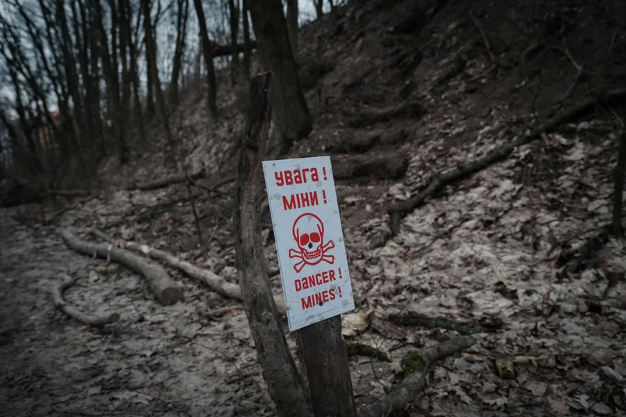
Finding and removing land mines is an excruciatingly slow process. Human deminers scour contaminated ground inch by inch with handheld metal detectors, waiting for the telltale beep of a magnetic anomaly. Although trained dogs are sometimes used, metal detectors have remained the go-to clearance method since the end of World War II. “There’s a very ...
scientificamerican.com

Esri’s ArcGIS Basemaps And ArcGIS Living Atlas Data To Be Integrated Into Autodesk Software Environment

Industry leaders are relying on the interoperability of geographic information systems (GIS) and building information modeling (BIM) to reduce costs and boost efficiency across construction projects. In support of these organizations, Esri, and Autodesk have cultivated a strategic alliance to unify GIS and BIM, delivering real business value to architects, engineers, planners, and contractors. Deepening ...
azobuild.com

Esri Introduces ArcGIS Video Server, Brings New Video Capabilities To Users

Satellites, drones, security cameras, sensors, and more capture vast streams of imagery each day, much of it in the form of video. Yet, deriving meaningful insights from video data can be challenging and time-consuming. To help organizations that must analyze this invaluable source of information and harness the full potential of video content, Esri, the ...
financialpost.com

Crowd-sourced Project To Map NSW’s ‘Creepy’ And ‘Safe’ Spots In Bid To Improve Women’s Safety

Dark streets and risky intersections as well as well-lit parks and vibrant night-time destinations will be mapped in New South Wales for the first time in an effort to improve women’s safety. Women and gender diverse people are being asked to contribute to a digital crowd-mapping project by anonymously identifying places where they have felt ...
theguardian.com
Investigadores De La UNAM Diseñan Algoritmo Capaz De Detectar Las Cenizas Del Volcán Popocatépetl

Investigadores De La UNAM Diseñan Algoritmo Capaz De Detectar Las Cenizas Del Volcán Popocatépetl

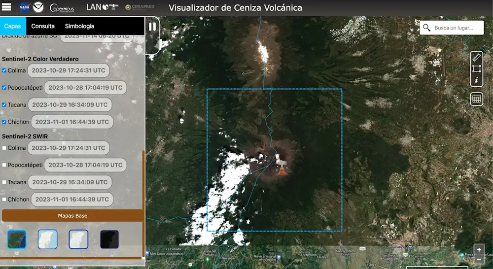
Investigadores de la UNAM, bajo la dirección del maestro en Geografía Víctor Manuel Jiménez Escudero, han desarrollado un algoritmo innovador que puede detectar con precisión las emisiones de ceniza provenientes del volcán Popocatépetl, conocido por su constante actividad, uno de los más dinámicos y vigilados del mundo. El Laboratorio Nacional de Observación de la Tierra ...
es.wired.com
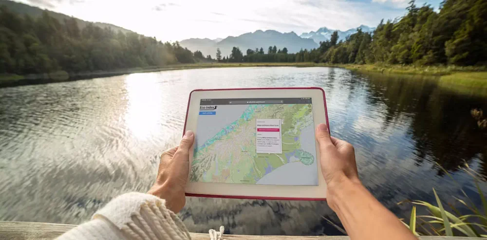
Restoring Ecosystems To Boost Biodiversity Is An Urgent Priority – Our ‘Eco-index’ Can Guide The Way

Restoring Ecosystems To Boost Biodiversity Is An Urgent Priority – Our ‘Eco-index’ Can Guide The Way

Biodiversity continues to decline globally, but nowhere is the loss more pronounced than in Aotearoa New Zealand, which has the highest proportion of threatened indigenous species in the world. Planning large-scale biodiversity restoration projects – whether they’re run by NGOs, governments or Indigenous groups – requires high-quality data. Despite the rising demand, however, accessible biodiversity ...
theconversation.com
Genera UAEMÉX Productos Cartográficos Para Ayuda En Afectaciones Provocadas Por 'Otis'

Genera UAEMÉX Productos Cartográficos Para Ayuda En Afectaciones Provocadas Por ‘Otis’

En el Laboratorio Nacional de Observación de la Tierra de la Facultad de Geografía de la Universidad Autónoma del Estado de México, han recibido más de 300 imágenes satelitales con las cuales han podido realizar al menos 12 productos cartográficos de valor agregado. Con los cuales, busca dar atención con mayor rapidez a las zonas ...
milenio.com
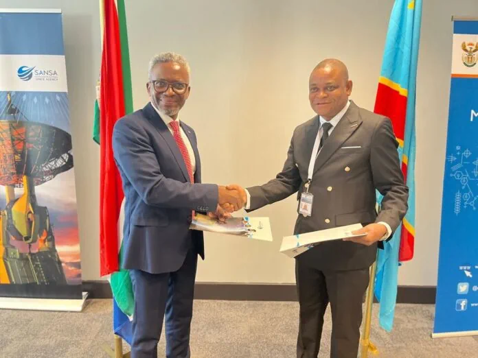
SANSA And Congo’s National Remote Sensing Centre Sign MoU To Advance Scientific Projects

SANSA And Congo’s National Remote Sensing Centre Sign MoU To Advance Scientific Projects

The South African National Space Agency (SANSA) and Democratic Republic of Congo National Remote Sensing Centre (DRC NRSC/CNT) recently signed a Memorandum of Understanding (MoU) during the 2023 GEO-Ministerial Summit in Cape Town to enhance collaborative efforts in implementing scientific and technological projects and programmes. The agreement underscores a shared commitment to promote mutual socio-economic ...
africanews.space

Oregon State University To Receive $6.5 Million For Geospatial Coordinate System Update Work

Oregon State University will receive $6.5 million in federal funding over a five-year period for research related to updating the National Spatial Reference System, a coordinate system that defines geographical elements ranging from longitude and latitude to height and orientation, the college said. OSU officials said common uses for the NSRS include surveying and mapping ...
kezi.com
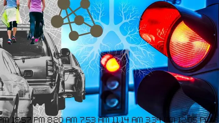
Developing Next-gen Traffic Signal Control Systems With Air Quality In Mind

Developing Next-gen Traffic Signal Control Systems With Air Quality In Mind

After a summer that broke all sorts of dismal records in terms of cataclysmic wildfires across North America, there is now an even greater awareness of poor air quality—its myriad health impacts and the overwhelming need for sustainable solutions. To that end, Yu Yang, an assistant professor of computer science and engineering in Lehigh University’s ...
eurekalert.org
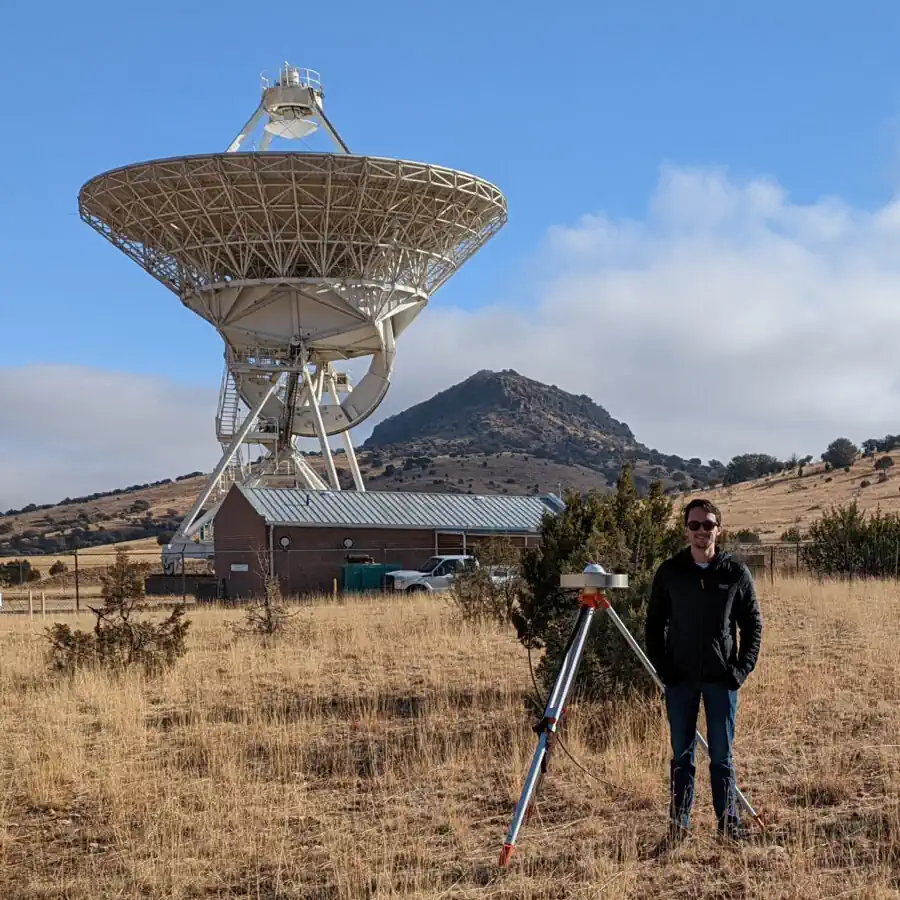
New Technique Could Improve GPS

New Technique Could Improve GPS

A new scientific technique could significantly improve the reference frames that millions of people rely upon each day when using GPS navigation services, according to a recently published article in Radio Science. For the first time, researchers at The University of Texas at Austin’s Applied Research Laboratories and NASA’s Goddard Space Flight Center have formed ...
news.utexas.edu

UP42 And GLOBHE Sign Partnership To Bring Drone Data To Geospatial Marketplace

UP42, a leading geospatial developer platform and marketplace, and GLOBHE, the world’s premier on-demand drone data marketplace, announced their partnership to make high-quality drone data available through UP42. The agreement expands UP42’s current offer of satellite, aerial, elevation, weather, AIS and RF data. “The addition of GLOBHE’s drone data to our marketplace underscores our commitment ...
amerisurv.com
An Open-Source Tool To Assist In Multi-Hazard Risk Assessment

An Open-Source Tool To Assist In Multi-Hazard Risk Assessment

RiskChanges is an open-source cloud-based spatial decision support tool using a dynamic and comprehensive approach to multi-hazard risk assessment. It is designed to support orgaizations in assessing and managing risks associated with multiple hazards at the local level to select optimal risk reduction alternatives. RiskChanges was developed by the University of Twente in collaboration with ...
reliefweb.int

Esri Integrates 3D Tiles Into The ArcGIS System Of Record, Enhancing 3D GIS Workflows

Advances in imagery collection and photogrammetry techniques have increased demand for digital representations of the physical world, or geospatial digital twins. To meet this demand, Esri will integrate 3D Tiles into its ArcGIS software. With the ability to work with a variety of data types, including open 3D data standards, customers can develop innovative solutions ...
datanami.com
AI Maps Icebergs 10,000 Times Faster Than Humans

AI Maps Icebergs 10,000 Times Faster Than Humans

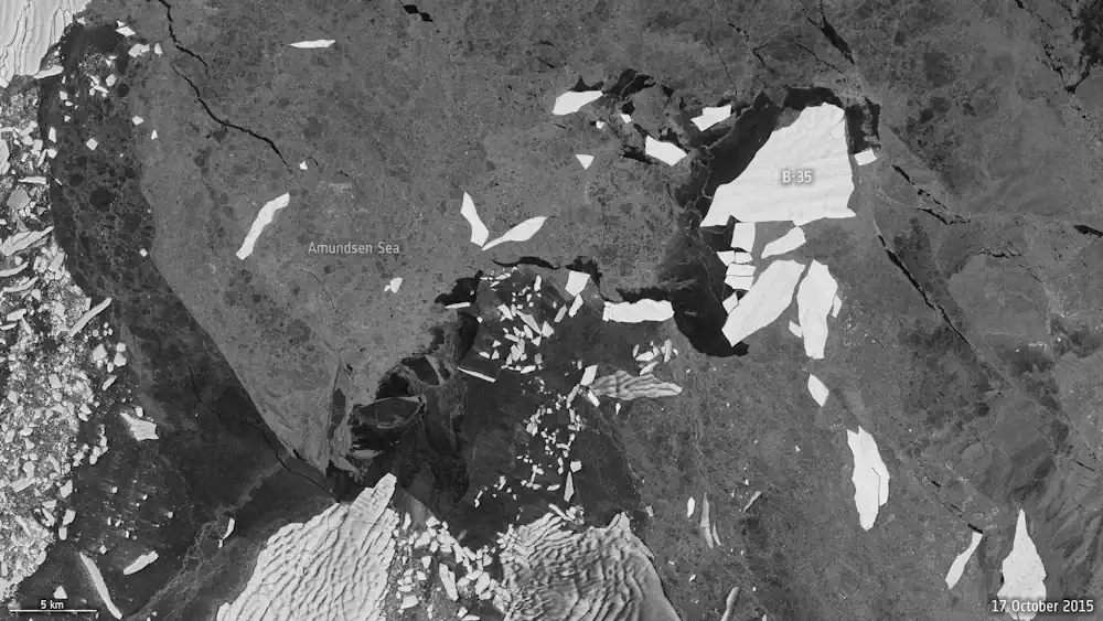
In a groundbreaking development, researchers from the University of Leeds have unveiled a neural network that can swiftly and accurately chart the expanse of large Antarctic icebergs in satellite images, accomplishing the task in a mere 0.01 seconds. This novel approach is in stark contrast to the laborious and time-consuming manual efforts needed previously. Anne ...
esa.int

RCMRD And CRTEAN Sign Agreement On Geospatial Training And Projects

Dr Emmanuel Nkurunziza, the Director-General of the Regional Centre for Mapping of Resources for Development (RCMRD), and Dr El-Hadi Gashut, the Director General of the Regional Center for Remote Sensing of North Africa States (CRTEAN), have signed a memorandum of understanding today to promote collaboration on geospatial projects and training. This partnership aims to avail ...
africanews.space

EUSI And Pixxel Partner For Hyperspectral Imagery Offerings

European Space Imaging (EUSI) and Pixxel have announced a strategic partnership that will give customers access to the “world’s most detailed hyperspectral imagery” from Pixxel directly through EUSI. Together with EUSI’s capability to build insights and products, the partnership has the potential to set a new benchmark in remote sensing applications in the region. Furthermore, ...
spacewatch.global

Stadt Bochum Und Hochschule Für Gesundheit Starten Beteiligung Gegen Lärm

Die Stadt Bochum ist gesetzlich verpflichtet, alle fünf Jahre Umgebungslärm, der von Hauptlärmquellen wie zum Beispiel Straßen- und Schienenverkehr ausgeht, zu kartieren und den Lärmaktionsplan zu aktualisieren. Dabei sind auch die Bürgerinnen und Bürger gefragt. Wo sind besonders laute oder auch, um diese zu schützen, besonders leise Orte? Was hat sich seit dem letzten Lärmaktionsplan ...
bochum.de
“Mancano Centinaia Di Alberi” I Cittadini Fotografano I Marciapiedi Spogli Del Nomentano

“Mancano Centinaia Di Alberi”: I Cittadini Fotografano I Marciapiedi Spogli Del Nomentano

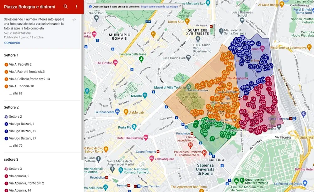
Quanti sono gli alberi mancanti nelle strade di Roma? Non è semplice rispondere a questa domanda. A Roma manca un censimento aggiornato degli alberi e per farsi un’idea di quale sia l’effettiva carenza, si dovrebbero incrociare i dati dei tagli e delle nuove piantumazioni. Ma sono informazioni che saranno disponibili solo con il prossimo bilancio ...
romatoday.it