Geomaticians

27

Esri España Y Seresco Aúnan Fuerzas Para Ofrecer Soluciones Al Sector Agrícola Mediante La Tecnología Arcgis

Esri, empresa líder mundial en tecnología geoespacial, y Seresco, especialistas y referentes en España en consultoría y sistemas de información orientados al registro, análisis predictivo y gestión de riesgos asociados al sector agroalimentario, colaborarán para ofrecer soluciones conjuntas que permitirán poner a disposición del sector los datos y las herramientas para la gestión sostenible de ...
dirigentesdigital.com

Esri India And ideaForge Join Hands

Esri India, the country’s leading Geographic Information System (GIS) Software & Solutions provider announced the signing of a Memorandum of Understanding (MOU) with ideaForge, a market leader in the Indian Unmanned Aircraft Systems. The objective of this partnership is to boost the adoption of drones in India. The partnership between Esri India and ideaForge will ...
timestech.in
Universidad Participa En El 'VI Congreso Nacional De Estudiantes De Geomática, Geodesia Y Geoinformática'

Universidad Participa En El ‘VI Congreso Nacional De Estudiantes De Geomática, Geodesia Y Geoinformática’

La jefa de posgrado de la Facultad de Ciencias Forestales y Ambientales de la Universidad Juárez del Estado de Durango, Emily García Montiel, compartió detalles sobre el “Sexto Congreso nacional de estudiantes de geomática, geodesia y geoinformática”, que tuvo lugar del 17 al 20 de mayo. En este evento, estudiantes e investigadores del núcleo básico ...
elsiglodedurango.com.mx

BIM E GIS Finalmente Integrati Con Usbim.Geotwin: La Soluzione ACCA Software Per Progettare E Gestire Edifici E Infrastrutture Integrando Dati GIS Con Modelli BIM

Integrando i due patrimoni informativi GIS, che offre una rappresentazione di contesto su scala urbana, regionale e/o nazionale, e BIM, che focalizza la propria attenzione sulla singola opera, è possibile ottenere un digital twin dell’opera contestualizzata nel proprio ambiente. usBIM.geotwin di ACCA software è la nuova piattaforma tecnologica per la digitalizzazione e la gestione geospaziale ...
professionearchitetto.it

Dubai Municipality Launches New Online System For Building Permits Services

Dubai Municipality has announced the launch of a new online system for building permits and control services aimed at streamlining procedures for customers in the emirate. The new system not only complies with the latest BIM standards and geographic information systems, but also facilitates user registration through digital ID and instant recognition. It enables smart ...
zawya.com

FAO, EU Provide Digital Technologies To Boost Land Management In Kenya

The Food and Agriculture Organization (FAO) of the United Nations and the European Union (EU) on Friday announced the setting up of Geographic Information System (GIS) laboratories to boost land governance in rural Kenya. Husna Mbarak, Lead in land and natural resource governance at the FAO, said the agency plans to set up 34 GIS ...
english.news.cn
Depremde Sınırları Değişen Mülkiyetlerin Yeri Ortofoto Harita Ile Belirleniyor

Depremde Sınırları Değişen Mülkiyetlerin Yeri “Ortofoto Harita” Ile Belirleniyor

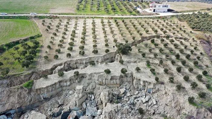
Tapu ve Kadastro Genel Müdürü Mehmet Zeki Adlı, depremlerden etkilenen şehirler için ortofoto haritaları üreterek, mülkiyetlerde nerede, ne derece kayma olduğunu tespit ettiklerini söyledi. “Ortofoto yöntemiyle yapılan bu çalışmaları bir yerde topladık. Haritaya dönüşmesi için koordinatlandırdık. Bunların koordinatlandırılması için Türkiye genelinde sabit GPS istasyonları dediğimiz noktalarımız var. 50-55 kilometre aralıklarla kurulan, 24 saat uyduda görüntü ...
trthaber.com
Nuri Successfully Sends 5 Out Of 8 Satellites Into Orbit

Nuri Successfully Sends 5 Out Of 8 Satellites Into Orbit

Five out of the total of eight satellites separated from Korea’s domestically developed space rocket Nuri, successfully entered their target orbits and are sending signals. Meanwhile, attempted communication with the remaining three satellites are “still ongoing.” The main payload, Next Generation Small Satellite, or NEXTSat-2, successfully entered its target orbit and two-way communication was made, ...
koreajoongangdaily.joins.com
UCSB Research Team Develops Methane Detection Tool

UCSB Research Team Develops Methane Detection Tool

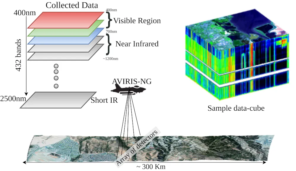
Satish Kumar and his graduate research team at UC Santa Barbara’s Vision Research Lab have led the charge in developing an AI-based methane detection tool called MethaneMapper. This first-of-its-kind software can spot methane gas via complex algorithms. The algorithms analyze multiple visual spectrums of images taken from custom-built cameras 10,000 feet aboveground. “The amount of ...
independent.com