Geomaticians

24

경남도, 건축·재난 등 분야에 국토위성 정보 활용 넓힌다

경남도, 건축·재난 등 분야에 국토위성 정보 활용 넓힌다

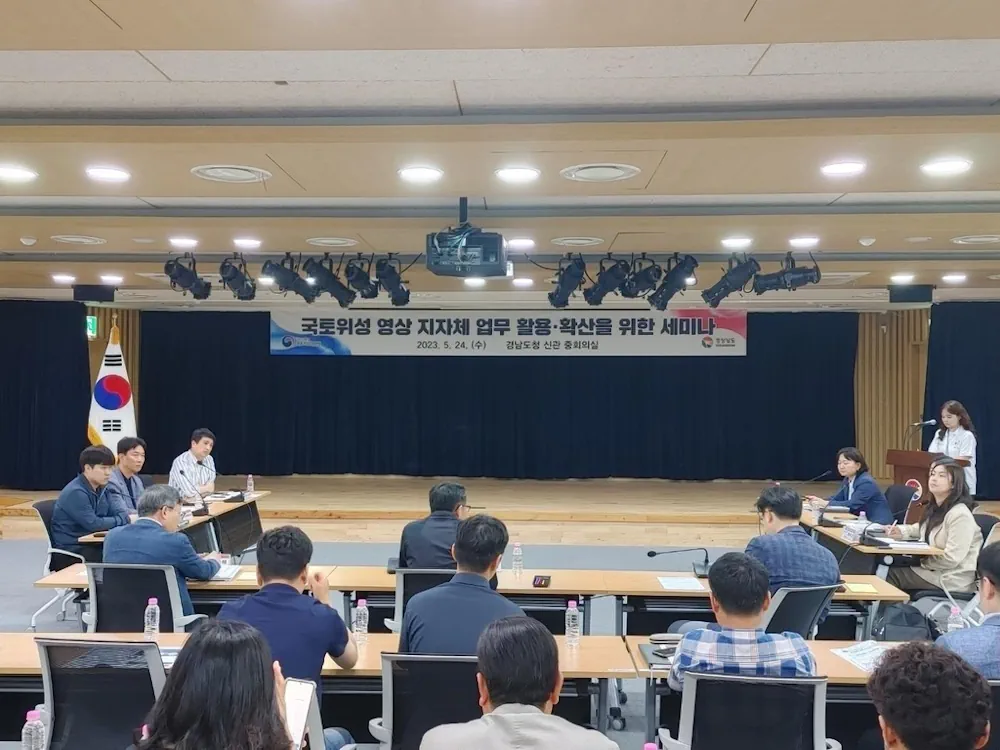
경남도는 도시, 건축, 항만, 산림 등 다양한 분야에 국토위성(차세대 중형 위성 1호) 영상을 확대 활용하기 위해 국토지리정보원(국토위성센터)과 세미나를 개최했다고 24일 밝혔다. 이번 세미나는 오는 8월 공공 분야 위성 영상 확대에 앞서 지자체 공간정보 활용 여건 조사차 경남도 공간정보플랫폼 운영 현황을 공유하고 실무자들 의견을 수렴하기 위해 개최됐다. 지난 3월 발생한 합천군 산불처럼 보안상 문제로 발생지 좌표가 ...
yna.co.kr

Agreement Signed To Establish ISESCO Chair In Machine Learning For Remote Sensing

Sultan Qaboos University (SQU) and the Islamic World Educational, Scientific and Cultural Organization (ICESCO) today signed a cooperation agreement to establish an ISESCO chair in the field of machine learning for remote sensing and geographic information systems. The agreement was signed by HH Sayyid Dr. Fahd bin Al Julanda Al Said, SQU Vice-Chancellor, and Dr. ...
timesofoman.com

Hexagon Modernizará El Sistema 112 De Baleares

El 112 de las Islas Baleares ha seleccionado la división Safety, Infrastructure & Geospatial de Hexagon para mejorar la recepción y despacho de llamadas de emergencia en el archipiélago, incluyendo a Mallorca, Menorca, Ibiza y Formentera. “El sistema que utilizamos actualmente es de 1995, por lo que está totalmente obsoleto”, ha afirmado Vicente Soria, director ...
economiademallorca.com
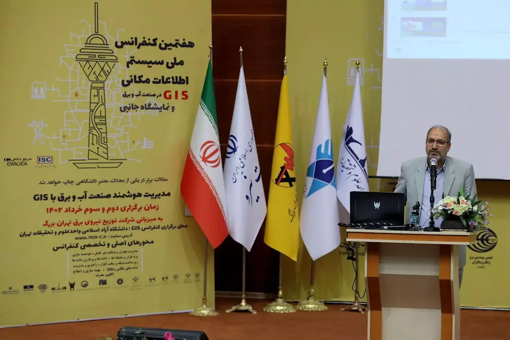
کنفرانس ملی سیستم اطلاعات مکانی در صنعت آب و برق در واحد علوم و تحقیقات برگزار شد

کنفرانس ملی سیستم اطلاعات مکانی در صنعت آب و برق در واحد علوم و تحقیقات برگزار شد

هفتمین کنفرانس ملی سیستم اطلاعات مکانی (GIS)، به همت معاونت پژوهشی واحد علوم و تحقیقات، با همکاری وزارت نیرو و شرکت توزیع نیروی برق تهران بزرگ با هدف دستیابی به آخرین یافته‌های علمی و پژوهشیGIS در ایران و جهان و تبادل تجربیات حاصله در صنعت آب و برق کشور و با حضور جمعی از پژوهشگران، ...
iau.ir

Geovet 2023 – Expanding Boundaries: Interdisciplinary Geospatial Research For The One Health Era

Since 2001, the GeoVet conference, held every 3 years, brings together a diverse group of international experts in spatial epidemiology, spatial statistics and Geographical Information Systems applied to animal health, public health and food safety. From September 19ᵗʰ to 21ˢᵗ 2023, in Silvi Marina, Teramo – Italy, experts from different disciplines will share their knowledge ...
eurekalert.org

Maptitude Revolutionizes School Redistricting Process For Nashua School District

The Nashua School District (NH) has successfully utilized Maptitude Mapping Software and Maptitude Online, powerful Geographic Information System (GIS) tools, to streamline the complex and time-consuming process of school redistricting. With the assistance of Maptitude, the district was able to complete this challenging task in under 25 hours, involving a committee of 25 people. Traditionally, ...
httpsspacewatch.global202305iceye-introduces-satellite-radar-dwell-capability

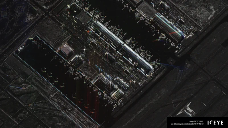
ICEYE Introduces Satellite Radar Dwell Capability

ICEYE has announced a new imaging mode known as Dwell to enable its synthetic aperture radar (SAR) satellites to remain focused on a specific point on the ground for an extended collection time. This long-duration imaging mode allows ICEYE satellites to capture significantly more information about the imaging target, creating a new capability for imagery ...
spacewatch.global
Desmatamento Do Interior Paulista Provocou Desaparecimento De 80 Espécies De Aves

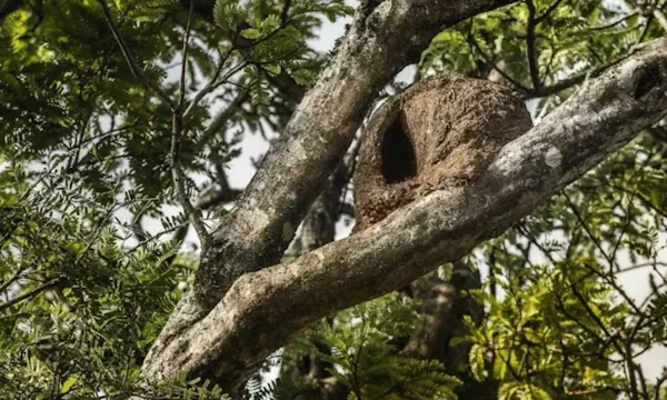
Desmatamento Do Interior Paulista Provocou Desaparecimento De 80 Espécies De Aves

Das 358 espécies de aves já mapeadas há algumas décadas em quatro unidades de conservação do interior do estado de São Paulo, apenas 278 foram registradas durante pesquisa de campo para identificar as aves remanescentes na região. As aves foram identificadas por meio de binóculos e também de seus sons, e o critério para registro ...
gizmodo.uol.com.br
Le Mappe Dei Satelliti Per Pianificare Soccorsi E Ricostruzione Post-alluvione

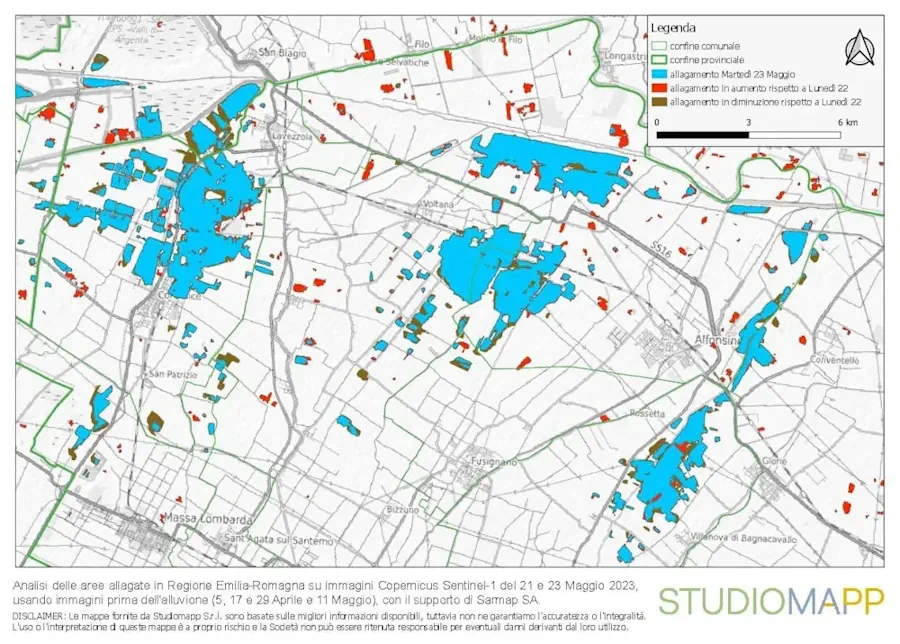
Le Mappe Dei Satelliti Per Pianificare Soccorsi E Ricostruzione Post-alluvione

Studiomapp, azienda con base a Ravenna specializzata in geo-intelligence e già premiata dal Dipartimento di Difesa degli Stati Uniti per aver vinto una sfida internazionale per velocizzare le operazioni di soccorso dopo disastri naturali analizzando immagini satellitari con l’intelligenza artificiale, ha reso disponibile mercoledì l’ultima mappa aggiornata delle aree colpite dall’alluvione in Romagna. per far ...
ravennatoday.it
A Better Way To Match 3D Volumes

A Better Way To Match 3D Volumes

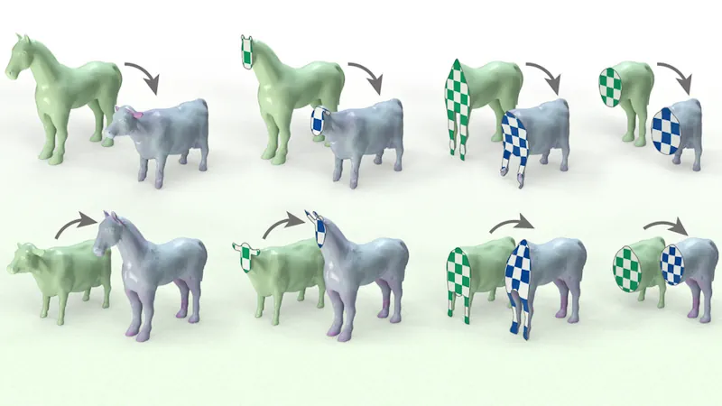
By mapping the volumes of objects, rather than their surfaces, a new technique could yield solutions to computer graphics problems in animation and CAD. In computer graphics and computer-aided design (CAD), 3D objects are often represented by the contours of their outer surfaces. Computers store these shapes as “thin shells,” which model the contours of ...
news.mit.edu