Geomaticians

22

인천 중·북부 상수도 시설,, 지리정보 시스템 갖춘다

인천시는 22일 북부, 중부의 총 133.56㎞에 달하는 상수도 시설물의 위치와 깊이 등 정보의 정확도를 높이기 위한 ‘2023년 상수도 지리정보시스템(GIS 정보 수정・갱신사업)’의 착수했다. 이번 사업은 기존에 단순 도면 전산화로 구축한 기존 상수관로 지리정보시스템(GIS) 정보를 위성통신을 활용해 상수시설물의 위치, 깊이, 관 재질 등 정보를 갱신하고 측정 정보 지리정보시스템(GIS)을 개선하는 사업이다. 부평정수장 탐사측량 시연회에서 전자유도탐사기·토탈스테이션 등의 장비를 동원해 ...
newsfreezone.co.kr
Un Proyecto Realizará Un Mapa Actualizado De La Presencia De Garrapatas En España

Un Proyecto Realizará Un Mapa Actualizado De La Presencia De Garrapatas En España

La importancia de las garrapatas ha trascendido el ámbito veterinario y se ha convertido en un problema sanitario de creciente actualidad. Enfermedades como Lyme, Rickettsiosis o Enfermedad Hemorrágica Crimea Congo son habitualmente diagnosticadas en nuestro país. Además, el cambio global está permitiendo la dispersión de algunas especies de garrapatas produciendo una creciente alarma social. En ...
interempresas.net
Alumnos De La UJED Destacan En Congreso Nacional De Geomática

Alumnos De La UJED Destacan En Congreso Nacional De Geomática

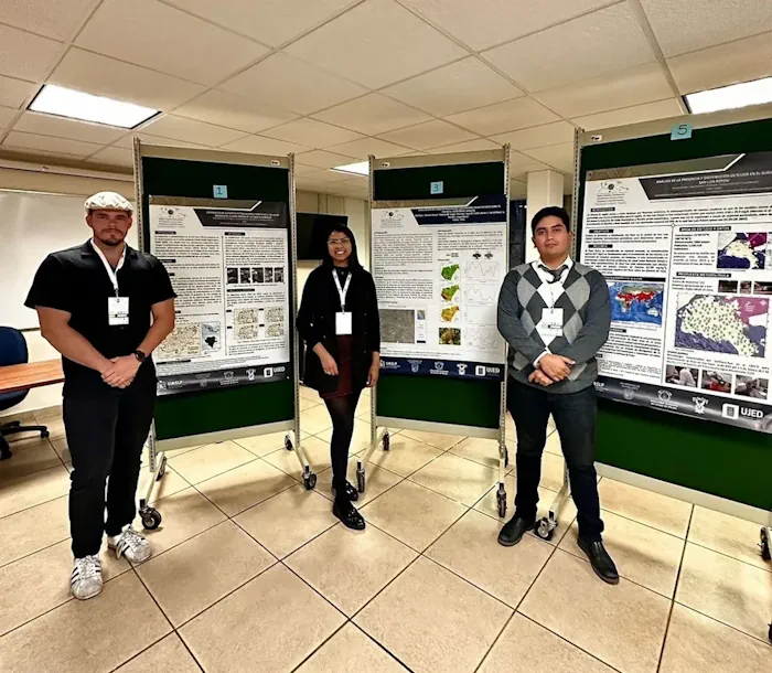
En este congreso, tres estudiantes de la maestría tuvieron la oportunidad de presentar sus trabajos de investigación, lo cual es fundamental para su formación profesional y les permite intercambiar conocimientos y generar nuevas ideas junto a sus compañeros de otras instituciones. Maritza Acosta Flores presentó su investigación titulada “Evaluación del Daño de Muérdago con sensores ...
elsiglodedurango.com.mx

Dubai Signs Deal To Enhance Drone Flight Routes

The Dubai Civil Aviation Authority (DCAA) and Dubai Municipality announced the signing of a Memorandum of Understanding (MoU) to collaborate on the Dubai Horizons project. The new initiative focuses on the planning of drone flight routes and landing sites. Over a three-year period, both parties will combine their expertise in generating geospatial data for the ...
itp.net
Mapeamento Identifica Conservação De Manguezais Da Grande Reserva Mata Atlântica

Mapeamento Identifica Conservação De Manguezais Da Grande Reserva Mata Atlântica

Pela primeira vez, pesquisadores de diferentes áreas de conhecimento se reúnem para entender como está a saúde dos manguezais na linha de costa, na área conhecida como Grande Reserva Mata Atlântica. A pesquisa envolve trabalho de campo, nos bosques de mangue, e um mapeamento aéreo feito por drones equipados com câmeras altamente tecnológicas e imagens ...

Forest Remote Sensing Faces New Era With 10-cm Satellite Imagery

Scientists from the Aerospace Information Research Institute (AIR), Chinese Academy of Sciences (CAS), have proposed a new algorithm called AGAR, which makes it possible to detect tree heights only using 10-cm stereoscopic imagery, according to a study published in Remote Sensing of Environment on May 10. Current knowledge on the limitation of stereoscopic imagery is ...
miragenews.com
Study Reveals Generation Mechanism Of Radiative Effects On Novel Active Optical Hyperspectral Lidar System

Study Reveals Generation Mechanism Of Radiative Effects On Novel Active Optical Hyperspectral Lidar System

Both the geometric and spectral information of the target are available with the hyperspectral light detection and ranging (LiDAR) in a single measurement. This advanced technique extends the scope of imaging spectroscopy to spectral three-dimensional (3D) sensing. However, two major geometric radiative effects exist in hyperspectral LiDAR, namely, the distance effect and incidence angle effect, ...
phys.org