Geomaticians

21

산림청-한국국토정보공사, 산림공간 디지털플랫폼 구현 업무협약 체결

산림청-한국국토정보공사, 산림공간 디지털플랫폼 구현 업무협약 체결

산림청은 이번 업무협약을 계기로 디지털트윈 국토 플랫폼을 활용한 △탄소중립 달성을 위한 디지털 산림 플랫폼 구현 △산림공간 디지털플랫폼 추진전략 기술 지원 △산불·산사태 등 산림재난 대응과 산림 관리를 위한 디지털트윈·확장 가상세계(메타버스) 서비스모델 발굴 및 공동 활용 △디지털트윈 정보 교류·기술 협력·자문 등을 상호 협력해 나갈 예정이다. 또한, 디지털플랫폼 정부 실현 기조에 따라 현행 아날로그 행정체계를 디지털 산림 플랫폼을 ...
boannews.com
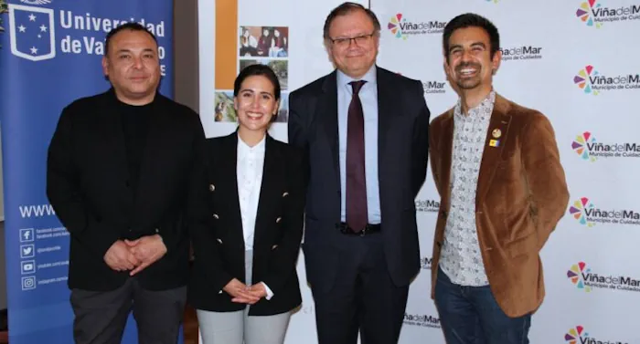
Lanzan En Viña Del Mar Primer Observatorio Turístico Municipal De Chile

Lanzan En Viña Del Mar Primer Observatorio Turístico Municipal De Chile

La entrada en funcionamiento del primer Observatorio Turístico Municipal de Chile concretó el municipio de Viña del Mar, en conjunto con la Universidad de Valparaíso, con el objetivo de profundizar en el estudio del fenómeno turístico de la ciudad, a través de la gestión de información verídica, relevante y oportuna, para orientar la toma de ...
epicentrochile.com

Raj Govt Approves Proposal To Create GIS-based 3D Models Of 4 Cities

Rajasthan government has approved a proposal for developing Geographic Information System (GIS) based 3D models of Jodhpur, Udaipur, Kota and Ajmer. According to an official statement, the state government will develop GIS-based 3D models of the four cities for better planning and management of urban development. Apart from this, a ‘repository’ of satellite imagery of ...
devdiscourse.com

نقشه‌برداری و آشکارسازی تغییرات تالاب‌ها و پهنه‌های آبی ایران با استفاده از تصاویر ماهواره‌ای

محققان دانشکده مهندسی نقشه‌برداری و اطلاعات مکانی دانشگاه تهران، تغییرات تالاب‌ها و پهنه‌های آبی ایران را با استفاده از تصاویر ماهواره‌ای مشخص کردند. دکتر مهدی حسنلو، دانشیار دانشکده مهندسی نقشه‌برداری و اطلاعات مکانی دانشگاه تهران و مجری طرح «نقشه‌برداری و آشکارسازی تغییرات تالاب‌ها و پهنه‌های آبی با استفاده از تصاویر ماهواره‌ای»، درباره ضرورت انجام این ...
news.ut.ac.ir