Geomaticians

11

AWS E Agência Espacial Brasileira Anunciam Renovação De Acordo

O acordo renova o compromisso da AEB e da AWS, firmado em fevereiro de 2022, e inclui iniciativas voltadas para o crescimento da indústria espacial brasileira, programas nacionais de pesquisa e desenvolvimento espacial (P&D), recursos de treinamento e impulsionamento de startups. Também está o Programa de Patrocínio de Dados Abertos da AWS, que visa a ...
tiinside.com.br

Hexagon Oferece Solução Inédita Para Ajudar A Combater Atividades Ambientais Ilegais Pelo Brasil

Combinando sistemas avançados de sensoriamento remoto assistido por inteligência artificial (IA) e ferramentas de modelagem espacial, a solução da Hexagon compara imagens de satélite de diferentes períodos, identificando mudanças nas áreas monitoradas de forma autônoma. Ao integrar dados de cadastros, sensores e sistemas legados, ela se diferencia ao tratar e classificar alertas, e notifica automaticamente ...
tiinside.com.br

В Казахстане Введут Публичную Кадастровую Карту

Подготовлен проект приказа министра цифрового развития, инноваций и аэрокосмической промышленности РК “Об утверждении правил ведения публичной кадастровой карты”, сообщает Zakon.kz. Карта предназначена для использования неограниченным кругом физических и юридических лиц, при этом осуществляется фильтрация данных при передаче пространственных данных из информационной системы посредством набора сервисов. Доступ в личный кабинет осуществляется на портале idp.egov.kz.
zakon.kz

Dig4vitis: Un Enfoque Innovador Y Sostenible Para Reducir El Uso De Pesticidas En La Viticultura

El proyecto Dig4Vitis liderado por las Universidades de Burgos y Valladolid busca reducir la utilización de pesticidas en la viticultura a través de una solución de agricultura de precisión que permita evaluar la deposición de pesticidas en viñedos comerciales mediante el uso de imágenes hiperespectrales y técnicas de Inteligencia Artificial en tiempo real. El objetivo ...
tecnovino.com

Fulcrum Integrates Esri’s ArcGIS Maps SDK In Its Platform

Fulcrum, a field inspection management platform, has integrated Esri’s ArcGIS Maps software development kit (SDK) into its platform to provide customers with seamless access to Esri’s geographic information system (GIS) capabilities. The integration will allow Fulcrum’s customers in industries such as power, water, telecom, agriculture, environmental engineering, and others to access and leverage Esri data ...
geospatialworld.net
Mappedin Expands Strategic Indoor Mapping Initiatives And Scale With Microsoft

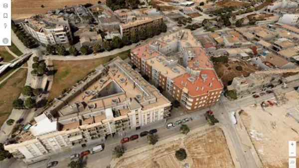
Mappedin, the leading platform for creating and maintaining indoor maps, is excited to announce its partnership with Microsoft. As a Microsoft Managed Solution Partner, Mappedin is bringing the best of digital indoor mapping to Azure Marketplace, Microsoft 365, and Power Platform. This partnership will enable Microsoft customers to seamlessly use Mappedin’s indoor mapping software regardless ...
newswire.ca

رونمایی از سامانه هوشمند نظارت بر حدنگاری اراضی کشاورزی

این سامانه که در همایش مشترک قضات ویژه حدنگاری (کاداستر) و مدیران کل ثبت سراسر کشور در مشهد رونمایی شددر راستای اجرای تفاهم نامه فی مابین سازمان ثبت اسناد و املاک کشور و وزارت جهادکشاورزی به منظور تسریع و پایش قراردادهای تطبیق و مستندسازی اراضی کشاورزی به صورت سیستم اطلاعات مکانی WebGIS طراحی شده است. ...
tahlilbazaar.com
Un ‘Gemelo Digital’ Permitirá Prevenir Inundaciones Y La Contaminación Del Mar Menor

Un ‘Gemelo Digital’ Permitirá Prevenir Inundaciones Y La Contaminación Del Mar Menor

La división de Seguridad, Infraestructuras y Geoespacial de la multinacional sueca Hexagon está trabajando con las autoridades españolas para proteger a los residentes y el medio ambiente a través de un gemelo digital del Campo de Cartagena. El gemelo digital permitirá al ministerio para la Transición Ecológica hacer comparaciones visuales de los cambios en el ...
murciaeconomia.com
Quintar Uses Google ARCore To Help People Navigate Live Events And Big Venues

Quintar Uses Google ARCore To Help People Navigate Live Events And Big Venues

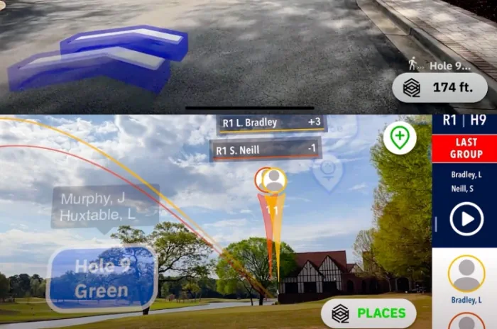
Quintar wants to enhance navigation with augmented reality so you can have an easier time navigating live events at big venues for sports or concerts. And so it announced today at Google I/O that is has partnered with Google on its ARCore tech platform. Quintar tried out the tech recently as the official mobile augmented ...
venturebeat.com
Google And Taito Reveal Augmented Reality 'Space Invaders' Game

Google And Taito Reveal Augmented Reality ‘Space Invaders’ Game

Google and Japanese games company Taito are teaming up for a new augmented reality version of the 1978 shoot ‘em-up arcade game Space Invaders. Inspired by the original gameplay, players are tasked with defending the Earth from Space Invaders in their neighborhood. Powered by Google’s ARCore Geospatial API and Streetscape Geometry API, the upcoming SPACE ...
hypebeast.com
Desmatamento Em Terras Públicas Não Destinadas-4 A Área De Estudo

Desmatamento Em Terras Públicas Não Destinadas-4: A Área De Estudo

O estudo foi realizado no distrito de Santo Antônio do Matupi. “Distritos” são unidades administrativas dentro de um município, neste caso o município de Manicoré na porção sul do estado do Amazonas. O distrito de Matupi, também conhecido como “km 180”, está localizado na rodovia Transamazônica (BR-230). Esta estrada principal faz a ligação com o ...
amazoniareal.com.br
Google Maps Is Expanding Immersive View To Routes

Google Maps Is Expanding Immersive View To Routes

Google Maps is expanding the Immersive View format it revealed last year to an important part of the app: routes. When you look for directions in Google Maps on iOS and Android in select cities, you’ll see a more detailed view of the route. The feature isn’t just about making your journey look nicer than ...
engadget.com