Geomaticians

04

Tracasa Global Implantará El Sistema GIS Para Gestionar Las Redes De Agua En 11 Municipios De La Costa Del Sol

Tracasa Global, empresa pública del Gobierno de Navarra, implantará el sistema de información geográfica (GIS) para la gestión de redes de agua en Acosol, que da servicio a 11 municipios de la Costa del Sol, en la provincia de Málaga. La empresa navarra, que comenzará a introducir sus servicios GeoSAS -con la tecnología Utility Network ...
aguasresiduales.info

Pianificazione Forestale Di Precisione E Tecnologia Lidar

Come ha dimostrato la tempesta Vaia e l’attuale epidemia di bostrico, i cambiamenti climatici possono mettere a dura prova le foreste dell’arco alpino. Anche la programmazione della gestione forestale deve essere affrontata con strumenti al passo con i tempi. In Provincia di Bolzano l’intera superficie forestale viene gestita attraverso strumenti di pianificazione decennali attraverso circa ...
news.provincia.bz.it
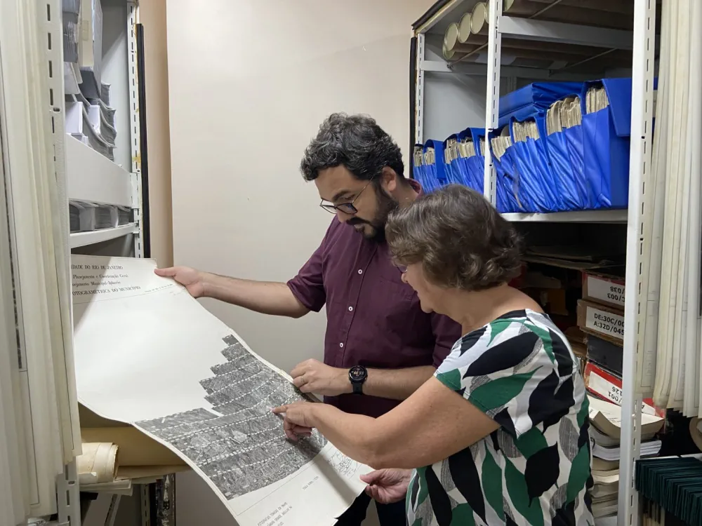
Instituto Pereira Passos E Rice University Firmam Acordo De Cooperação Para Enriquecer Atlas Digital Sobre O Rio De Janeiro

Instituto Pereira Passos E Rice University Firmam Acordo De Cooperação Para Enriquecer Atlas Digital Sobre O Rio De Janeiro

O Instituto Pereira Passos, órgão da Prefeitura do Rio, anunciou nesta terça-feira (02/05) um acordo com a Rice University, instituição de ensino superior americana sediada em Houston, para cooperação em cima da plataforma imagineRio, um atlas digital pesquisável que ilustra a evolução social e urbana da cidade ao longo de toda a sua história. Com ...
prefeitura.rio
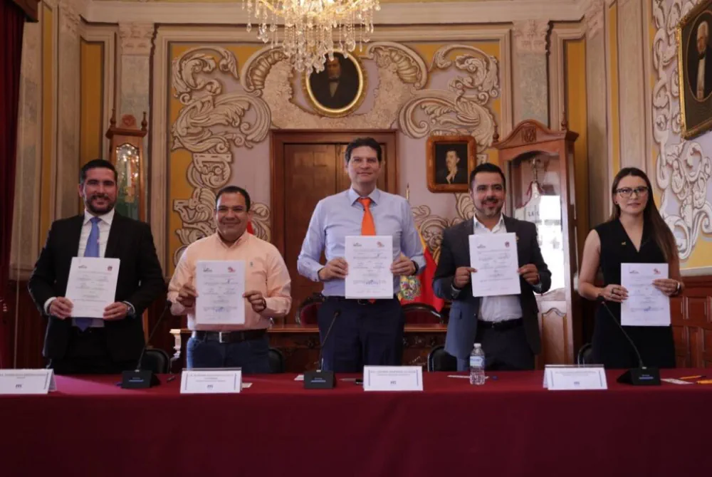
Morelia, Tarímbaro Y Charo, Suman Esfuerzos Para Un Desarrollo Metropolitano En Orden

Morelia, Tarímbaro Y Charo, Suman Esfuerzos Para Un Desarrollo Metropolitano En Orden

Al determinar que a través del trabajo coordinado se avanza mucho mejor en el desarrollo de los municipios, el Alcalde, Alfonso Martínez Alcázar, auguró que será de gran apoyo la firma de convenio de colaboración entre Morelia, Charo y Tarímbaro en aras de establecer un mejor intercambio y transferencia de información geográfica y estadística, con ...
morelia.gob.mx

RGPH 2024 : Lancement Des Travaux Cartographiques Préparatoires

Cette opération, qui va se dérouler pendant 14 mois sur le terrain, consiste à géoréférencer l’ensemble des logements, des établissements économiques et administratifs et des équipements socio-culturels existants sur l’ensemble du territoire national et de subdiviser ce dernier en unités géographiques dites “districts de recensements”, indique un communiqué du HCP. La cartographie des établissements économiques ...
perspectivesmed.com
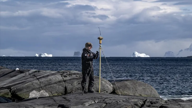
Antarktika Bilim Seferi'nin Haritacıları, Beyaz Kıta'da Piri Reis'in Izinde

Antarktika Bilim Seferi’nin “Haritacıları”, Beyaz Kıta’da Piri Reis’in Izinde

Milli Savunma Bakanlığına bağlı Harita Genel Müdürlüğü ve Türk Deniz Kuvvetleri Seyir, Hidrografi ve Oşinografi Dairesi Başkanlığı, 7. Ulusal Antarktika Bilim Seferi’ne katılarak, Piri Reis’in izinde, kıtada denizden ve karadan koordinatları belirlemeye yönelik ölçümler yaptı. Cumhurbaşkanlığı himayelerinde, Sanayi ve Teknoloji Bakanlığı uhdesinde, TÜBİTAK MAM Kutup Araştırmaları Enstitüsü koordinasyonunda gerçekleştirilen 7. Ulusal Antarktika Bilim Seferi kapsamında, ...
aa.com.tr
GeoComm Announces Availability Of School Mapping Solution Designed To Accelerate School Incident Response

GeoComm, provider of Public Safety Location Intelligence®, is excited to announce the availability of GeoComm School Safety, a digital mapping solution which leverages the latest Esri ArcGIS technology to support faster response to school emergencies. The solution provides detailed indoor maps of schools and surrounding grounds, along with critical information needed by school safety authorities, ...
directionsmag.com
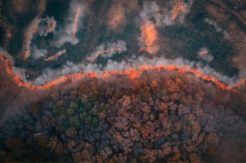
ICEYE Announces Beta Release Of Wildfire Data Product

ICEYE Announces Beta Release Of Wildfire Data Product

ICEYE, a provider of natural catastrophe insights, has announced the beta release of its Wildfire Insights product. ICEYE Wildfire uses artificial intelligence and machine learning to provide building-level impact data for wildfires in near real time based on satellite imagery. The product captures data for any wildfire that impacted communities throughout the US, ICEYE said. ...
insurancebusinessmag.com
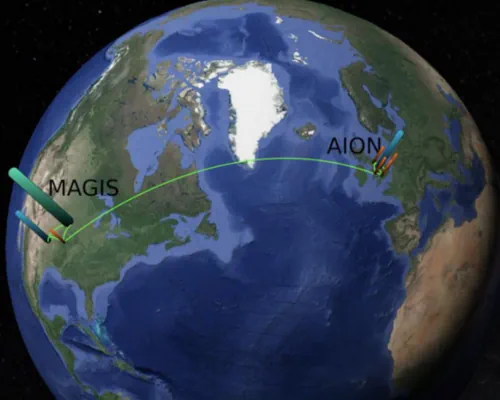
Cold Atoms For New Physics

Cold Atoms For New Physics

On 13 and 14 March CERN hosted an international workshop on atom interferometry and the prospects for future large-scale experiments employing this quantum-sensing technique. This quantum sensing technology holds great promise for making ultra-sensitive measurements in fundamental physics. Like light interferometry, atom interferometry involves measuring interference patterns, but between atomic wave packets rather than light ...
cerncourier.com
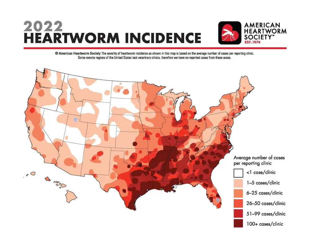
Map Shows Heartworm Rates Continue To Increase In Hot Spots, New Locations

Map Shows Heartworm Rates Continue To Increase In Hot Spots, New Locations

Incidence of heartworm disease has continued to rise not only in previously known hot spots but also in unexpected locations with previously low heartworm rates, according to the 2022 Heartworm Incidence Map from the American Heartworm Society (AHS). “For many pet owners—and even veterinarians—it can be all too easy to assume that heartworm isn’t common ...
avma.org
New 3D Maps Reveal Hundreds Of Ancient Landslides South Of Auckland

New 3D Maps Reveal Hundreds Of Ancient Landslides South Of Auckland

Just-released maps have revealed hundreds of ancient landslides around Pukekohe, while offering a multi-dimensional view of the region’s active faults and volcanic features. Capturing more than 830 square kilometres, from Manukau Harbour’s southern shoreline to the lower Waikato River, the new GNS Science-produced maps show Auckland’s rolling southern landscapes as they’ve never been seen. It ...
nzherald.co.nz
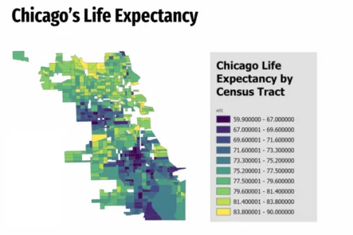
Mapping And Health Equity Project Created By UIC Alum, Student Addresses Chicago’s Health Disparities

Mapping And Health Equity Project Created By UIC Alum, Student Addresses Chicago’s Health Disparities

Near the end of the 2019 fall semester, Sonya Gupta was a University of Illinois Chicago undergraduate conducting research on the location and extent of healthcare deserts in the Chicago area and the potential of mobile health clinics to bridge the gap … In the fall of 2020, biological sciences major Ryan Zomorrodi started research ...
today.uic.edu