Geomaticians

02

자율주행용 정밀도로지도, 일반 국도까지 지원한다

자율주행용 정밀도로지도, 일반 국도까지 지원한다

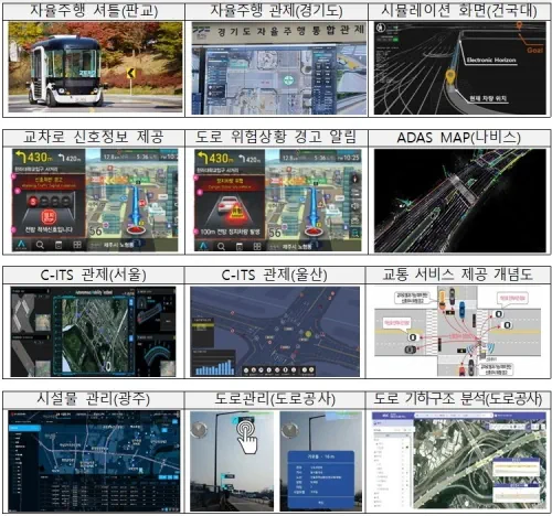
국토교통부 국토지리정보원은 고속국도와 일반국도를 대상으로 자율주행의 핵심 인프라인 정밀도로지도 구축을 완료하고 지난달 27일부터 무상으로 제공하고 있다. 정밀도로지도는 차선, 표지, 도로시설 등을 도로 디지털트윈으로 구현한 고정밀 전자지도로 차선 단위의 차량위치 결정이 가능해 자율주행을 지원하도록 제작된 지도를 말한다. 자율주행 뿐만 아니라 고정밀 내비게이션과 운전 중 발생할 수 있는 상황을 차량이 스스로 인지해 판단하는 전자 제어 시스템인 ADAS(Advanced ...
hellot.net
광주시, AI·빅데이터 활용 미래형 스마트 교통도시로 거듭난다

광주시, AI·빅데이터 활용 미래형 스마트 교통도시로 거듭난다

광주시는 지능형교통체계(ITS) 스마트 횡단보도를 구축하고 교통안전시설물 관리시스템을 추진하는 등 미래형 스마트 교통도시로 거듭난다고 2일 밝혔다. 시는 광주경찰청 교통안전시설 담당자들과 워크숍을 열어 교통시설 추진정책 및 확충분야를 심도 있게 논의, 시민 불편은 줄이고 교통안전은 높이는 ‘2023년 미래형 교통시설 중점 추진 정책’을 마련해 이날 발표했다. 먼저 AI 센서와 빅데이터를 활용한 ITS 스마트횡단보도 구축사업을 추진한다. 스마트횡단보도는 첨단센서 기술로 보행자와 ...
chum-dan.net
El Primer Mapa De Riesgos Climáticos En Canarias Detalla Qué Municipios Sufrirán Más Los Efectos Del Calentamiento Global

El Primer Mapa De Riesgos Climáticos En Canarias Detalla Qué Municipios Sufrirán Más Los Efectos Del Calentamiento Global

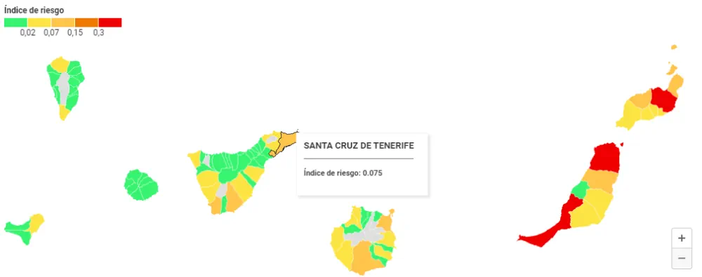
El impacto de la crisis climática no será igual en toda Canarias. Nuevos datos difundidos por el Gobierno regional revelan que municipios como Pájara, en Fuerteventura, o Haría, en Lanzarote, sufrirán más los efectos del calentamiento global en sus costas que otras regiones del Archipiélago. Los resultados concluyen, de nuevo, que la dependencia del turismo ...
eldiario.es

پرتاب سری «ماهواره‌های پارس» و «طلوع» در سال جاری

رئیس سازمان فضایی ایران از پرتاب ماهواره‌هایی در سال جاری خبر داد و گفت: در سال جاری سری ماهواره‌های پارس (پارس ۱ و ۲) به عنوان جفت ماهواره، ماهواره طلوع با دقت ۱۰ متر رنگی آماده پرتاب می‌شوند. رئیس سازمان فضایی ایران ادامه داد: علاوه بر آن قرارداد، در حال پیگیری انعقاد قرارداد برای ساخت ...
khabaronline.ir

Integran En Una Plataforma Información Sobre El Envejecimiento En México

Esta plataforma de libre acceso fue desarrollada por el Instituto de Geografía (IGg) de la UNAM, el Instituto Nacional de Geriatría (INGER), la Universidad de Colima y CHRISTUS Centro de Excelencia e Innovación. En la conformación del SIESDE colaboraron médicos, geógrafos, demógrafos, ingenieros y científicos de datos, en un trabajo enmarcado en la perspectiva del ...
dgcs.unam.mx
Track, Trace And Triumph How Utah Division Of Wildlife Resources And Google Public Sector Are Setting The Standard To Protect The State’s Wildlife

Track, Trace And Triumph: How Utah Division Of Wildlife Resources And Google Public Sector Are Setting The Standard To Protect The State’s Wildlife

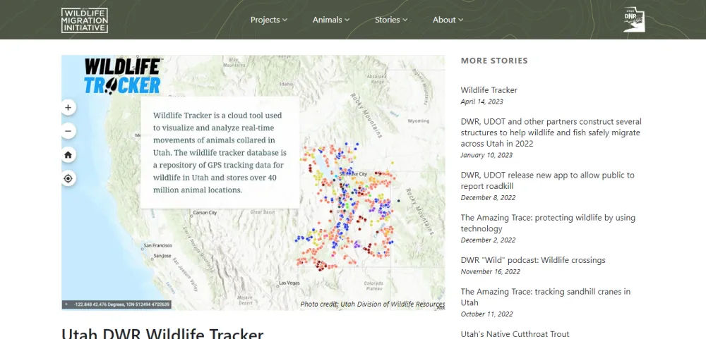
Fast forward to 2023, and now Utah DWR officials can get real-time location data for thousands of animals without leaving their office. What’s more, they can overlay today’s location data with up to 20 years of historical information to make data-driven decisions to improve wildlife habitat and populations using the state’s Wildlife Tracker application, running ...
utahbusiness.com
El Nuevo Sistema De La UMA Que Detecta Las Zonas De Humedales

El Nuevo Sistema De La UMA Que Detecta Las Zonas De Humedales

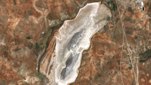
Este sistema, según Christoph Schröder , especialista en Sistemas de Información Geográfica del ETC-UMA, se encarga de mapear con imágenes satélite las extensiones de agua de los humedales, a partir de una herramienta que desde la nube ‘Google Earth Engine’ calcula y observa la evolución de una serie de indicadores como pueden ser el agua ...
malagahoy.es
Geographic Technology Provides Landowners With Precise Tools When Making Land Management Decisions

Geographic Technology Provides Landowners With Precise Tools When Making Land Management Decisions

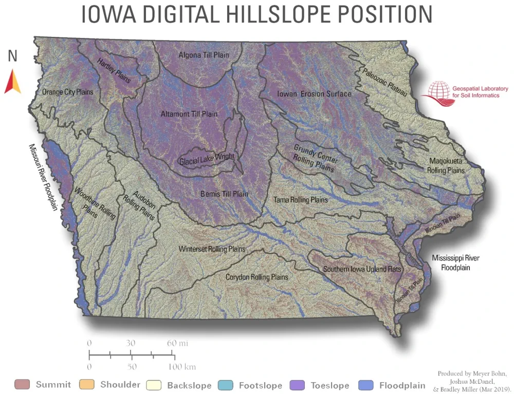
According to Lee Burras and Bradley Miller, agronomists at Iowa State University, advances in geospatial technology coupled with more traditional farming knowledge have allowed researchers and landowners to understand the land more intimately than ever before. Miller, who began his career working in water quality, has seen firsthand how soil can be impacted by the ...
extension.iastate.edu
Geospatial World Forum 2023 To Be Held In Rotterdam In May

Geospatial World Forum 2023 To Be Held In Rotterdam In May

The Geospatial World Forum (GWF) is gearing up for its 14th edition, and it promises to be a must-attend event for professionals in the geospatial industry. With expected participation of 800+ attendees from more than 75 countries, the GWF is set to be a global gathering of industry leaders, innovators, and experts. More than 300 ...
geospatialworld.net