Geomaticians

31

SpacePNT Completes Navileo™ PNT GNSS Receiver Integration Testing

SpacePNT and D-Orbit have completed their integration testing of SpacePNT’s NaviLEO™ GNSS receiver technology that is onboard the ION Orbital Transfer Vehicle (ION SCV011) that is scheduled for launch from Vandenberg Space Force Base in June of 2023. NaviLEO™ is a low-cost, high performance, multi-GNSS, multi-frequency receiver, product platform developed by SpacePNT in Switzerland to ...
news.satnews.com
울산시, 방사능재난 대비 ‘시민행동 알림체계’ 시연회

울산시는 31일 오후 2시 시청 제2별관 4층 재난안전상황실에서 ‘방사능재난 대비 시민행동 알림체계(시스템)’ 시연회를 개최한다고 밝혔다. 이 시스템은 대규모 대피가 예상되는 방사능재난 상황 발생 시 시민들의 신속한 대피를 지원하기 위해 구축됐다. 또 흩어져 있는 각종 방사능재난 관련된 정보를 한곳에 모아 시민들이 쉽고 편리하게 사용할 수 있도록 기능을 구현했다. 한국원자력안전기술원 주민보호 지리정보시스템(PGIS), 국가교통정보센터, 울산시 지능형 교통 체계(ITS) ...
mobile.newsis.com
La UNA Proyecta Implementación De SmartCampus

La UNA Proyecta Implementación De SmartCampus

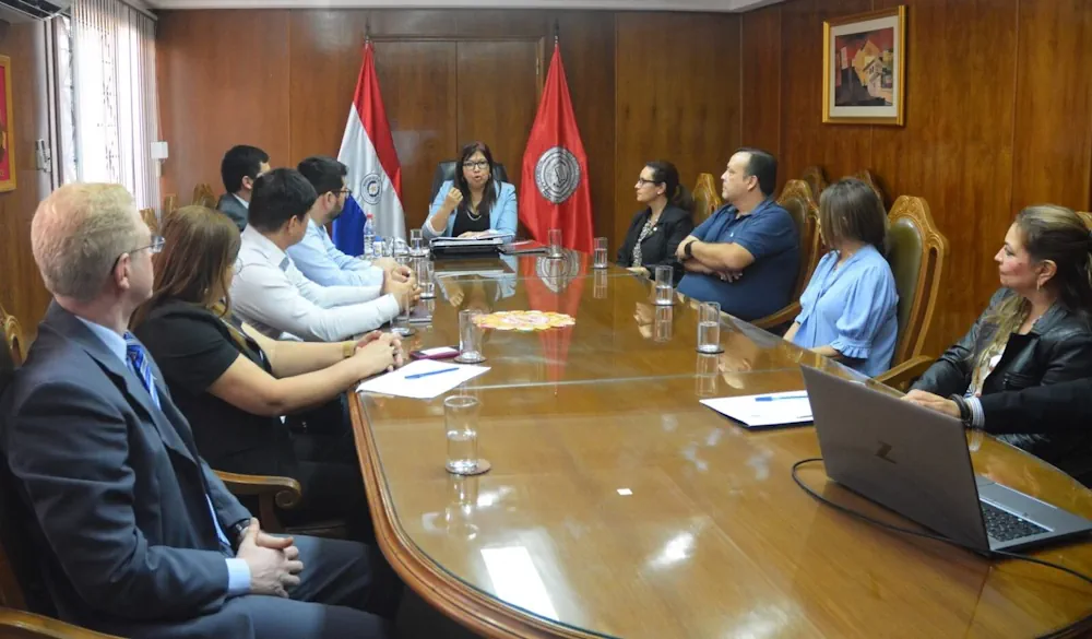
La Prof. Dra. Zully Vera de Molinas, rectora de la Universidad Nacional de Asunción (UNA), recibió la visita de representantes de tres organizaciones nacionales y extranjeras con el objetivo de establecer las bases para introducir un sistema de información geográfica (SIG) para desarrollar un Smart Campus. La visita tuvo lugar en el campus de San ...
una.py
Nuevo Geoportal Estadístico Del INDEC De Argentina

Nuevo Geoportal Estadístico Del INDEC De Argentina

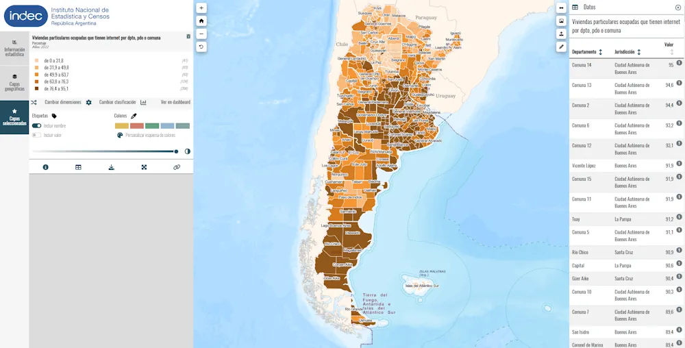
El 18 de mayo del presente año, el Instituto Nacional de Estadística y Censos de Argentina (INDEC) realizó el lanzamiento de su geoportal estadístico, plataforma web que permite la diseminación de datos estadísticos de manera desagregada en el territorio. En esta etapa inicial, el geoportal del INDEC ofrece a los usuarios los datos provisionales del ...
cepal.org

Singaporean Alliance Organizes Geospatial-oriented AI Challenge

In collaboration with AI Singapore, the Singapore Land Authority (SLA) has launched an innovative challenge centered on visual localization, aimed at addressing how AI can accurately extract camera pose data from 2D images. This is an essential concept in computer vision that refers to the exact position and orientation of a camera in 3D space ...
gim-international.com
FCC Updates National Broadband Map To Resolve 4M Challenges

FCC Updates National Broadband Map To Resolve 4M Challenges

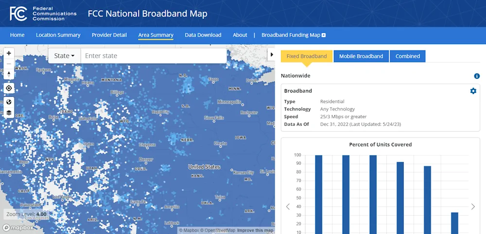
The Federal Communications Commission (FCC) released its second iteration of the national broadband map that provides availability data for stakeholders working to expand high-speed internet access across the U.S. The new map shows that more than 8.3 million U.S. homes and businesses lack access to high-speed broadband (nearly 330,000 unserved locations more than the first ...
fiercetelecom.com
L'agricoltura Del Futuro L'uso Di Droni Per Un'irrigazione Più Sostenibile Negli Uliveti

L’agricoltura Del Futuro: L’uso Di Droni Per Un’irrigazione Più Sostenibile Negli Uliveti

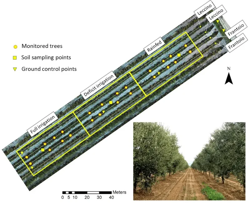
Un recente studio pubblicato sulla rivista Agronomy ha dimostrato come l’uso di immagini visibili e termiche acquisite da un drone possa essere un metodo efficace per monitorare lo stato idrico delle piante, la crescita della chioma e la resa degli ulivi. Questa scoperta potrebbe avere implicazioni significative per la gestione sostenibile dell’acqua in agricoltura. Gli ...
quadricottero.com
Mapping The Conflict Between Farming And Biodiversity

Mapping The Conflict Between Farming And Biodiversity

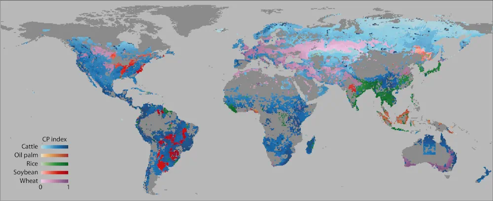
Food is one of society’s great moral quandaries. Its production pushes many species to the brink of extinction and the grazing of land that destroys ecosystems. For governments, industry, and communities to effectively balance agricultural needs with environmental needs, however, quantitative information is required. Researchers in Japan, including the Research Institute for Humanity and Nature ...
eurekalert.org