Geomaticians

May

SpacePNT Completes Navileo™ PNT GNSS Receiver Integration Testing

SpacePNT and D-Orbit have completed their integration testing of SpacePNT’s NaviLEO™ GNSS receiver technology that is onboard the ION Orbital Transfer Vehicle (ION SCV011) that is scheduled for launch from Vandenberg Space Force Base in June of 2023. NaviLEO™ is a low-cost, high performance, multi-GNSS, multi-frequency receiver, product platform developed by SpacePNT in Switzerland to ...
news.satnews.com

울산시, 방사능재난 대비 ‘시민행동 알림체계’ 시연회

울산시는 31일 오후 2시 시청 제2별관 4층 재난안전상황실에서 ‘방사능재난 대비 시민행동 알림체계(시스템)’ 시연회를 개최한다고 밝혔다. 이 시스템은 대규모 대피가 예상되는 방사능재난 상황 발생 시 시민들의 신속한 대피를 지원하기 위해 구축됐다. 또 흩어져 있는 각종 방사능재난 관련된 정보를 한곳에 모아 시민들이 쉽고 편리하게 사용할 수 있도록 기능을 구현했다. 한국원자력안전기술원 주민보호 지리정보시스템(PGIS), 국가교통정보센터, 울산시 지능형 교통 체계(ITS) ...
mobile.newsis.com
La UNA Proyecta Implementación De SmartCampus

La UNA Proyecta Implementación De SmartCampus

La Prof. Dra. Zully Vera de Molinas, rectora de la Universidad Nacional de Asunción (UNA), recibió la visita de representantes de tres organizaciones nacionales y extranjeras con el objetivo de establecer las bases para introducir un sistema de información geográfica (SIG) para desarrollar un Smart Campus. La visita tuvo lugar en el campus de San ...
una.py
Nuevo Geoportal Estadístico Del INDEC De Argentina

Nuevo Geoportal Estadístico Del INDEC De Argentina

El 18 de mayo del presente año, el Instituto Nacional de Estadística y Censos de Argentina (INDEC) realizó el lanzamiento de su geoportal estadístico, plataforma web que permite la diseminación de datos estadísticos de manera desagregada en el territorio. En esta etapa inicial, el geoportal del INDEC ofrece a los usuarios los datos provisionales del ...
cepal.org

Singaporean Alliance Organizes Geospatial-oriented AI Challenge

In collaboration with AI Singapore, the Singapore Land Authority (SLA) has launched an innovative challenge centered on visual localization, aimed at addressing how AI can accurately extract camera pose data from 2D images. This is an essential concept in computer vision that refers to the exact position and orientation of a camera in 3D space ...
gim-international.com
FCC Updates National Broadband Map To Resolve 4M Challenges

FCC Updates National Broadband Map To Resolve 4M Challenges

The Federal Communications Commission (FCC) released its second iteration of the national broadband map that provides availability data for stakeholders working to expand high-speed internet access across the U.S. The new map shows that more than 8.3 million U.S. homes and businesses lack access to high-speed broadband (nearly 330,000 unserved locations more than the first ...
fiercetelecom.com
L'agricoltura Del Futuro L'uso Di Droni Per Un'irrigazione Più Sostenibile Negli Uliveti

L’agricoltura Del Futuro: L’uso Di Droni Per Un’irrigazione Più Sostenibile Negli Uliveti

Un recente studio pubblicato sulla rivista Agronomy ha dimostrato come l’uso di immagini visibili e termiche acquisite da un drone possa essere un metodo efficace per monitorare lo stato idrico delle piante, la crescita della chioma e la resa degli ulivi. Questa scoperta potrebbe avere implicazioni significative per la gestione sostenibile dell’acqua in agricoltura. Gli ...
quadricottero.com
Mapping The Conflict Between Farming And Biodiversity

Mapping The Conflict Between Farming And Biodiversity

Food is one of society’s great moral quandaries. Its production pushes many species to the brink of extinction and the grazing of land that destroys ecosystems. For governments, industry, and communities to effectively balance agricultural needs with environmental needs, however, quantitative information is required. Researchers in Japan, including the Research Institute for Humanity and Nature ...
eurekalert.org

Esri España Y Seresco Aúnan Fuerzas Para Ofrecer Soluciones Al Sector Agrícola Mediante La Tecnología Arcgis

Esri, empresa líder mundial en tecnología geoespacial, y Seresco, especialistas y referentes en España en consultoría y sistemas de información orientados al registro, análisis predictivo y gestión de riesgos asociados al sector agroalimentario, colaborarán para ofrecer soluciones conjuntas que permitirán poner a disposición del sector los datos y las herramientas para la gestión sostenible de ...
dirigentesdigital.com

Esri India And ideaForge Join Hands

Esri India, the country’s leading Geographic Information System (GIS) Software & Solutions provider announced the signing of a Memorandum of Understanding (MOU) with ideaForge, a market leader in the Indian Unmanned Aircraft Systems. The objective of this partnership is to boost the adoption of drones in India. The partnership between Esri India and ideaForge will ...
timestech.in
Universidad Participa En El 'VI Congreso Nacional De Estudiantes De Geomática, Geodesia Y Geoinformática'

Universidad Participa En El ‘VI Congreso Nacional De Estudiantes De Geomática, Geodesia Y Geoinformática’

La jefa de posgrado de la Facultad de Ciencias Forestales y Ambientales de la Universidad Juárez del Estado de Durango, Emily García Montiel, compartió detalles sobre el “Sexto Congreso nacional de estudiantes de geomática, geodesia y geoinformática”, que tuvo lugar del 17 al 20 de mayo. En este evento, estudiantes e investigadores del núcleo básico ...
elsiglodedurango.com.mx

BIM E GIS Finalmente Integrati Con Usbim.Geotwin: La Soluzione ACCA Software Per Progettare E Gestire Edifici E Infrastrutture Integrando Dati GIS Con Modelli BIM

Integrando i due patrimoni informativi GIS, che offre una rappresentazione di contesto su scala urbana, regionale e/o nazionale, e BIM, che focalizza la propria attenzione sulla singola opera, è possibile ottenere un digital twin dell’opera contestualizzata nel proprio ambiente. usBIM.geotwin di ACCA software è la nuova piattaforma tecnologica per la digitalizzazione e la gestione geospaziale ...
professionearchitetto.it

Dubai Municipality Launches New Online System For Building Permits Services

Dubai Municipality has announced the launch of a new online system for building permits and control services aimed at streamlining procedures for customers in the emirate. The new system not only complies with the latest BIM standards and geographic information systems, but also facilitates user registration through digital ID and instant recognition. It enables smart ...
zawya.com

FAO, EU Provide Digital Technologies To Boost Land Management In Kenya

The Food and Agriculture Organization (FAO) of the United Nations and the European Union (EU) on Friday announced the setting up of Geographic Information System (GIS) laboratories to boost land governance in rural Kenya. Husna Mbarak, Lead in land and natural resource governance at the FAO, said the agency plans to set up 34 GIS ...
english.news.cn
Depremde Sınırları Değişen Mülkiyetlerin Yeri Ortofoto Harita Ile Belirleniyor

Depremde Sınırları Değişen Mülkiyetlerin Yeri “Ortofoto Harita” Ile Belirleniyor

Tapu ve Kadastro Genel Müdürü Mehmet Zeki Adlı, depremlerden etkilenen şehirler için ortofoto haritaları üreterek, mülkiyetlerde nerede, ne derece kayma olduğunu tespit ettiklerini söyledi. “Ortofoto yöntemiyle yapılan bu çalışmaları bir yerde topladık. Haritaya dönüşmesi için koordinatlandırdık. Bunların koordinatlandırılması için Türkiye genelinde sabit GPS istasyonları dediğimiz noktalarımız var. 50-55 kilometre aralıklarla kurulan, 24 saat uyduda görüntü ...
trthaber.com
Nuri Successfully Sends 5 Out Of 8 Satellites Into Orbit

Nuri Successfully Sends 5 Out Of 8 Satellites Into Orbit

Five out of the total of eight satellites separated from Korea’s domestically developed space rocket Nuri, successfully entered their target orbits and are sending signals. Meanwhile, attempted communication with the remaining three satellites are “still ongoing.” The main payload, Next Generation Small Satellite, or NEXTSat-2, successfully entered its target orbit and two-way communication was made, ...
koreajoongangdaily.joins.com
UCSB Research Team Develops Methane Detection Tool

UCSB Research Team Develops Methane Detection Tool

Satish Kumar and his graduate research team at UC Santa Barbara’s Vision Research Lab have led the charge in developing an AI-based methane detection tool called MethaneMapper. This first-of-its-kind software can spot methane gas via complex algorithms. The algorithms analyze multiple visual spectrums of images taken from custom-built cameras 10,000 feet aboveground. “The amount of ...
independent.com

TomTom And Alteryx Expands Partnership With Location Intelligence Offering

TomTom (TOM2), the geolocation technology specialist, announced an expanded partnership with Alteryx, the Analytics Cloud Platform company. The agreement will support new Alteryx cloud-based analytics offerings, such as Alteryx Location Intelligence, which premiered at the Alteryx Inspire user conference. Together, TomTom and Alteryx collaborate to integrate TomTom’s Maps APIs into Alteryx products and location insights ...
geospatialworld.net
German Campaign Aims To Get Youngsters Excited About Mapping And Surveying

German Campaign Aims To Get Youngsters Excited About Mapping And Surveying

The German Association for Geodesy (DVW) has launched a campaign to build young people’s awareness of the exciting career opportunities in the geospatial industry. The world of geoinformation is diverse, dynamic, challenging and – most importantly – indispensable in our rapidly changing world. While surveyors and other geospatial professionals are obviously aware of this fact, ...
gim-international.com
SmartSat Launches Maya Nula Research Program

SmartSat Launches Maya Nula Research Program

SmartSat Cooperative Research Centre (CRC), an Australian space research centre, announced on the 23rd of May that they have launched a new research program: Maya Nula. This program intends to develop Australian satellite Earth Observation (EO) capability with space sensor technology to advance Australia’s agriculture industry. The SmartSat-led initiative will facilitate innovative research projects to ...
spacewatch.global
Venezuela’s Hidden Runways Bring Both Life And Destruction To Indigenous Lands

Venezuela’s Hidden Runways Bring Both Life And Destruction To Indigenous Lands

Flying over a dense jungle in southern Venezuela, the sea of trees below is suddenly replaced by large patches of bare soil, tree stumps and the turquoise waters of ponds from abandoned gold mines. An airstrip 600 meters long marks the entrance to one of Venezuela’s more than 3,700 gold mines. Only half of the ...
news.mongabay.com
경남도, 건축·재난 등 분야에 국토위성 정보 활용 넓힌다

경남도, 건축·재난 등 분야에 국토위성 정보 활용 넓힌다

경남도는 도시, 건축, 항만, 산림 등 다양한 분야에 국토위성(차세대 중형 위성 1호) 영상을 확대 활용하기 위해 국토지리정보원(국토위성센터)과 세미나를 개최했다고 24일 밝혔다. 이번 세미나는 오는 8월 공공 분야 위성 영상 확대에 앞서 지자체 공간정보 활용 여건 조사차 경남도 공간정보플랫폼 운영 현황을 공유하고 실무자들 의견을 수렴하기 위해 개최됐다. 지난 3월 발생한 합천군 산불처럼 보안상 문제로 발생지 좌표가 ...
yna.co.kr

Agreement Signed To Establish ISESCO Chair In Machine Learning For Remote Sensing

Sultan Qaboos University (SQU) and the Islamic World Educational, Scientific and Cultural Organization (ICESCO) today signed a cooperation agreement to establish an ISESCO chair in the field of machine learning for remote sensing and geographic information systems. The agreement was signed by HH Sayyid Dr. Fahd bin Al Julanda Al Said, SQU Vice-Chancellor, and Dr. ...
timesofoman.com

Hexagon Modernizará El Sistema 112 De Baleares

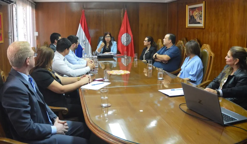
El 112 de las Islas Baleares ha seleccionado la división Safety, Infrastructure & Geospatial de Hexagon para mejorar la recepción y despacho de llamadas de emergencia en el archipiélago, incluyendo a Mallorca, Menorca, Ibiza y Formentera. “El sistema que utilizamos actualmente es de 1995, por lo que está totalmente obsoleto”, ha afirmado Vicente Soria, director ...
economiademallorca.com
کنفرانس ملی سیستم اطلاعات مکانی در صنعت آب و برق در واحد علوم و تحقیقات برگزار شد

کنفرانس ملی سیستم اطلاعات مکانی در صنعت آب و برق در واحد علوم و تحقیقات برگزار شد

هفتمین کنفرانس ملی سیستم اطلاعات مکانی (GIS)، به همت معاونت پژوهشی واحد علوم و تحقیقات، با همکاری وزارت نیرو و شرکت توزیع نیروی برق تهران بزرگ با هدف دستیابی به آخرین یافته‌های علمی و پژوهشیGIS در ایران و جهان و تبادل تجربیات حاصله در صنعت آب و برق کشور و با حضور جمعی از پژوهشگران، ...
iau.ir

Geovet 2023 – Expanding Boundaries: Interdisciplinary Geospatial Research For The One Health Era

Since 2001, the GeoVet conference, held every 3 years, brings together a diverse group of international experts in spatial epidemiology, spatial statistics and Geographical Information Systems applied to animal health, public health and food safety. From September 19ᵗʰ to 21ˢᵗ 2023, in Silvi Marina, Teramo – Italy, experts from different disciplines will share their knowledge ...
eurekalert.org

Maptitude Revolutionizes School Redistricting Process For Nashua School District

The Nashua School District (NH) has successfully utilized Maptitude Mapping Software and Maptitude Online, powerful Geographic Information System (GIS) tools, to streamline the complex and time-consuming process of school redistricting. With the assistance of Maptitude, the district was able to complete this challenging task in under 25 hours, involving a committee of 25 people. Traditionally, ...
httpsspacewatch.global202305iceye-introduces-satellite-radar-dwell-capability

ICEYE Introduces Satellite Radar Dwell Capability

ICEYE has announced a new imaging mode known as Dwell to enable its synthetic aperture radar (SAR) satellites to remain focused on a specific point on the ground for an extended collection time. This long-duration imaging mode allows ICEYE satellites to capture significantly more information about the imaging target, creating a new capability for imagery ...
spacewatch.global
Desmatamento Do Interior Paulista Provocou Desaparecimento De 80 Espécies De Aves

Desmatamento Do Interior Paulista Provocou Desaparecimento De 80 Espécies De Aves

Das 358 espécies de aves já mapeadas há algumas décadas em quatro unidades de conservação do interior do estado de São Paulo, apenas 278 foram registradas durante pesquisa de campo para identificar as aves remanescentes na região. As aves foram identificadas por meio de binóculos e também de seus sons, e o critério para registro ...
gizmodo.uol.com.br
Le Mappe Dei Satelliti Per Pianificare Soccorsi E Ricostruzione Post-alluvione

Le Mappe Dei Satelliti Per Pianificare Soccorsi E Ricostruzione Post-alluvione

Studiomapp, azienda con base a Ravenna specializzata in geo-intelligence e già premiata dal Dipartimento di Difesa degli Stati Uniti per aver vinto una sfida internazionale per velocizzare le operazioni di soccorso dopo disastri naturali analizzando immagini satellitari con l’intelligenza artificiale, ha reso disponibile mercoledì l’ultima mappa aggiornata delle aree colpite dall’alluvione in Romagna. per far ...
ravennatoday.it