Geomaticians

28

땅 속 보이지 않는 파이프···3D로 생생하게 보다

땅 속 보이지 않는 파이프···3D로 생생하게 보다

복잡하게 매설되어 있는 파이프는 때때로 문제의 원인이 되기도 한다. 건물 건설에 앞서 지하기반 공사 과정에서 예상과 다른 파이프 위치로 인해 설계가 달라지거나, 혹은 파이프를 건드려 파손사고가 일어나는 경우가 있다. ‘파이프는 망가져야 고친다’라는 말처럼 파이프에 대한 정확한 정보의 부재로 인해 항상 사고가 터지고 사후 수습을 하는 형태. 이러한 문제점을 해결하기 위해 무브먼츠는 파이프를 3D 모델로 지상으로 ...
서울시립대-이지스 “산학 협력, 디지털 트윈 이끈다”

서울시립대-이지스 “산학 협력, 디지털 트윈 이끈다”

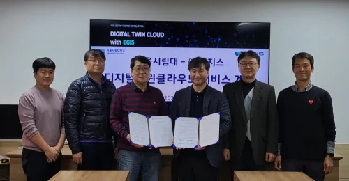
3차원 지리공간정보(GIS) 전문기업 이지스(대표 김성호)는 서울시립대와 최근 본교 21세기관 회의실에서 ‘디지털트윈 클라우드 교육 서비스 협력’을 위한 계약을 맺었다고 27일 밝혔다. 이지스는 이번 계약을 통해 지리 공간정보 기반 디지털트윈 클라우드 구독서비스 30개 계정을 교육용으로 제공하기로 했다. 이와 함께 교육·기술적 지원도 제공할 예정이다. 특히 영상, 드론, 라이다, 센서 데이터, 2D·3D 공간정보, 다양한 속성정보 등을 클라우드 플랫폼 상에서 ...

Smart City. Uno Scanner Laser Per Costruire Il Gemello Digitale Di Milano, Al Via Fase Di Test

Uno scanner laser sul tetto di un veicolo del Comune che scatta fotografie ad alta frequenza per produrre una ricostruzione digitale del territorio. I milanesi e le milanesi lo vedranno circolare da oggi fino al 7 aprile in alcune zone della città, in particolare quelle interessate dai grandi cantieri (ad esempio le aree degli ex ...

La Nueva Constelación De Satélites IRIDE Para Vigilar Italia Y Europa, Será Construida Por Thales Alenia Space

Con los contratos obtenidos de la ESA, Thales Alenia Space suministrará un primer lote de seis pequeños satélites con radar de apertura sintética (SAR) y un satélite basado en tecnología óptica para la constelación italiana de observación de la Tierra, IRIDE. Los satélites se construirán en Italia bajo la responsabilidad de Thales Alenia Space y ...
hispaviacion.es

Govt To Introduce GPS-based Toll System In Six Months

The Indian government has announced plans to implement a GPS-based toll system within the next six months, which will replace traditional toll plazas, said Union minister Nitin Gadkari. This new system will rely on GPS technology to track and charge vehicles as they use highways and other roads, eliminating the need for physical toll booths ...
Türkiye Maps Northwestern Forest Migration Amid Climate Change

Türkiye Maps Northwestern Forest Migration Amid Climate Change

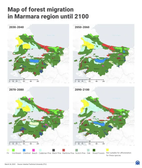
Türkiye on Friday released a map of the projected distribution of trees and the migration of forests around the country’s internal Marmara Sea until the end of this century. The initiative was part of a project carried out to explore the potential of the northwestern forests in the Marmara region to adapt to climate change. ...
aa.com.tr

Mapping The Risks Of Isolation Due To Sea Level Rise Associated With Global Warming

A trio of environmental engineers, two with the University of Canterbury in New Zealand, the third with the University of Maryland, has developed a way to illustrate the impact of sea level rise isolation associated with global warming. In their paper published in Nature Climate Change, Tom Logan, M. J. Anderson and Allison Reilly describe ...
phys.org