Geomaticians

24

Indian Space Startup Pixxel Bags US Contract For Hyperspectral Imagery

Bengaluru-based space startup Pixxel has bagged a five-year contract for supplying technical hyperspectral imagery to United States’ National Reconnaissance Organization (NRO). Pixxel will provide technical hyperspectral imagery (HSI) remote sensing capabilities through modelling and simulation and data evaluation using its currently on-orbit pathfinder systems and future constellations. Last year, Pixxel had launched its hyper-spectral imaging ...
newsdrum.in

Guatemala Y Ecuador Planifican Más Cooperación

Con el objetivo de formalizar y aprobar iniciativas de interés común para el período 2023-2024, se llevó a cabo la II Reunión de la Comisión Mixta de Cooperación Técnica y Científica, Educativa y Cultural entre Guatemala y Ecuador, informó el Ministerio de Relaciones Exteriores (Minex). La cita tuvo como propósito promover desarrollo ambiental, comercial y ...
dca.gob.gt

Web App Soon For Easy Access To BBS Data

The national statistical bureau is going to introduce a web application for supplying statistics based on GIS, aimed at ensuring easy access to data for all. The Bangladesh Bureau of Statistics (BBS) with the technical support of the Centre for Environmental and Geographic Information Services (CEGIS) is developing the app, BBS joint director Md Rafiqul ...
thefinancialexpress.com.bd
FutureTales LAB And ESRI Set Up “Urban Hazard Studio” Data Hub

FutureTales LAB And ESRI Set Up “Urban Hazard Studio” Data Hub

FutureTales LAB by MQDC, a futurology research centre, is collaborating with ESRI (Thailand), a leader in location intelligence and geo-informatics with ArcGIS software, to set up the “Urban Hazard Studio” data hub to study Greater Bangkok’s flood risks. The hub will analyse, evaluate, and share information to alert people and society so all sectors prepare ...
bangkokpost.com
Observing Group-living Animals With Drones And Computer Vision

Observing Group-living Animals With Drones And Computer Vision

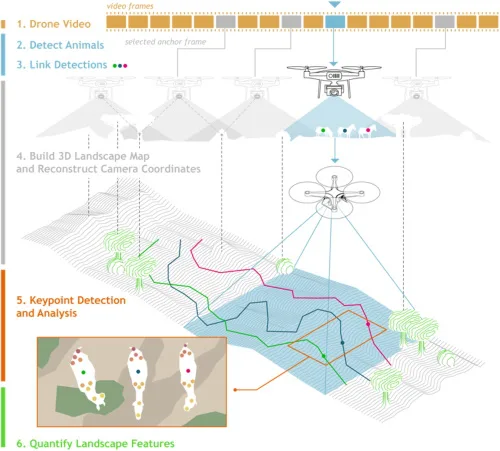
To explore animal groups such as zebras or gelada monkeys, Ben Koger, Blair Costelloe, Iain Couzin, and other researchers from the Max Planck Institute of Animal Behavior, the CASCB at the University of Konstanz, and Aarhus University developed a new method for collecting data about animal behaviour and the animals’ surrounding natural physical landscape using ...
CASSINI Hackathon I Migliori Talenti Europei Si Sfidano Tra Satelliti E Intelligence

CASSINI Hackathon: I Migliori Talenti Europei Si Sfidano Tra Satelliti E Intelligence

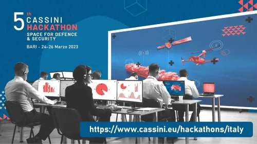
Tre giorni di tempo per sviluppare i propri progetti e sfidarsi nel realizzare applicazioni basate su dati e servizi satellitari dell’Unione Europea con l’obiettivo di creare soluzioni innovative per migliorare la sicurezza e la difesa in Europa. Tre le sfide sulle quali cimentarsi: mobilità sulla terraferma, sicurezza in mare, protezione delle infrastrutture critiche. Il CASSINI ...
rivistageomedia.it