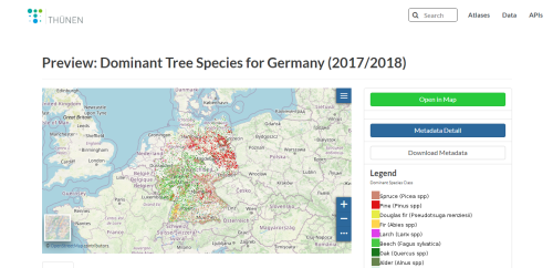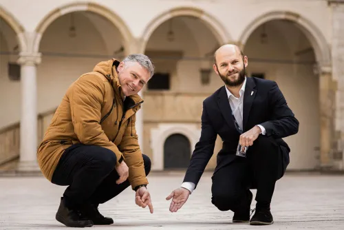
Nowa Geodezyjna Ciekawostka Na Wawelu
Przy okazji obchodzonego 21 marca Światowego Dnia Geodetów na dziedzińcu Zamku Królewskiego na Wawelu posadowiony został geodezyjny medalion oznaczający symboliczną krakowską oś świata: Axis Mundi Cracoviensis. To już kolejna inicjatywa Mariusza Meusa z akcji „Honorowy Południk Krakowski”, członka Stowarzyszenia Geodetów Polskich. Wśród jego licznych geodezyjnych projektów można wymienić chociażby wyznaczenie współrzędnych geodezyjnego środka Polski oraz ...