Geomaticians

18

Neue Karte Zeigt Co2-ausstoss Aller Schweizer Gebäude

Auf dem Geoportal des Bundes ist eine neue Karte aufrufbar. Die Karte stellt für jedes Schweizer Wohngebäude dar, wie viel CO2 unter Normbedingungen ausgestossen wird. Dies teilt das Bundesamt für Umwelt (Bafu) mit. Mit einem interaktiven CO2-Rechner kann demnach zudem simuliert werden, wie sich ein Heizungswechsel und energetische Sanierungen auf den CO2-Ausstoss auswirken. Die Karte ...
energate-messenger.ch

Bruxelles Lance Enfin Sa Stratégie De Smart City

La Ville de Bruxelles a présenté vendredi sa stratégie de déploiement du digital à tous les étages de la vie collective à travers le concept de “smart city”, également dans le viseur de nombreuses villes européennes. La Ville de Bruxelles a présenté vendredi sa stratégie de déploiement du digital à tous les étages de la ...
Un Equipo De Investigación Creará La Primera Cartografía De Afrodescendientes Y Africanos En La Argentina

Un Equipo De Investigación Creará La Primera Cartografía De Afrodescendientes Y Africanos En La Argentina

El proyecto se titula “Africanos y sectores populares en la Argentina. Cartografía de la desigualdad, racialidad y género”. Es dirigido por la historiadora Florencia Guzmán y lo integran los antropólogos Lea Geler y Alejandro Frigerio, junto a siete investigadores e investigadoras provenientes de diferentes disciplinas. El equipo forma parte del Grupo de Estudios Afrolatinoamericanos (Geala), ...
redaccionmayo.com.ar

AirWorks Launches Geospatial Data Marketplace

AirWorks and Nearmap have announced that Nearmap will join AirWorks’ newly launched data marketplace, AirWorks Automate. The marketplace is intended to be an ecosystem of geospatial data providers that aims to bridge the gap between data access, processing, and analytics, uniting it in a single platform. Through the agreement, AirWorks and joint Nearmap-AirWorks customers will ...
spatialsource.com.au
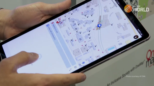
Singapore Uses Geospatial Data To Make Roads Greener, Safer, And Easier To Navigate

Singapore Uses Geospatial Data To Make Roads Greener, Safer, And Easier To Navigate

Developed by the Singapore Land Authority, the SLA App provides information that’s not available on normal maps. The map on the platform was designed especially for wheelchair users. The app was demonstrated at the Geo Connect Asia event in Singapore. Developed by the Singapore Land Authority, the SLA App provides information that’s not available on ...
thaipbsworld.com
From Tires To Brakes, U Of T Researchers Tackle ‘Non-tailpipe’ Air Pollution From Vehicles

From Tires To Brakes, U Of T Researchers Tackle ‘Non-tailpipe’ Air Pollution From Vehicles

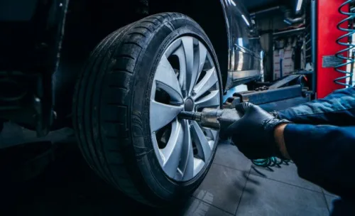
While the push to mandate EVs aims to reduce tailpipe emissions such as carbon dioxide — the federal government has set a target of complete EV adoption by 2035 — swapping every vehicle on the road still won’t eliminate all the sources of air pollution that can impact human health. That’s because brake pads, rotors ...
news.engineering.utoronto.ca