Geomaticians

02

Une Cartographie Des Sites D'aquaculture Sur Le Site Géolittoral

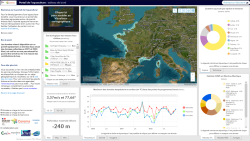
Une Cartographie Des Sites D’aquaculture Sur Le Site Géolittoral

Le site Géolittoral s’enrichit d’une nouvelle rubrique qui donne accès à une cartographie et un tableau de bord des données sur les sites d’aquaculture et un visualiseur qui permet d’approfondir certaines thématiques. Elle a été développée à la demande de l’Etat par le Cerema, en collaboration avec les Centres techniques conchylicole (Capena, SMEL, Cepralmar, SMIDAP). ...
cerema.fr
Les Données Satellitaires Au Service De La Gestion Des Littoraux Face Au Changement Climatique Bilan Du Programme Européen ‘ESA Coastal Erosion’ Mené Par I-sea

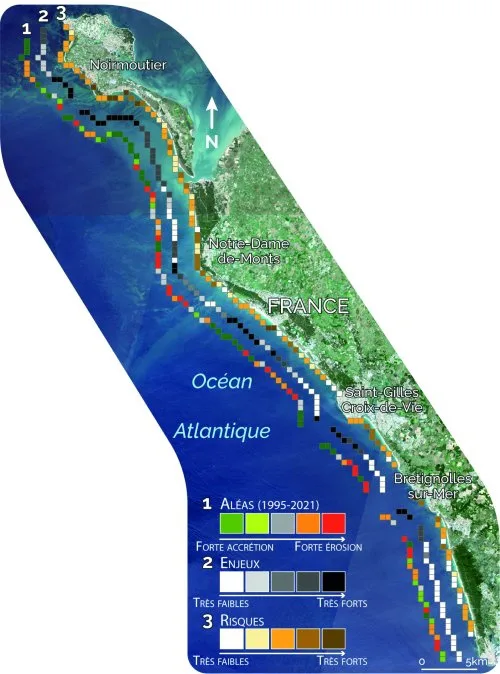
Les Données Satellitaires Au Service De La Gestion Des Littoraux Face Au Changement Climatique : Bilan Du Programme Européen ‘ESA Coastal Erosion’ Mené Par I-sea

Spécialisée dans la surveillance de la Biodiversité et du Littoral, l’entreprise bordelaise i-Sea est le chef de file de ESA Coastal Erosion, un programme européen de grande envergure initié en 2019 sous l’égide de l’ESA, l’Agence Spatiale Européenne. Basé sur l’observation satellitaire du littoral dans le but de prévenir et lutter contre le recul du ...
cdurable.info

Brasil E China Retomam A Parceria Para A Produção De Satélites

A Ministra da Ciência, Tecnologia e Inovação, Luciana Santos, confirmou nesta última terça-feira (28), anunciou que o Brasil quer começar a construção de um novo satélite do Programa de Satélites de Recursos Terrestres (CVBERS), com a China. De acordo com a ministra, a construção deve trazer de volta ao Brasil, o papel de protagonista perdido ...
diario24horas.com.br
NV5 Geospatial Begins Pilot Project To Analyze Climate Change For Caribbean Nations

NV5 Geospatial, North America’s most comprehensive geospatial science data firm, today announced that it will conduct aerial lidar and orthoimagery surveys across the Caribbean on behalf of the Caribbean Community Climate Change Centre (CCCCC). Funded by the Caribbean Development Bank (CDB), this pilot project will provide advanced geospatial data to help the island nations better ...
smartcitiesdive.com
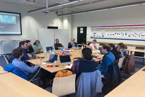
Researchers To Explore Issues And Challenges To Suburban Densification

Researchers To Explore Issues And Challenges To Suburban Densification

Researchers from the University of Liverpool are part of a new European project to explore the challenges, drivers and barriers of making suburban areas more populated. The SUBDENSE project, which involves TU Dortmund University, the Institut national de l’information géographique et forestière (IGN) and the IOER Leibniz Institute of Ecological Urban and Regional Development, was ...
news.liverpool.ac.uk
Invasive Plant Species Will Spread Even Further In Germany According To Simulation Study

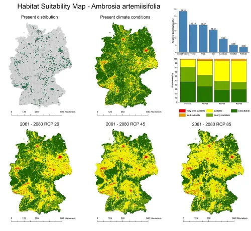
Invasive Plant Species Will Spread Even Further In Germany According To Simulation Study

Many invasive plant species have not yet filled their potentially suitable habitat. This is what geographers at Leipzig University established in a recent simulation study. They coupled different data sets to predict the probability of occurrence of selected invasive plant species for any location in Germany. “Using satellite imagery to divide Germany into quadrants, I ...
phys.org
Tree Count In Africa Drylands Could Improve Conservation Study

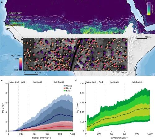
Tree Count In Africa Drylands Could Improve Conservation: Study

A first count of trees in Africa’s drylands has enabled scientists to calculate how much carbon they store and could help devise better conservation strategies for the region and beyond, a study said Wednesday. The number of trees in the vast region—the count came to nearly 10 billion—has not been known up to now, and ...
phys.org