Geomaticians

June

Digitale Karte Dokumentiert Saure Waldböden

Die Zürcher Wälder sind wie viele andere Gebiete in Mitteleuropa von Bodenversauerung betroffen. Das Amt für Landschaft und Natur hat rund zehn Prozent der Waldböden im Kanton genauer untersucht und die Ergebnisse in einer digitalen Karte dokumentiert. Für die Bewirtschaftung dieser Wälder, gerade angesichts des Klimawandels, wird die Waldbodenkarte wertvolle Zusatzinformationen geben.
zh.ch

GSI To Carry Remote Sensing In Bihar To Identify Magnetite-bearing Rocks

The Bihar government has decided to sign an MoU with Geological Survey of India for conducting remote sensing and aerial survey of the southern part of the state to identify magnetic anomaly on the surface representing the presence of rocks having a higher content of ferrous and ferromagnesian minerals, an official said. For the first ...
business-standard.com
Lancement Du Portail Cartographique Des Énergies Renouvelables

Lancement Du Portail Cartographique Des Énergies Renouvelables

Afin de permettre aux élus de mener à bien cet exercice, et dans l’objectif de rendre accessible au public l’ensemble des informations relatives aux énergies renouvelables, le ministère de la Transition énergétique, le Cerema et l’Institut national de l’information géographique et forestière (IGN) mettent en ligne un portail cartographique. Le portail cartographique a vocation à ...
ecologie.gouv.fr

Galileo Second Generation Enters Full Development Phase

ESA Director of Navigation, Javier Benedicto, invited Thales Alenia Space (Italy), Airbus Defence and Space (Germany) and Thales Six GTS (France) to sign respective contracts to initiate System Engineering Support for the next generation of Europe’s navigation satellite system. With 28 satellites in orbit, Galileo provides meter-level accuracy to more than four billion users around ...
news.satnews.com
Researcher’s Giant Feat Defending Native Forest And Prime Koala Habitat

Researcher’s Giant Feat Defending Native Forest And Prime Koala Habitat

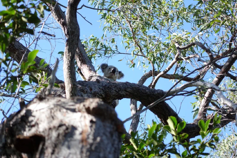
Dr Timothy Cadman has successfully secured the protection of local hardwood areas once primed for logging, including native forest belonging to the proposed Great Koala National Park along the Mid North Coast of New South Wales. Dr Cadman has employed geographical information systems (GIS) for data mapping and analysis of the local environment, providing evidence ...
news.griffith.edu.au
Using AI To Push The Boundaries Of Wildlife Survey Technologies

Using AI To Push The Boundaries Of Wildlife Survey Technologies

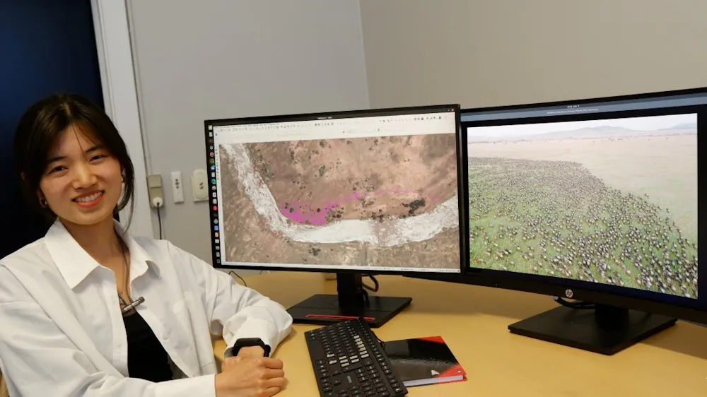
In their research, associate professor from the NRS Department Tiejun Wang and his master’s student Zijing Wu developed an AI-model to automatically locate and count large herds of migratory ungulates (wildebeest and zebra). They used their method in the Serengeti-Mara ecosystem using fine-resolution (38–50 cm) satellite imagery. They achieved accurate detection of nearly 500,000 individuals across ...
phys.org
Social Media Snaps Map The Sweep Of Japan’s Cherry Blossom Season In Unprecedented Detail

Social Media Snaps Map The Sweep Of Japan’s Cherry Blossom Season In Unprecedented Detail

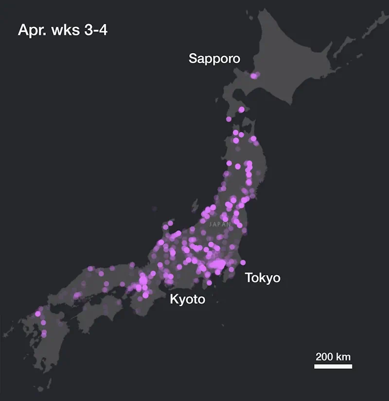
Social media contains enormous amounts of data about people, our everyday lives, and our interactions with our surroundings. As a byproduct, it also contains a vast trove of information about the natural world. In a new study published in Flora, we show how social media can be used for “incidental citizen science”. From photos posted ...
theconversation.com

Aggiornamento Atlante Delle Analisi Del Terreno

E’ online sul Geoportale l’aggiornamento del servizio regionale “Atlante delle analisi del terreno”. L’Atlante è un servizio di consultazione e diffusione online dei dati di analisi dei terreni dove si possono trovare informazioni “puntuali” sullo strato superficiale dei terreni agrari del Piemonte. L’aggiornamento è consistito nell’ampliamento del numero di analisi disponibili grazie alla georeferenziazione di ...
regione.piemonte.it

메타버스 공간에서 진행할 협업 연구 플랫폼 만든다

실제로 건설 현장에 가서 직접 둘러보지 않고 가상공간에서 진척사항을 체크하고 변경 내용을 확인하거나 시뮬레이션을 돌려보며 상황에 따른 최적의 방안을 마련하는 것이 가능하게 되면 얼마나 좋을까. 이같은 환경을 현실화 하기 위한 연구가 한창이다. 바로 개방형확장현실(OXR) 융합연구단(단장 조금원)이 진행하고 있는 메타버스 기술을 활용한 디지털 협업 플랫폼 연구다. OXR융합연구단은 지난 2021년 말 출범한 연구조직이다. 한국과학기술정보연구원(KISTI), 한국과학기술원(KAIST), 한국건설기술연구원(KICT), 한국한의학연구원 ...
aitimes.com

Gugik Publikuje Model Pojęciowy Oraz Schemat Aplikacyjny Dla Mapy Glebowo-rolniczej

Główny Urząd Geodezji i Kartografii we współpracy z Instytutem Upraw Nawożenia i Gleboznawstwa – PIB oraz w uzgodnieniu z Ministerstwem Rolnictwa i Rozwoju Wsi opracował model pojęciowy bazy danych oraz schemat aplikacyjny GML dla mapy glebowo-rolniczej dla skali 1:5000 w postaci wektorowej. Większość dostępnych dzisiaj w PZGiK map glebowo-rolniczych w skali 1:5 000 opracowano od ...

WFP-Powered GIS to Help Lesotho Stay Ahead of Climate Shocks and Hunger

On Wednesday (31 May) the Government of the landlocked kingdom of around 2 million people in southern Africa launched a GIS (geospatial information systems) platform, facilitated by the World Food Programme (WFP) that could be a game-changer for the country on a number of fronts, not least in training and providing resources for up to ...
miragenews.com

‘India Conducts Asia’s First Demo Of Performance-based Navigation For Copters’

India conducted Asia’s first demonstration of performance-based navigation for helicopters for a flight from Juhu in Mumbai to Pune using GAGAN satellite technology, civil aviation minister Jyotiraditya Scindia said on Wednesday. GAGAN — GPS Aided GEO Augmented Navigation — is a state-of-the-art space-based augmentation system which adds more accuracy to output of GPS Navigation system ...

Geospatial Startup Partners With World’s Largest Mapping Company To Improve Urban Planning To Create Happier And Healthier Cities

A “pioneering” British tech startup aims to improve urban planning for towns and cities by helping planners to better respond to local needs for community facilities, spaces and events. Yeme Tech, has created a highly sophisticated Community Data Platform (CDP) to help planners and developers instantly identify social infrastructure, facilities, and community spaces which are ...
directionsmag.com

Arianespace Will Launch Kompsat-6 With The Vega C For KARI

Kompsat-6 is the second SAR (Synthetic Aperture Radar) imaging satellite developed by KARI and will replace its predecessor, Kompsat-5, while deploying improved imaging radar performance. This EO satellite will carry two payloads, the SAR instrument (X-Band Synthetic Aperture Radar) and the S-AIS (Satellite-Automatic Identification System). SAR payload is a high-resolution all-weather imager, which has applications ...
news.satnews.com

Delhi To Have AI-based Traffic System By 2024-end: Official

The national capital will have an artificial intelligence-based traffic system by the end of next year to reduce congestion and facilitate faster and smarter vehicular movement, a senior official said on Wednesday. Speaking at ASSOCHAM seventh road safety conference here, Special Commissioner of Police (Traffic) Surender Singh Yadav mentioned that the Intelligent Traffic Management System ...
devdiscourse.com

Les Sols Des Zones Oasiennes En Proie À Une Baisse De Fertilité

La dégradation des sols des palmeraies impacte négativement la fertilité de cet écosystème aussi rare qu’essentiel sur le plan social. Grâce à une étude réalisée par des scientifiques marocains, la caractérisation des besoins des terres oasiennes via des cartes thématiques permettra de se prémunir contre ce danger. L’étude en question a été déclinée sous forme ...
medias24.com

NASA Supercomputer Enables Seasonal Forecasts for High Mountain Asia

Using forecasts run on a NASA supercomputer, scientists from Oak Ridge National Laboratory (ORNL); NASA Goddard Space Flight Center; the University of California, Berkeley; and the Korea National University of Transportation assessed the ability of NASA’s Goddard Earth Observing System Subseasonal to Seasonal Version 2 (GEOS-S2S-2) forecasting system to predict atmospheric and land surface conditions ...
nccs.nasa.gov

O Dronach W Geodezji Na Bezpłatnym Webinarze

Akademia UAV i SkySnap zapraszają na bezpłatny webinar dotyczący procesu wdrażania dronów w geodezji. Spotkanie odbędzie się 6 czerwca o godz. 17.00. Program wydarzenia obejmuje następujące zagadnienia: (1) Jak wdrażać drony w firmie geodezyjnej – tworzenie własnych zasobów czy zlecenia podwykonawcom? (2) Prawo dronowe – o czym warto wiedzieć i na co zwrócić uwagę przy ...
geoforum.pl

2ème Édition De “Tunisia Drone Day” Se Tiendra Le 10 Juin 2023 À La Cité Des Sciences

L’Association Africaine pour la Promotion du Géospatial (AGEOS) organise en collaboration avec le cercle Aéronautique, comprenant la Fédération Tunisienne des Pilotes de Ligne (FTPL), l’Association Tunisienne de l’Aéronautique (ATA) et l’Association Tunisienne des Contrôleurs de la Circulation Aérienne (ATCCA), la deuxième édition de la conférence internationale “Tunisia Drone Day “. Cette conférence se tiendra le ...
tekiano.com

Developers Invited To The 2023 OGC Tiling Interfaces Code Sprint

The Open Geospatial Consortium (OGC) invites software developers to the OGC Tiling Interfaces Code Sprint, to be held online and in-person from June 12-14, 2023, at the Moonshot Labs of the National Geospatial-Intelligence Agency (NGA) in St Louis, Missouri, USA. Participation in the code sprint is free. Registration for in-person participation closes at 5pm EDT ...
directionsmag.com
Hexagon US Federal Announces The Digital Defense Summit At HxGN Live Global 2023

Hexagon US Federal Announces The Digital Defense Summit At HxGN Live Global 2023

Hexagon US Federal is involved in shaping a first-of-its kind Digital Defense Summit for U.S. Government and global attendees from federal civilian, defense, intelligence organizations, and industry partners and customers. The four-day event will take place during the HxGN Live Global 2023 digital reality conference, from June 12 – 15, 2023 in Las Vegas, NV.
businesswire.com