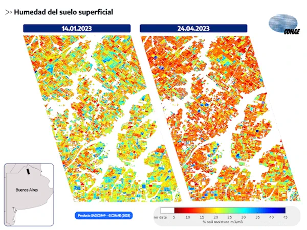
El Joven Que Da A Conocer A La Patagonia Con Google Maps
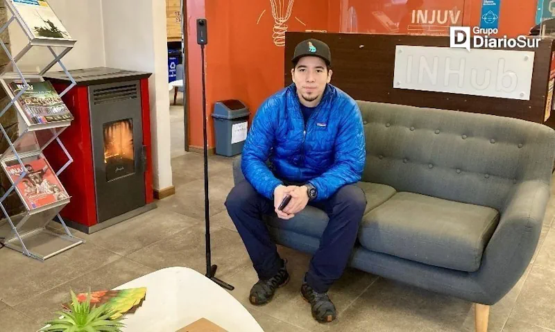
Claudio Garrido es un joven estudiante de Técnico en Turismo y Naturaleza de la Universidad Austral de Chile, coyhaiquino que emprende con “360° Future View”, un proyecto que busca contribuir a la comunidad regional y al futuro turista con la actualización de mapas en la región, mediante Google Maps. Este joven emprendedor, prepara su equipamiento, ...
diarioregionalaysen.cl