Geomaticians

29

Meet The Omnivore Startup Develops App Letting Users Turn Objects Into 3D Models With Just A Smartphone

Meet The Omnivore: Startup Develops App Letting Users Turn Objects Into 3D Models With Just A Smartphone

It lets users capture any object with their smartphone camera and quickly creates a high-quality, detailed 3D model of it for use in any AR or metaverse application. AR-Generation now offers an extension that enables direct export of 3D models from MagiScan to NVIDIA Omniverse, a development platform for connecting and building 3D tools and ...
blogs.nvidia.com

A&M-Corpus Christi Initiative To Create K-12 STEM, Geospatial Programs

A new Texas A&M University-Corpus Christi initiative aims to foster the next generation of land surveyors and geospatial scientists. The initiative aims to develop a curriculum for high school students and develop training workshops for high school STEM educators, as well as geospatial camps for middle school teachers. “We’ve seen a decline in the number ...
caller.com

Índice Ambiental Municipal Pode Ser Acessado No Painel De Indicadores Do Sisema

Maior interatividade, agilidade e acessibilidade. Essas são as características que a consulta ao Índice de Desempenho Ambiental Municipal (Idam) passa a ter no Painel de Indicadores (Power Bi) do Sistema Estadual de Meio Ambiente e Recursos Hídricos (Sisema). A partir desta segunda-feira (26/6), é possível saber como está o desempenho ambiental das cidades de Minas, ...
agenciaminas.mg.gov

Google Lays Off Staff At Its Mapping App Waze

Alphabet-owned Google on Tuesday said it is cutting jobs at mapping app Waze as it merges the app’s advertising system with Google Ads technology, without giving details on the number of layoffs. Google had in December said that it will merge Waze and Google Maps teams to consolidate processes, making it a part of the ...
reuters.com

New Website Allows People To Report And Track Non-emergency Issues In Santa Maria

The City of Santa Maria has launched a new website that allows people to report and track non-emergency issues located within the city limits. Called Neighborhood Connect, the website is a GIS (geographic information system)-based program designed to help city government track and identify trends, and to improve overall customer service. The website allows users ...

National Space Mission For Earth Observation Axed

Mainstream media outlets are reporting this morning that the federal government has cancelled the $1.2 billion National Space Mission for Earth Observation (NSMEO), for “budget repair” purposes. Reportedly, Australia will now have to continue to rely upon overseas partners for access to Earth observation data. The whole idea of the NSMEO was to reduce sovereign ...
spatialsource.com.au

Building A Governance Framework For Forest Data In Eastern And Southern Africa

Building A Governance Framework For Forest Data In Eastern And Southern Africa

The East and Southern Africa Forest Observatory (OFESA) was launched at the Global Landscapes Forum (GLF)’s Nairobi conference in late 2018, with twin goals of supporting improved forest monitoring and reporting practices, and developing a data governance framework for the countries in the region. The Observatory’s geoportal, hosted by the Kenya-based Regional Centre for Mapping ...
forestsnews.cifor.org
3D Digital Models Are Resurrecting Lost Neighborhoods

3D Digital Models Are Resurrecting Lost Neighborhoods

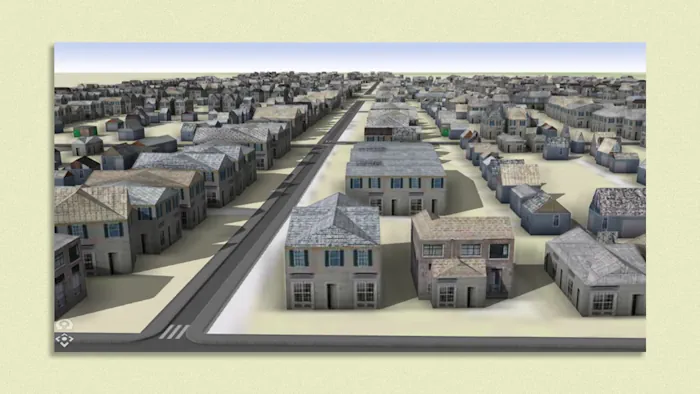
Using a revolutionary new AI-powered method, researchers are mining old insurance maps to visually reconstruct “ghost” neighborhoods — with promising results. The process could help with efforts to better estimate the economic loss caused by the demolition of historically diverse neighborhoods nationwide. It could also humanize that oft-forgotten history, bringing it to life in a ...
axios.com
Using Geospatial Tools To Assess Sewer Risk

Using Geospatial Tools To Assess Sewer Risk

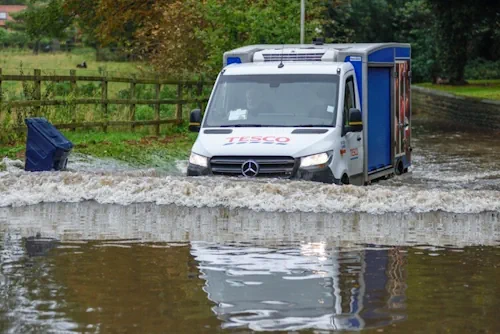
Anglian Water is the largest water and water recycling company by geographic area in England and Wales, serving much of the Eastern portion of the United Kingdom. Recently, the utility company created a geospatial tool in order to get a real-time picture of sewer risk and identify specific hotspots to prioritize where work is most ...
geoweeknews.com
معرفی یک شاخص جدید برای پایش خشکسالی با کمک سنجش از دور

معرفی یک شاخص جدید برای پایش خشکسالی با کمک سنجش از دور

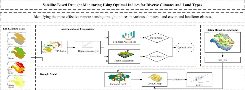
در پژوهشی که به تازگی در دانشکده جغرافیا دانشگاه تهران به راهنمایی دکتر عطاالله عبدالهی کاکرودی، دانشیار گروه سنجش از دور و GIS انجام شده است، شاخصی بهینه و کارآمد برای پایش ماهواره‌ای خشکسالی معرفی شده است. «در سال‌های اخیر بهره‌گیری از داده‌های سنجش از دور برای پایش خشکسالی گسترش یافته و شاخص‌های سنجش از ...
news.ut.ac.ir
Hydrographic Survey Data Uncovers Preserved Glacial Landscape

Hydrographic Survey Data Uncovers Preserved Glacial Landscape

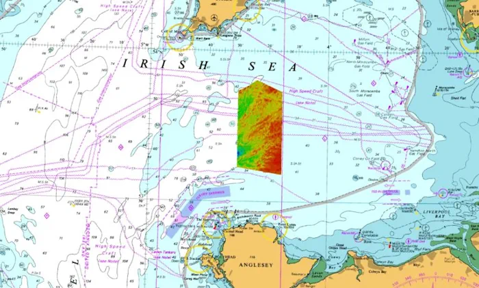
Part of a series of data sets collected in the Irish Sea, off North Wales, under the Civil Hydrography Programme (CHP) has given us a fantastic insight into the geological past of the UK. The CHP is a long-running data collection programme undertaking systematic surveys of the UK’s coastal waters. Administered by the Maritime and ...
ukhodigital.blog.gov.uk
This Self-driving Boat Maps Underwater Terrain

This Self-driving Boat Maps Underwater Terrain

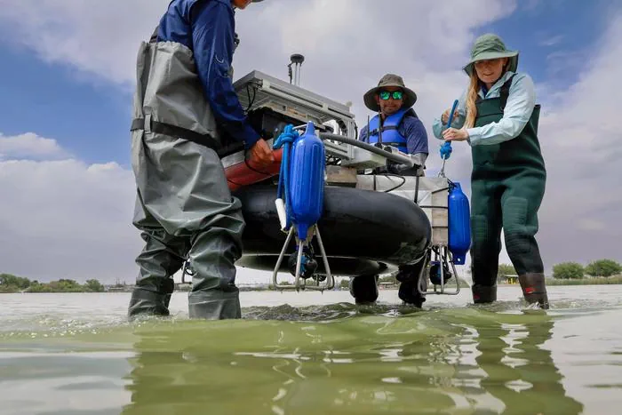
Researchers at The University of Texas at El Paso have constructed a fully autonomous boat that can carry out bathymetric surveys — surveys of the depth and terrain of bodies of water like oceans, rivers and lakes. The team hopes the robotic boat can help simplify the survey process, which usually takes a crew of ...
eurekalert.org