Geomaticians

27

Nace La Asociación Nacional De Agricultura De Precisión

Se trata de una organización española independiente y sin ánimo de lucro, que responde a la necesidad de promover la Agricultura de Precisión y facilitar la transformación digital agrícola en España, en línea con las directrices de sostenibilidad definidas por la Unión Europea. Rrealizará actividades enmarcadas en tres grandes ámbitos: transferencia, iniciativas científico-técnicas y actividades ...
interempresas.net
El IECA Cuenta Con Una Nueva Base De Datos Espacial De Lugares Donde Se Asienta La Población

La localización, delimitación y asignación de topónimos de los asentamientos en los que el hombre ejerce alguna actividad sobre el territorio es fundamental para lograr un adecuado análisis de la realidad existente en el mismo, que permita planificar correctamente un desarrollo sostenible y sostenido en el tiempo. Con este objetivo, el Instituto de Estadística y ...
europapress.es
Depremlerde Hasar Alan Evler Türk Ve Japon Mühendislerce Denetleniyor

Depremlerde Hasar Alan Evler Türk Ve Japon Mühendislerce Denetleniyor

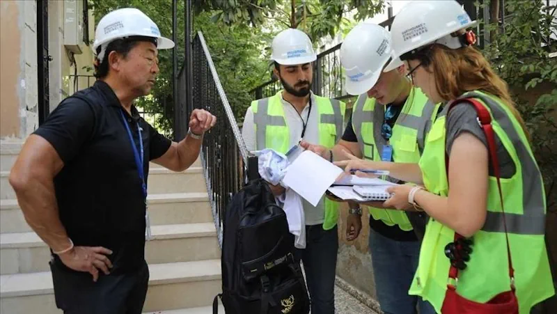
Gaziantep’te 6 Şubat’taki depremlerde az ve orta hasar alan binalar, Türk ve Japon mühendislerin ortak çalışmasıyla coğrafi bilgi sistemi temelli uygulamayla denetleniyor. Büyükşehir Belediyesinden yapılan açıklamaya göre, Uluslararası Miyamoto-Protek Firması ile kentteki az ve orta hasar alan yaklaşık 50 bin hanenin denetlenmesi için işbirliği yapıldı. Projeyle depremzedelerin güvenli şekilde evlerine dönüş işlemlerinin hızlandırılması amaçlanıyor. İş ...
elbistaninsesi.com

Una Nueva Herramienta Explora El Riesgo De Inundaciones Costeras En Garachico

El proyecto Life Garachico, que acaba de finalizar su primera fase, ha presentado una nueva herramienta en línea que sirve para mejorar la vigilancia y el conocimiento sobre el riesgo de inundaciones por temporales marítimos en el casco urbano de Garachico, en la Isla Baja. Se trata del llamado Visor GIS, un mapa interactivo que ...
elperiodicodeycodendaute.es

The Institute Of Geosciences And Georesources Of The National Resource Council Has Published An Update Of Geothopica

The Institute Of Geosciences And Georesources Of The National Resource Council Has Published An Update Of Geothopica – Italy’s National Geothermal Data Platform. The updated version of GeoThopica, which was originally created in 2007 by CNR-IGG, benefits from the BNDG currently containing about twice the data compared to when it was originally created. The most ...
thinkgeoenergy

Agriculture Ministry Signs MoU With Pixxel Space To Develop Geospatial Solutions

The Union Agriculture Ministry has signed an MoU with Pixxel Space India Pvt. Ltd., to develop various geospatial solutions, mainly for monitoring the health of crops and soil. The Memorandum of Understanding was signed on Monday in the presence of Agriculture Secretary Manoj Ahuja. Mahalanobis National Crop Forecast Centre on behalf of the ministry will ...
bqprime.com
Policing In Chennai Goes Hi-Tech With GIS Mapping, Analytics Of Crime Zones

Policing In Chennai Goes Hi-Tech With GIS Mapping, Analytics Of Crime Zones

The Greater Chennai Police (GCP) on Tuesday launched mapping of crime zones using Geographic Information System (GIS). Commissioner of Police Shankar Jiwal inaugurated the new initiative at the integrated command and control centre. A special GIS centre has been established and equipped with the latest software tools to collate data from Crime and Criminal Tracking ...
thehindu.com
New Salt Lake Program Uses Weather Data, Satellite Imagery To Help Residents Water More Efficiently

New Salt Lake Program Uses Weather Data, Satellite Imagery To Help Residents Water More Efficiently

Water supply in Utah’s capital city is in a good place after a robust snowpack runoff that’s all but over. As the irrigation season moves forward, Salt Lake City is turning to a new tool to help reduce overwatering in the summer. Salt Lake City officials announced a new pilot program with Utah State University ...
ksl.com
China Completes Egypt's Remote Sensing Satellite Misrsat 2

China Completes Egypt’s Remote Sensing Satellite Misrsat 2

China Aerospace Science and Technology Corporation (CASC) has completed the assembly and testing of Egypt’s remote sensing satellite MisrSat 2, according to a statement by the Ministry of International Cooperation on Sunday. The satellite was built using a $92 million grant provided by China to fund two projects in Egypt that was signed in February ...
english.ahram.org.eg

Geo-Tracking System Enhances Polio Response In Congo

Since the Republic of Congo first confirmed a case of circulating variant poliovirus type 1 in March 2023 – the first such detection in more than two decades -, the country has been pioneering the deployment of Geospatial Tracking Systems (GTS) to help curb further transmission. Geospatial Tracking Systems have a critical role to play ...
afro.who.int
Newly Released IEEE 802.11az Standard Improving Wi-Fi Location Accuracy Is Set To Unleash A New Wave Of Innovation

Newly Released IEEE 802.11az Standard Improving Wi-Fi Location Accuracy Is Set To Unleash A New Wave Of Innovation

When you use an IEEE 802.11™ (Wi-Fi®) enabled device, such as your mobile phone, it can use GPS when outdoors because it has a clear line of sight to satellites. But indoors, with a roof overhead and surrounding walls and other obstacles, GPS signals are blocked, and the device needs to connect to Wi-Fi. Outdoors, ...
standards.ieee.org