Geomaticians

21

Spotnik Launches Smart City Studio Pro

Spotnik Technologies, a Nikai Group company in the UAE, has created an enterprise-grade business support solution that is the latest advancement in productivity and efficiency solutions for smart cities and digital twins. The software toolkit allows users to play with data models, geospatial localizations, and 3D environmental features which will help businesses and governments make ...
zawya.com

Botuverá Implementa Plataforma De Geoprocessamento

Em 2023, Botuverá estreia sua plataforma de Geoprocessamento, embora com um lançamento em fase inicial. Ela conta com alguns dados importantes para a consulta pública, como as áreas de risco da Defesa Civil de movimentação de massa e inundações, massas de água e suas áreas de preservação permanente, o zoneamento da cidade (conforme o plano ...
araguaiabrusque.com.br
رصد خانه شبکه برق تهران رونمایی شد

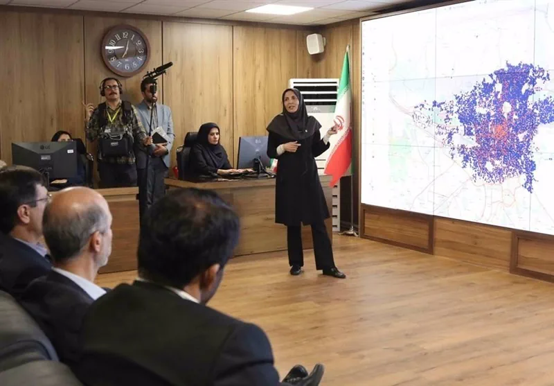
رصد خانه شبکه برق تهران رونمایی شد

بهره برداری از دو طرح مهم در حوزه «پایش و کنترل رفتار مصرفی شهروندان تهرانی» و «راهبری و پایش هوشمند شبکه برق مشترکان شهر تهران» طی مراسمی با حضور وزیر نیرو در شرکت توزیع نیروی برق تهران بزرگ آغاز شد. رصد‌خانه شبکه برق و انرژی شرکت توزیع نیروی برق شهر تهران یکی از این دو ...
tasnimnews.com
Paraguay Y Japón Fortalecen Cooperación En Programa Espacial Para El Desarrollo

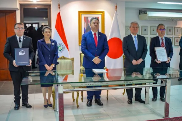
Paraguay Y Japón Fortalecen Cooperación En Programa Espacial Para El Desarrollo

Paraguay y Japón suscribieron este lunes un acuerdo para la gestión de un programa espacial aplicado al desarrollo socioeconómico, que incluirá asistencia y equipamiento para el Laboratorio de Sistemas de Información Geográfica y Observación de la Tierra (GEOLab). El acuerdo fue suscripto con motivo de la visita oficial del director del presidente de la Agencia ...
ip.gov.py

China Launches New Satellite For Earth Observation Technology Test

China launched a Long March-6 carrier rocket on Tuesday from the Taiyuan Satellite Launch Center in north China’s Shanxi Province, sending a new experimental satellite into preset orbit. The satellite, known as Shiyan-25, will be mainly used to carry out experiments on new Earth observation technologies for areas including land resource surveys, urban planning and ...
news.cgtn.com

ESA Backs Greek Firms’ And Universities’ CubeSats

Seven CubeSat missions that demonstrate a variety of services including connectivity and secure communications are being developed by small and medium-sized companies and universities in Greece, following an open call and selection by ESA. The initiative underpins efforts – led by ESA on behalf of the Greek Ministry of Digital Governance – to expand the ...
esa.int

New Space Companies Join Copernicus

With commercial companies playing an increasingly important role in creating a dynamic and innovative space industry, nine New Space satellite data suppliers have joined the Copernicus programme as ‘Contributing Missions’. Copernicus, now 25 years old, is the biggest environmental programme in the world, providing terabytes of free and open satellite data and information services to ...
esa.int
Scotland’s Spatial Hub Becomes Open Data

Scotland’s Improvement Service (IS) has launched open access to the Spatial Hub, making it available beyond the public sector to anyone. It said the hub, which is run by the Spatial Information Service and brings together a wide range of data directly from local authorities and partner organisations, has been made more widely available due ...
ukauthority.com
Manuel Banza Analisou Os Locais Em Lisboa Onde É Prioritário Criar Refúgios Climáticos

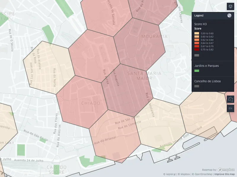
Manuel Banza Analisou Os Locais Em Lisboa Onde É Prioritário Criar Refúgios Climáticos

As Ondas De Calor Tem-se Intensificado Em Lisboa. Nestes Dias Extremos, Valorizamos Ruas Com Árvores E Espaços Com Ar Condicionado. Mas Há Zonas Onde Faz Muito Calor Mas Há Poucas Opções Para Nos Refrescarmos – Zonas Onde Seria Urgente Criar Refúgios Climáticos. Manuel Banza, Cientista De Dados, Apaixonado Por Lisboa, Identificou Esses Locais. A viagem ...
lisboaparapessoas.pt
Mapping Connecticut's Understory From Outer Space

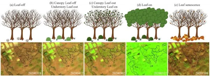
Mapping Connecticut’s Understory From Outer Space

Distinguishing separate plant species from one another is hard even for human eyes; however, a team of UConn researchers was able to use data from a satellite nearly 500 miles (786km) above Earth’s surface to map Connecticut’s forest understory plant communities. The results of this study are published in Remote Sensing of Environment. The understory, ...
phys.org