Geomaticians

06

Birmingham Creates Interactive Mapping Portal Using Bluesky Tree Data

Birmingham City Council has launched a first of its kind mapping portal to address the issue of tree equity across the city. With National Tree Map data, created by aerial mapping company Bluesky International, at its core, the interactive tool allows users to identify which parts of the city have lower than average tree canopy ...
directionsmag.com

Esri Maps Ireland’s Summer 2023 Festival Circuit

Esri Ireland, the market leader in Geographic Information Systems (GIS), has created a digital map highlighting some of the best-loved and lesser-known festivals happening across the island of Ireland this summer. Using Esri’s ArcGIS digital mapping system, the interactive map has something for all tastes and interests, allowing you to plan your ultimate festival adventure ...
irelandbeforeyoudie.com
Santé Une Carte Montre La Présence Des Tiques Dans Les Régions De France

Santé : Une Carte Montre La Présence Des Tiques Dans Les Régions De France

L’an dernier, 11 000 piqûres de tiques ont été signalées à l’Institut national de recherche pour l’agriculture et l’environnement (Inrae) avec un maximum au moins de juin. Si les piqûres ont lieu majoritairement en forêt, un quart des piqûres de tiques surviennent à la maison : 22% dans les jardins, et même 4% à l’intérieur ...
francetvinfo.fr
Historic England Launches The Country’s First Online Building Stones Database

Historic England Launches The Country’s First Online Building Stones Database

From Portland Stone to Millstone Grit, Historic England is launching a new online database of the stones that define the rich diversity of our country’s buildings. Historic England is unveiling the first Building Stones Database for England, which brings together information on over 4,000 types of building stones, their uses and sources, in a searchable ...
specificationonline.co.uk

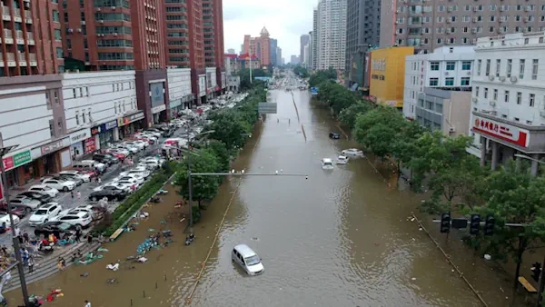
New Study Reveals The Resilience Patterns Of Human Mobility In Response To Extreme Urban Floods

New Study Reveals The Resilience Patterns Of Human Mobility In Response To Extreme Urban Floods

Resilience can be interpreted as the comprehensive ability of a system to prepare for, absorb, and recover from external or internal disturbances and shocks. In the context of human mobility, resilience therefore refers to the ability of people’s movements within and between cities to cope with and adapt to disruptive events, such as natural disasters. ...
phys.org

O Dronach W Geodezji Na Bezpłatnym Webinarze

Akademia UAV i SkySnap zapraszają na bezpłatny webinar dotyczący procesu wdrażania dronów w geodezji. Spotkanie odbędzie się 6 czerwca o godz. 17.00. Program wydarzenia obejmuje następujące zagadnienia: (1) Jak wdrażać drony w firmie geodezyjnej – tworzenie własnych zasobów czy zlecenia podwykonawcom? (2) Prawo dronowe – o czym warto wiedzieć i na co zwrócić uwagę przy ...
geoforum.pl