Geomaticians

30

IAT Lança Plataforma Para Conservação E Restauração Da Biodiversidade

IAT Lança Plataforma Para Conservação E Restauração Da Biodiversidade

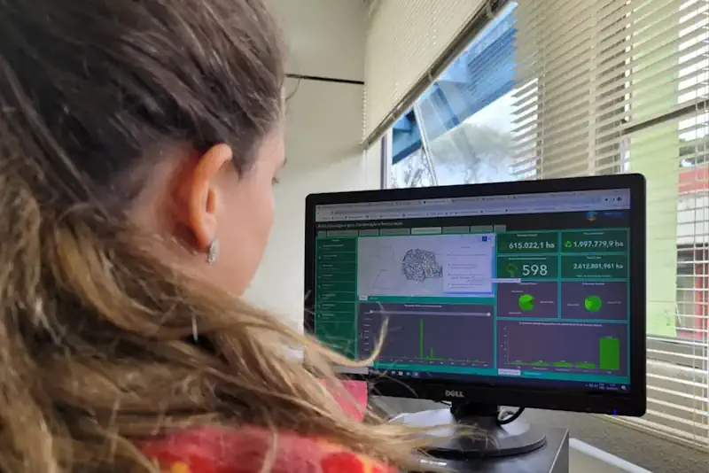
O Instituto Água e Terra (IAT) lançou nesta sexta-feira (28), Dia Mundial da Conservação da Natureza, uma nova ferramenta para colaborar com a preservação do meio ambiente no Paraná. A plataforma Áreas Estratégicas para a Conservação e Restauração da Biodiversidade (AECR), desenvolvida pelas equipes da diretoria de Patrimônio Natural e do Núcleo de Inteligência Geográfica ...
aen.pr.gov.br
The Multi-institution Project Received $5M In Funding From Google.Org To Better Understand Arctic Permafrost Thaw

The Multi-institution Project Received $5M In Funding From Google.Org To Better Understand Arctic Permafrost Thaw

As the Arctic warms at nearly four times the global rate, permafrost – frozen ground that has remained below 0 degrees Celsius for at least two consecutive years – is thawing rapidly, causing widespread ground collapse and infrastructure damage, threatening Arctic communities and releasing carbon into the atmosphere. To date, while vast amounts of high ...
news.asu.edu
New App Developed At NYU Tandon School Of Engineering Promises To Make Navigating Subway Stations Easier For People With Blindness And Low Vision

New App Developed At NYU Tandon School Of Engineering Promises To Make Navigating Subway Stations Easier For People With Blindness And Low Vision

A new trip-planning app has shown encouraging results in improving navigation inside subway stations, according to a study published in IEEE Journal of Translational Engineering in Health and Medicine, promising the possibility of easier commutes for people who are blind and low-vision. Designed by researchers at NYU Tandon School of Engineering and NYU Grossman School ...
eurekalert.org
Spatial Regionalization Algorithm Shows Promising Results In Complex Datasets

Spatial Regionalization Algorithm Shows Promising Results In Complex Datasets

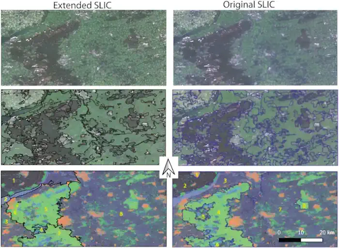
In the paper, “Extended SLIC superpixels algorithm for applications to non-imagery geospatial rasters,” published in the International Journal of Applied Earth Observation and Geoinformation, researchers from Adam Mickiewicz University and University of Cincinnati proposed an improved version of the popular SLIC algorithm for image segmentation, known as extended SLIC, to be applicable on multidimensional spatial ...
phys.org
NASA-led Mission To Map Air Pollution In 3D Over Megacities

NASA-led Mission To Map Air Pollution In 3D Over Megacities

This summer, as wildfire smoke blankets large swaths of North America and heat-stoked summer haze reaches its seasonal peak, NASA and its partners are deploying several new tools to observe air quality and pollution from the street to the stratosphere. Launched into orbit earlier this spring, TEMPO, short for Tropospheric Emissions: Monitoring of Pollution, is ...
nasa.gov
Researchers Successfully Train A Machine Learning Model In Outer Space For The First Time

Researchers Successfully Train A Machine Learning Model In Outer Space For The First Time

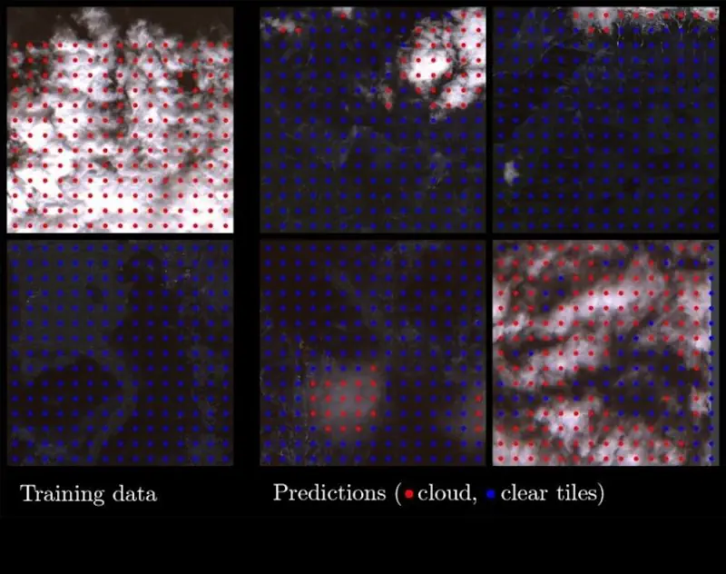
For the first time, a project led by the University of Oxford has trained a machine learning model in outer space, on board a satellite. This achievement could revolutionise the capabilities of remote-sensing satellites by enabling real-time monitoring and decision making for a range of applications. Currently, most satellites can only passively collect data, since ...
ox.ac.uk