Geomaticians

29

WiMi Hologram Cloud Developed A Big Data Analytical Engine System Based On GIS Location

WiMi Hologram Cloud Inc., a leading global Hologram Augmented Reality (“AR”) Technology provider, today announced that a big data analytical engine system based on GIS location was developed to improve the efficiency of data utilization. WiMi’s big data analytical engine system not only integrates and analyzes spatial data using GIS technology, but also processes, mines, ...
technode.global
1Spatial Launches Configurable GIS Mobile App For Surveying

1Spatial Launches Configurable GIS Mobile App For Surveying

1Spatial — a global provider of geospatial software and solutions for improved data governance — has launched the 1Capture, a customizable mobile application for data capture. 1Capture is a mobile GIS editing application that is multi-use and configurable. It provides accurate and reliable GIS data collection and editing in the field for a multitude of ...
gpsworld.com
„Aktionswoche Geodäsie“ Mit Rund 200 Schülern

„Aktionswoche Geodäsie“ Mit Rund 200 Schülern

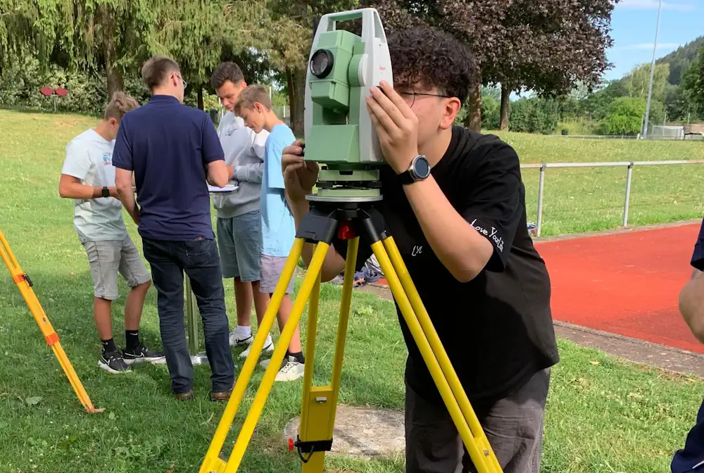
Vom 13. bis 21. Juli fand in Baden–Württemberg die „Aktionswoche Geodäsie“ statt. Insbesondere die staatlichen Stellen beziehungsweise die kommunalen Arbeitgeber waren dabei aufgefordert, das Berufsbild der Vermessung einer breiten Öffentlichkeit zugänglich zu machen und junge Menschen für den Beruf und dessen Tätigkeitsbereiche zu begeistern. Höhenbestimmung mittels Nivellierinstrumenten und mit dem Tachymeter, Positionsbestimmung mit Satelliten, Bauabsteckung ...
schwaebische.de

Nagaland: WRI India Launches Energy Access Explorer In State For Unserved And Underserved Communities

After Jharkhand and Assam, the World Resources Institute (WRI) India launched its flagship geospatial platform, energy access explorer or EAE, for Nagaland in Kohima on July 28. A WRI India official told this correspondent EAE is a geospatial platform that provides data on electricity, health, education and livelihood indicators in the regions that it serves ...
indiatodayne.in

Sri Lanka To Map All Roads Belonging To Local Gov’t Bodies By 2025

All roads maintained by Sri Lanka’s local councils will be mapped by 2025, a state minister said on Thursday evening. State Minister of Provincial Councils and Local Government Janaka Wakkumbura told the media that such operation, which was last carried out 36 years ago, would help all stakeholders identify roads maintained by each local government ...
english.news.cn
Estudiantes Y Vecinos De Las Nieves Continúan Mediciones De Precipitación Este Invierno 2023

Estudiantes Y Vecinos De Las Nieves Continúan Mediciones De Precipitación Este Invierno 2023

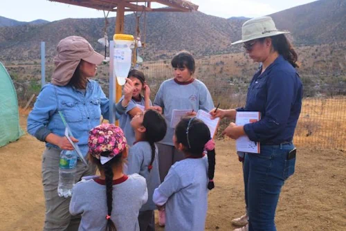
Con el invierno en pleno desarrollo en la región de Coquimbo, la iniciativa de ciencia ciudadana toma protagonismo en los sectores cordilleranos: escuelas y vecinos trabajan en conjunto al Centro Científico CEAZA, en el que desde el 2018 realizan mediciones de las precipitaciones de lluvia o nieve que ocurran en sus comunas. Al finalizar un ...
ceaza.cl
Mystery Of How Diamonds Reach The Earth’s Surface Finally Solved

Mystery Of How Diamonds Reach The Earth’s Surface Finally Solved

Diamonds form under great pressures in the depths of the Earth and are hundreds, or even billions of years old. They are usually found in types of volcanic rocks called kimberlites, which are located in the oldest, strongest, and thickest parts of the continents, such as in South Africa, where the well-known diamond rush of ...
earth.com
Driverless Cars Could Get AI-powered Heat Vision For Nighttime Driving

Driverless Cars Could Get AI-powered Heat Vision For Nighttime Driving

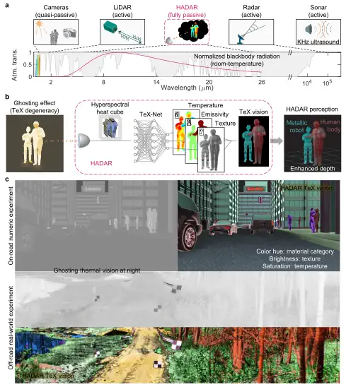
Driverless cars can struggle to distinguish between a pedestrian and a cardboard cutout of a person when it is dark or particularly rainy. A system that uses AI to identify objects based on their heat emission patterns could help autonomous vehicles to operate more safely in all outdoor conditions. Zubin Jacob at Purdue University in ...
newscientist.com