Geomaticians

12

Archeologia Italiana A Portata Di Click: Il Nuovo Geoportale Nazionale Svela I Segreti Del Nostro Patrimonio Storico

Il Geoportale Nazionale per l’Archeologia (GNA) è un punto di raccolta e di condivisione dei dati esito delle indagini archeologiche condotte sul territorio italiano, realizzato grazie alla collaborazione delle soprintendenze e degli archeologi, di altri enti e liberi professionisti. Si tratta di una mappa archeologica dinamica del territorio nazionale, di accesso libero e di facile ...
scintilena.com

New Trimble Terra Office Workflow Delivers Integration With Esri ArcGIS Pro

Trimble announced today the release of the Trimble® Terra™ Office add-in for Esri ArcGIS Pro. The add-in is a new product in Trimble’s Terra Office suite of desktop solutions for integrating Trimble TerraFlex® field data collection software with GIS systems of record. With a streamlined user interface, the new Terra Office add-in for ArcGIS Pro ...
directionsmag.com

Maxar Previews Its New Maxar® Geospatial Platform At Esri UC

Maxar Technologies, provider of comprehensive space solutions and secure, precise, geospatial intelligence, today announced the initial release of its new Maxar Geospatial Platform (MGP), enabling fast and easy access to the world’s most advanced Earth intelligence. MGP will simplify the discovery, purchasing and integration of geospatial data and analytics. MGP users will have access to ...
spaceref.com
Así Puedes Personalizar Los Mapas Cartográficos De Madrid Para Planificar Una Escapada Al Aire Libre

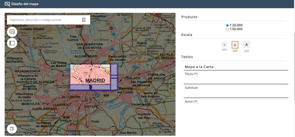
Así Puedes Personalizar Los Mapas Cartográficos De Madrid Para Planificar Una Escapada Al Aire Libre

Con la llegada del verano y las vacaciones las ganas de descubrir nuevas rutas de senderismo, bicicleta o, en definitiva, para practicar cualquier disciplina deportiva al aire libre aumentan, con una Comunidad de Madrid en la que hay infinidad de rincones que son desconocidos… hasta ahora. Porque con el «Mapa a la Carta» del Ministerio ...
madridesnoticia.es
NETL CO2-locate Database To Enhance Carbon Capture And Storage Projects

NETL CO2-locate Database To Enhance Carbon Capture And Storage Projects

Creating a net-zero carbon emissions power sector and economy is an immense endeavor that requires a host of intricate technologies and applications, and the CO2-Locate database is a centralized platform that allows users to quickly and accurately obtain the data they need. Now published on the Energy Data eXchange® (EDX), CO2-Locate is one of several ...
netl.doe.gov

NSW To Build Out Digital Twin Features

New South Wales’ digital twin will undergo extensive work over the next 12 months to bring to life its next set of features, with the state government to enlist the help of a third-party delivery partner to build out the platform. But with funding provided by the former Coalition government to deliver a 4D model ...
innovationaus.com

L’observatoire Des Forêts Françaises Est Lancé

Le ministre de l’Agriculture Marc Fesneau et le ministre de la Transition écologique Christophe Béchu lancent l’Observatoire des forêts françaises, afin de rassembler et proposer en un lieu unique les informations indispensables au pilotage des forêts. Cet observatoire a « pour vocation de constituer un centre de partage et de production de données indispensables pour ...
lafranceagricole.fr

Sri Lanka To Cooperate With Foreign Company For Real-time Satellite Imagery On Oil Spills

Sri Lanka’s cabinet has approved a proposal to sign a memorandum of understanding with a foreign company for real-time satellite imagery on oil spills, an official told reporters on Tuesday. Cabinet spokesman Bandula Gunawardena said the number of ships operating in Sri Lankan territorial waters is increasing due to the growth of shipping and port ...
english.news.cn
Huawei Has Filed A Patent To Include Cameras Inside Their Future Earwear As A Pedestrian Safety Feature

Huawei Has Filed A Patent To Include Cameras Inside Their Future Earwear As A Pedestrian Safety Feature

Over the years there have been many headlines regarding teens having been killed, maimed or severely injured due to wearing earbuds and not paying attention to their surroundings, especially near crosswalks. One report pointed to the Toronto Police mentioning Apple’s AirPods as a problem, though it’s more of generic earphones issue in general. The issue ...
patentlyapple.com

Open-Source Online Tool To Optimize Wind-Solar Projects

Scientists At The University Of Murcia Have Developed Climax, An Open-source Tool That Uses The Synergy Between Wind And PV To Reduce The Variability Of Their Combined Production. Climax Identifies Regions With Consistent Temporal Resource Variability And Determines The Optimal Allocation Of Each Technology In Those Regions. The researchers have developed an approach that goes ...
pv-magazine.com
Oregon Beginning Work On Revised 'Wildfire Hazard' Map

Oregon Beginning Work On Revised ‘Wildfire Hazard’ Map

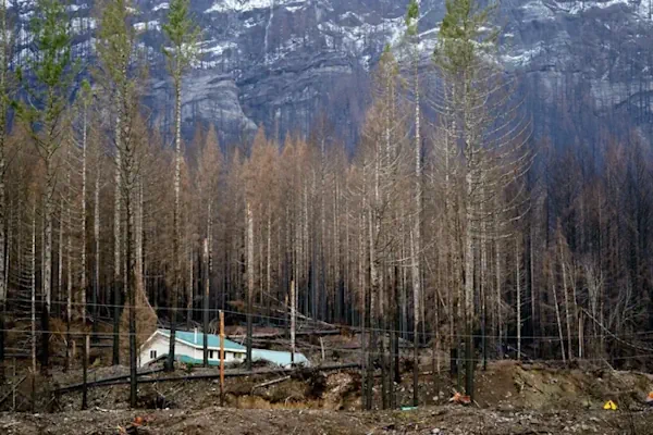
What was called the ‘wildfire risk map’ is now the ‘wildfire hazard map.’ The map is intended to educate homeowners about their exposure to wildfire risk, determine where fire mitigation resources should be prioritized and identify where future state rules on home hardening and defensible space will apply. The name change reflects a shift by ...
ijpr.org
State-owned Aerospace Giant To Build 300-Satellite Constellation At Very Low Earth Orbit By 2030 For Better, More Economic Remote Sensing Services

State-owned Aerospace Giant To Build 300-Satellite Constellation At Very Low Earth Orbit By 2030 For Better, More Economic Remote Sensing Services

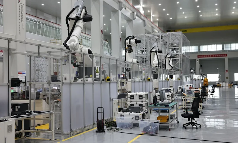
China Unveiled Plans To Build A New Satellite Constellation At The Very Low Earth Orbit (VLEO) That Would Comprise 300 Satellites Orbiting The Globe By 2030 And Provide Ultra-fast Remote Sensing And Communication Services, With The First Satellite To Be Launched December This Year , The Global Times Learned From Developers On Wednesday. The Second ...
globaltimes.cn
Thermal Imagery Sector Heats Up

Thermal Imagery Sector Heats Up

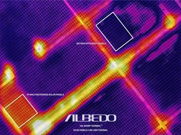
British investment firm Seraphim Space surveyed the Earth observation sector a few years ago, categorizing startups by sensor type. Analysts determined that firms focused on electro-optical and synthetic aperture radar were advancing rapidly. Thermal imagery startups were not. “Much to our surprise, it was the only sensor area that didn’t have any companies that had ...
spacenews.com