Geomaticians

25

Digitaler Zwilling Überwacht Energieverbrauch Von Gebäuden In Kaunas

CSCI wollte zwar auf 3D-Daten umsteigen, erkannte jedoch, dass viele verschiedene Anwendungen erforderlich wären, um all diese Funktionen inklusive der Gebäudeklima-Analysefunktion einzubauen. Dies würde möglicherweise auch Kompatibilitätsprobleme mit sich bringen. Das Team benötigte eine intuitive, einheitliche Plattform, um die Ziele für den digitalen Zwilling im städtischen Maßstab zu erreichen. CSCI kam nach Prüfung verschiedener Möglichkeiten ...
energie.de
Grazer Forscher Stellen Schwere Dürre In Europa Fes

Grazer Forscher Stellen Schwere Dürre In Europa Fest

Kernstück des EU-Projekts, von dem die TU Graz wesentlicher Bestandteil ist, sind Zwillingssatelliten namens “Tom und Jerry”. In einer polaren Umlaufbahn in knapp 490 Kilometern Höhe umkreisen die Satelliten die Erde und liefern den Geodätinnen und Geodäten der TU Graz dabei die Daten aus dem Weltall, die sie für die Bemessung des Grundwasserspeichers brauchen. Das ...
meinbezirk.at

Togg’da Yerli Harita Uygulaması Kullanılacak

Togg arabalarında Google ya da Yandex harita uygulamaları değil Türkiye’de üretilen yerli harita uygulaması “Gez” kullanılacak. Togg arabalarında yerli harita uygulaması kullanılacak. Türkiye’nin Otomobili Togg, mobil uygulaması “Trumore” ile dijital dünyadaki yerini aldı. Yerli harita uygulaması “Gez” de kullanıma sunuldu. Türkiye’nin Otomobili Togg, dijital dünyaya iddialı girdi. Trumore mobil uygulamasıyla kullanıcılara farklı bir deneyim sunuluyor. ...
sonhaberler.com

Yeraltı Sularının Kullanılması Nedeniyle…

Gümüşhane Üniversitesi Rektörü Prof. Dr. Halil İbrahim Zeybek, Mühendislik ve Doğa Bilimleri Fakültesi Harita Mühendisliği Bölüm Başkanı Doç. Dr. Sefa Yalvaç ile Mühendislik ve Doğa Bilimleri Fakültesi Jeoloji Mühendisliği Bölümü Uygulamalı Jeoloji Kürsüsü Öğretim Üyesi Doç. Dr. Selçuk Alemdağ, zemin çökmelerinin güncel jeodezik tekniklerle izlenmesi ve olası nedenlerinin araştırılmasına yönelik bilimsel çalışma başlattı. Çalışmalar kapsamında ...
torbaliguncel.com

Marmara Için Sürpriz ‘İHA’ Kararı!

Çevre, Şehircilik ve İklim Değişikliği Bakanı Murat Kurum, sosyal medya hesabı üzerinden yaptığı açıklamada, “Daha temiz bir Marmara için yeni denetim modeli hayata geçiriyoruz, genelgemizi yayımladık” dedi. Marmara Denizi’ndeki kirliliğin önüne geçmek amacıyla hazırlanan düzenlemeyle denetim faaliyetleri güçlendirilecek, çevresel olumsuzlukların kontrolü sağlanacak. Bu amaçla İstanbul ve Kocaeli’ndeki denetimler için Türkiye Çevre Ajansı’na yetki verildi. Bakanlıktan ...
ekonomi.haber7.com
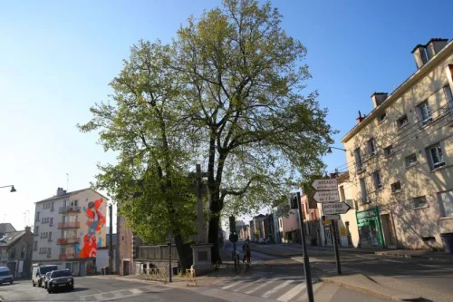
Une Carte Interactive Vous Invite À Découvrir 38000 Arbres Dans Renne

Une Carte Interactive Vous Invite À Découvrir 38000 Arbres Dans Rennes

Pour inciter les habitants à découvrir la richesse et la diversité de son patrimoine arboré, la Ville de Rennes propose une carte interactive affichant les caractéristiques (essence, âge…) de plus de 38000 arbres plantés le long des rues et dans les espaces verts. Cet outil a été développé par le Service d’information géographique (SIG) de ...
metropole.rennes.fr
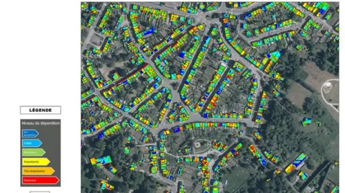
Thermographie Aérienne Des Toitures Garantir Le Respect De La Vie Privée Et Éviter Les Dérive

Thermographie Aérienne Des Toitures : Garantir Le Respect De La Vie Privée Et Éviter Les Dérives

Dès les données thermographiques récoltées et traitées, la volonté est de pouvoir proposer (gratuitement) aux citoyens les informations utiles permettant d’entreprendre des travaux d’isolation. Les communes concernées tout comme la province du Brabant wallon, peuvent aussi profiter de ces relevés pour améliorer la performance énergétique des bâtiments publics. Reste deux questions qui suscitent d’ailleurs de ...
rtbf.be

México Lanza Plataforma Para Monitorear El Uso Del Agua En La Minería

El Gobierno mexicano lanzó este martes el Sistema de Información Geográfica (SIG), denominado “Agua y Minería”, con el que planea mejorar el uso del agua y monitorear la relación que tiene la actividad minera con los acuíferos de México. La nueva plataforma pública fue desarrollada por el IMTA y recupera información del Registro Público de ...
swissinfo.ch

New Horizon Europe Project ‘Evoland’ Sets Off

A consortium under the lead of VITO officially launched the new Horizon Europe project EvoLand in Leuven (Belgium). EvoLand will develop and test new and innovative methods and algorithms and implement a bundle of candidate Copernicus Land Monitoring Service prototypes. This will be realised by integrating novel EO and in-situ data with the latest Machine ...
geospatialworld.net

Inside The Department Of Energy Project Using Drones To Map Radioactive Waste Storage Vaults

Flyability’s Elios 3 has successfully completed a 3D mapping operation of a radioactive waste storage vault following more than a year of preparation and research. The information obtained in the mapping project will prove crucial to planning the vault’s removal. This is thought to be the first time a drone has been deployed to enter ...
dronelife.com

Strava Will Add High-res 3D Maps For Outdoor Activities

Strava routes are about to get three-dimensional. The popular fitness social network announced today that it’s acquired Fatmap, a mobile app known for its 3D maps for outdoor sports like hiking, trail running, skiing, and mountain biking. “Fatmap tech will power Strava maps for both free members and subscribers,” Strava spokesperson Brian Bell told The ...
theverge.com

Galileo High Accuracy Service Now Operational, Providing Corrections Worldwide For Free

The Galileo High Accuracy Service (HAS) is officially available, becoming the first GNSS to offer free precise point positioning (PPP) corrections worldwide via both the Galileo signal in space (E6-B) and the internet. The announcement was made Tuesday during the 2023 European Space Conference in Brussels, Belgium. The EU agency for the Space Programme (EUSPA), ...
insidegnss.com

Mysterious White Clouds Keep Popping Up Near The Bahamas, And No One Knows Why

The perplexing patches of light-colored ocean are sometimes noticed in other oceans and lakes worldwide, but in the Bahamas, they pop up more often than usual. Direct sampling of the cloudy waters suggests they contain high concentrations of carbonate-rich particles. Much of the Bahama archipelago sits on a submerged platform of carbonate known as the ...
sciencealert.com