Geomaticians

24

Une Plateforme Logicielle Pour Une Gestion De Crise Plus Efficace

Puma-X a l’ambition de faciliter la communication entre tous les outils de gestion de crise, des prévisions météorologiques aux automates d’appel. L’outil a été testé par la ville de Cannes au mois de janvier. L’outil dispose d’un PCS dynamique couplé à la cartographie 3D, d’un traitement en temps réel des données structurées et non structurées ...
lagazettedescommunes.com
Geotrack Desarrollará El Concepto “Geoblockchain” Para Mejorar La Logística Y El Transport

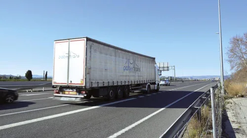
Geotrack Desarrollará El Concepto “Geoblockchain” Para Mejorar La Logística Y El Transporte

“Gracias al desarrollo del concepto ‘geoblockchain’ se podrá mejorar significativamente la trazabilidad integral de mercancías, agilizar procesos asociados, mejorar rendimientos productivos y aumentar la competitividad de las empresas, contribuyendo con ello a la sostenibilidad y eficiencia de la distribución de mercancías”, Ramón García, director general del Centro de Innovación para la Logística y Transporte de ...
diariodelpuerto.com

HERE, AWS Provide Device Positioning Services To Developers

HERE Technologies, a location data platform, announced its collaboration with Amazon Web Services (AWS), a cloud platform. This collaboration will deliver improved performance for indoor and outdoor positioning capabilities, enabling AWS third-party developers to track and manage internet-of-things (IoT) devices. HERE Positioning enables developers to switch between different localizing technologies, and it relies exclusively on ...
geospatialworld.net
Neues Optisches Beschichtungssystem Verhindert Beschlagen Und Unerwünschte Reflexionen

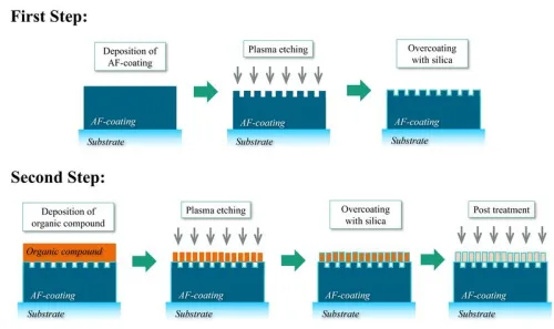
Neues Optisches Beschichtungssystem Verhindert Beschlagen Und Unerwünschte Reflexionen

»Wenn man von der Kälte in einen warmen Raum kommt, kann die Brille beschlagen und somit die Sicht des Brillenträgers stark einschränken«, sagt Anne Gärtner. »Das Gleiche kann auch bei Sensoren wie den LiDAR-Systemen in autonom fahrenden Autos passieren. Hier ist es wichtig, dass die Oberflächen auch bei Beschlag hochtransparent bleiben, damit die Funktionalität erhalten ...
idw-online.de

Dubai Municipality Launches 3D Infrastructure

H.E. Dawoud Al Hajri, Director General of Dubai Municipality, said: “The project will undertake a comprehensive study on choosing advanced technologies to build a 3D model and an inclusive map of geospatial data on infrastructure and service lines below the ground, integrating all the precise details within a single source of information. The study will ...
mediaoffice.ae

Esri & Texmin Sign MOU, Research And Innovation In Mineral Exploration Key Focus

Esri India and the TEXMiN Foundation have signed a Memorandum of Understanding (MoU) to establish a Geospatial Excellence Center at the Indian Institute of Technology (Indian School of Mines), Dhanbad. Esri India is the nation’s top provider of Geographic Information System (GIS) Software & Solutions. The research and innovation in spatial analytics & remote sensing ...
egov.eletsonline.com
Sharks, Spatial Data, And A Conservation Success Story

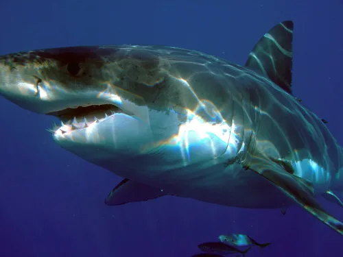
Sharks, Spatial Data, And A Conservation Success Story

It’s hard out there for a shark. A critical barometer to the health of ocean ecosystems, shark and ray populations have faced significant global declines from overfishing, habitat loss, and environment degradation. Add to the mix a slow reproductive cycle and the broader logistical challenges of trying to monitor animals with ranges that can exceed ...
phys.org